


Map shows fall foliage timeline prediction for Colorado, rest of country
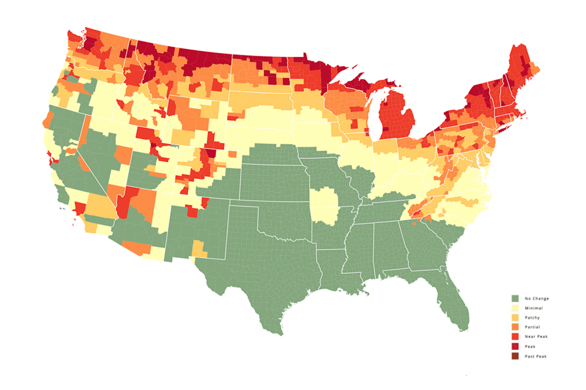
Are you curious about when fall colors will start changing in your part of the Colorado? You’re not alone. Thankfully, SmokyMountains.com has released their annual fall foliage prediction map, utilizing NOAA historical temperatures, NOAA historical precipitation, NOAA forecasted temperatures, NOAA forecasted precipitation, historical leaf peak trends, peaks observation trends, and user reports to predict when fall colors will start changing around the country.
The SmokyMountains.com fall foliage project started in 2013, prompted by visitors to the Smoky Mountain region asking about when they should plan their trip to see the best fall colors. It’s since evolved to become an interactive map that includes predictions across the entire country, refining data that gets used and improving predictions in years since.
Check out an interactive map that depicts the fall color forecast around the United States below:
Obviously, having 100 percent accuracy can be tricky due to the many factors that impact fall colors, but in general, this prediction map does a very good job year after year.
Find more information about the SmokyMountains.com project and report fall colors in your area to help improve their future predictions here.
STAY INFORMED: Sign-up for the daily OutThere Colorado newsletter here
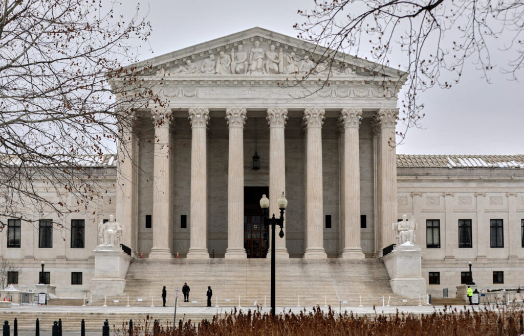
Supreme Court hands California parents win over secret gender transition policy
Jack Birle, Washington Examiner
jack.birle.washington.examiner@gazetteedit.wpenginepowered.com
Updated 2 minutes ago
The Supreme Court gave California parents a significant victory late Monday when it kept in place a lower court’s block of the Golden State’s public school policy hiding students’ gender identity and preferred pronouns from parents. A 6-3 majority on...
Jack Birle, Washington Examiner
Reporter

Ballot access, dual-office ban bills move swiftly through Colorado legislature
Marianne Goodland
marianne.goodland@coloradopolitics.com
Updated 1 hour ago
With an eye on the 2026 election cycle and mounting tensions with the Trump administration, Colorado lawmakers are fast-tracking a pair of election bills they say will protect the state’s mail ballot system and tighten rules for elected officials. The...
Marianne Goodland
Reporter

1 killed in two-vehicle crash in Greenwood Village Monday
Michael Braithwaite
michael.braithwaite@gazette.com
Updated 44 minutes ago
One person was killed in a two-vehicle crash in Greenwood Village on Monday that closed Belleview Drive for about four hours. The crash, which occurred just before noon Monday, was at the intersection of Belleview and University Avenue, a spokesperson...
Michael Braithwaite
Reporter

Justice Department’s new policy saves $1.6 million in taxpayer dollars previously spent on transgender procedures
Mia Cathell, Washington Examiner
mia.cathell.washington.examiner@gazetteedit.wpenginepowered.com
Updated 4 hours ago
EXCLUSIVE — One of the Trump administration’s latest initiatives is projected to save taxpayers over $1.65 million, which previously would’ve been spent on gender-affirming care for federal prisoners who identify as transgender. Under the new prison policy, issued on Feb....
Mia Cathell, Washington Examiner
Reporter

UN nuclear watchdog says Iran nuclear site damaged in strikes
Washington Examiner Staff, Washington Examiner
washington.examiner.staff.washington.examiner@gazetteedit.wpenginepowered.com
Updated 4 hours ago
One of Iran’s nuclear facilities was damaged in the strikes orchestrated by Israel and the United States over the weekend, the International Atomic Energy Agency confirmed on Tuesday morning. The Natanz Nuclear Facility in Iran’s Isfahan province was targeted during...

Freedom Plane takes ‘documents that forged a nation’ on US tour for 250 celebration
Washington Examiner Staff, Washington Examiner
washington.examiner.staff.washington.examiner@gazetteedit.wpenginepowered.com
Updated 4 hours ago
A special event for the country’s 250th anniversary celebration begins this week with the debut of the Freedom Plane National Tour as part of the National Archives’ recognition of the nation’s 250th celebration festivities. The tour brings historical documents that...

Trump to attend White House Correspondents’ Dinner for first time as president
Washington Examiner Staff, Washington Examiner
washington.examiner.staff.washington.examiner@gazetteedit.wpenginepowered.com
Updated 4 hours ago
President Donald Trump announced on Monday that he accepted an invitation to this year’s White House Correspondents’ Dinner. It would mark the first time Trump has attended the dinner, in either term, since he’s been president. Trump announced the decision...

Senate adds Trump ban on purchases by large investors to bipartisan housing bill
Zach Halaschak, Washington Examiner
zach.halaschak.washington.examiner@gazetteedit.wpenginepowered.com
Updated 4 hours ago
The Senate added language that would ban large institutional investors from purchasing single-family homes into bipartisan housing legislation, a big win for the White House. President Donald Trump has advanced such a ban as a key plank of his housing agenda, even though it is...
Zach Halaschak, Washington Examiner
Reporter

It’s time to apply for big game hunting licenses in Colorado
Seth Boster
seth.boster@gazette.com
Updated 6 hours ago
Colorado Parks and Wildlife’s new big game brochure has been hitting hunters’ mailboxes ー the annual reminder to start planning for the seasons ahead. CPW also reminded in a recent social media post: “Whether you’re after a long-awaited lifetime tag...
Seth Boster
Reporter

Denver gas prices rose by nearly 30 cents in last week, survey finds
Michael Braithwaite
michael.braithwaite@gazette.com
Updated 1 hour ago
The average price of gas in the Denver area rose by 28.2 cents per gallon last week, an increase far greater than national trends, a survey of local gas stations found. According to a survey of 844 Denver gas stations,...
Michael Braithwaite
Reporter
PREV
PREVIOUS

Teen nearly drowns at Water World amusement park in Colorado
Facebook Twitter WhatsApp SMS Email Print Copy article link Save A 14-year-old boy was taken to Children’s Hospital in Aurora on Saturday after nearly drowning at the Water Amusement Park in Denver, according to officials from the Federal Heights Fire Department. Crews from the fire department were dispatched to the park at about 3 PM after […]

Multiple temperature records fall in Colorado amid heat wave, according to NWS
Facebook Twitter WhatsApp SMS Email Print Copy article link Save Facebook Twitter WhatsApp SMS Email Print Copy article link Save According to the National Weather Service, multiple temperature records were broken in Colorado on September 6 amid a heat wave that has brought highs above 100 degrees Fahrenheit to the state. The Front Range region […]