


‘Distress signal’ leads to cliffside rescue at 13,400 feet in Colorado
Search and rescue volunteers likely saved the life of a climber on one of Colorado’s popular fourteeners over the weekend.
According to Chaffee County Search and Rescue North, they received a report of a climber that had been ‘cliffed-out’ in the area of 14,074-foot Missouri Mountain at about 9:40 AM on Saturday, May 28.
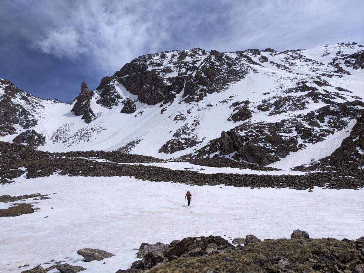
A solo hiker was on the ridge between the summit of Missouri Mountain and Elkhead Pass, which is the pass between Missouri and Belford peaks, when he slid an estimated 400 feet down from the ridge to the top of a 100-foot cliff band located at roughly 13,400 feet of elevation. At this point, he was unable to make any safe movements that would bring him up or down the mountain. Fortunately, the hiker had a personal locator beacon that could send out a distress signal.
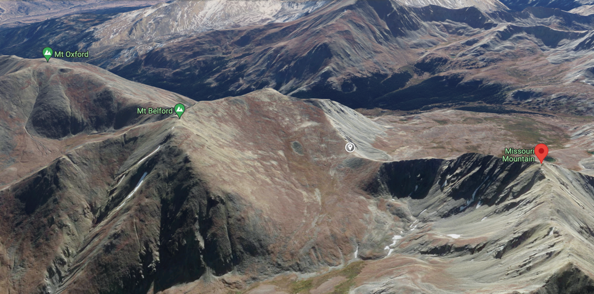
This 3-D rendering shows Missouri Mountain, Mount Belford, and Mount Oxford – three of Colorado's fourteeners. The grey pin located between Missouri and Belford shows the location of Elk Head Pass, with the hiker being found below the ridge between the pass and the Missouri Mountain summit. Photo Credit: @2022 Google Maps.

This 3-D rendering shows Missouri Mountain, Mount Belford, and Mount Oxford – three of Colorado’s fourteeners. The grey pin located between Missouri and Belford shows the location of Elk Head Pass, with the hiker being found below the ridge between the pass and the Missouri Mountain summit. Photo Credit: @2022 Google Maps.
Due to strong winds, search and rescue was unable to insert a team in the area via helicopter. Instead, a team of seven climbers hiked into the scene with gear from the Missouri Gulch Trailhead – found about five miles away and 4,000 feet below.
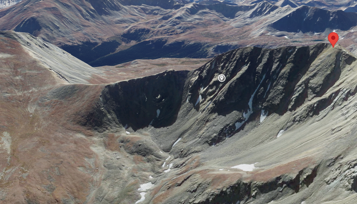
The grey dot on this rendering shows roughly where the climber got stuck. The red pin is the summit of Missouri Mountain, with Elkhead Pass being located to the left in this image. Image: @2022 Google Maps.

The grey dot on this rendering shows roughly where the climber got stuck. The red pin is the summit of Missouri Mountain, with Elkhead Pass being located to the left in this image. Image: @2022 Google Maps.
Once the subject had been located, the rescue team staged below the stuck climber. Two crew members then ascended a nearby couloir that allowed them to traverse to reach their subject. The rescue subject was then lowered via rope, with the team rappelling down after.
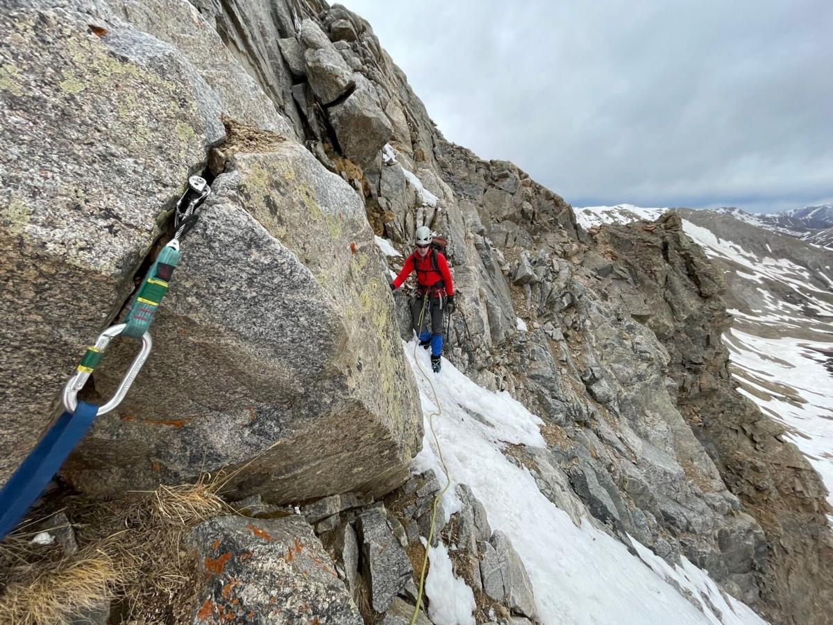
A search and rescue team member on one of the rope systems used during the rescue. Photo Credit: Chaffee County Search and Rescue North.

A search and rescue team member on one of the rope systems used during the rescue. Photo Credit: Chaffee County Search and Rescue North.
No one was injured and all parties were out of the field by 7:30 PM, roughly 10 hours after the initial report was received.
In their announcement of the rescue, Chaffee County Search and Rescue North noted that this particular ridge has been a problem area for many years, notably more difficult than other nearby routes and made even more dangerous in winter and spring conditions. They stressed that preparation and research were crucial for those attempting the route.
It’s unclear what caused this climber to slip off the ridge, though even with the right gear, slipping can be a risk when snow and ice is present. Generally, when climbers set out to summit a peak of this nature under winter conditions, they’ll use traction and self-arrest tools, such as crampons and a mountaineering axe.
While a ridge-proper route isn’t listed as an option for traveling between the Missouri Mountain summit and Elkhead Pass on the popular 14ers.com website, the rescue team described this descent as mixed class three and class four terrain. With winter conditions present on the peak at the time, this would have made the terrain even more dangerous.
Most hikers summiting Missouri Mountain ascend via the class two northwest ridge. Those then seeking to subsequently summit the neighboring Mount Belford typically descend to the Missouri Gulch valley floor between the peaks before making a longer ascent toward the Belford summit opposed to moving across the dangerous ridge toward Elkhead Pass.
One key part of this story that shouldn’t go missed is that this climber was carrying a personal locator beacon that was capable of sending out a distress signal. In an extremely remote area, this device likely played a key role in the survival of the climber. The report on this incident wasn’t specific about what device was being used, though it was likely something similar to the Garmin inReach, which allows users to track their position on the mountain and communicate via GPS.
This story also provides a good example of how important it can be to pack gear suitable for a potential situation that results in getting stuck on the mountain. It’s unlikely this climber was planning to spend so much time exposed to the elements at more than 13,000 feet above sea level, but it can happen, and it’s important to plan ahead for the possibility.
Any backcountry rescue case also tends to highlight how important it is for someone to let people know where they’re headed and when they’ll be back prior to leaving for an adventure. In this case, the emergency beacon worked as intended and led to an expedited rescue. However, sometimes gear can fail and had that been the case, someone’s knowledge of where this solo climber might be found would have been crucial, especially on such a remote and low-traffic part of the mountain.
Thanks goes out to Chaffee County Search and Rescue North for their role in this successful mission. Colorado’s search and rescue efforts rely on volunteers. If you’d like to help support Colorado’s search and rescue effort, one way to do it is to purchase a $3 CORSAR card.
STAY INFORMED: Sign-up for the daily OutThere Colorado newsletter here