A scenic journey through time on an epic, underrated drive in southern Colorado
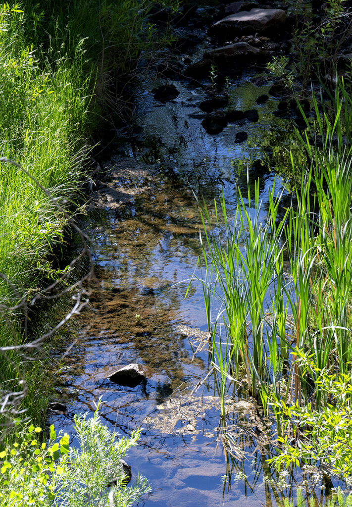
FREMONT COUNTY • A backcountry road bends between creek-fed greenery to reveal a gaping hole in the granite arching high against the sky.
“I love Window Rock,” says Charlotte Bumgarner.
It’s but one curious sight she loves along the endlessly curious Gold Belt Tour of southern Colorado.
Bumgarner is executive director of a stewarding nonprofit that celebrates “a 131-mile journey through Colorado’s richest gold rush history and most breathtaking mountain scenery.” Much more is revealed along the roads looping between Fremont and Teller counties: reminders of dinosaurs and a volcanic era and scenes of eras defined by mining, railroading, oil and ranching before modern scenes of recreation.

Perhaps Coloradans are familiar with the renowned mountain biking and rock climbing on one end of Shelf Road closer to Cañon City. Perhaps they are unaware of wonders like Window Rock closer to the Cripple Creek side ー among many more wonders across the connecting Phantom Canyon Road and High Park Road and Teller County 1 farther afield.
“If you ask Colorado people what the Gold Belt Tour is, I would say very few know what we’re talking about,” says Ty Seufer, a Cañon City native on the nonprofit board.
Gold Belt Tour Association formed ahead of the route gaining national scenic byway status in 2000, one of 13 federally honored in Colorado. Previously, in 1989, the Gold Belt Tour was listed as one of the state’s first five scenic and historic byways.
However much of a “hidden gem” Seufer knows the byway to be, those recognitions shared his view: “It’s one of the most gorgeous 100-mile loops in all of Colorado.”
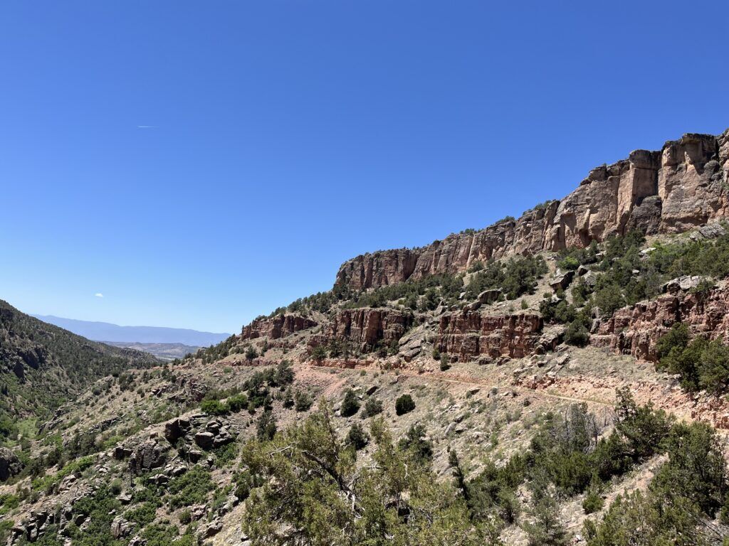
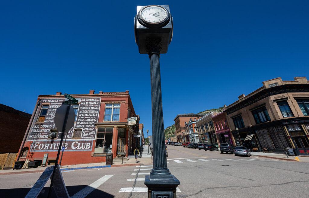
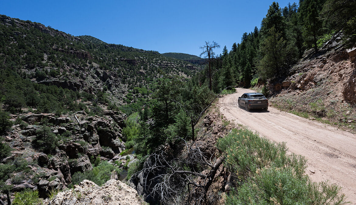
Seufer lives by the loop’s wild side: From the fields of Cañon City, it’s a narrow, curvy drive up Phantom Canyon, over bridges and through tunnels of an old railroad line that climbs 4,000-plus feet amid pine woods, aspen groves and alpine meadows to the Wild West vestige of Victor. Continuing on toward Cripple Creek, one can veer off for Shelf Road and descend back to Cañon City, catching red rock views and a thrill along a rough, narrow ledge.
Bumgarner indeed recommends driving down Shelf Road, against the rock, rather than driving up against the drop-off. She lives closer to the Gold Belt Tour’s gentler, paved side — closer to High Park Road, which runs between Colorado 9 and Teller County 1.
The drive boasts an underappreciated view of Pikes Peak and of an unusual, often overlooked promontory. Notes Gold Belt Tour Association: “The cone shape of Mount Pisgah gives a clue to its volcanic origin.”
Ash from an eruption 37 million years ago helped preserve stumps that were once mighty redwoods in a once-verdant land that is now Florissant Fossil Beds National Monument. That preserve is off Teller County 1. Another prehistoric site is off lower Shelf Road: Garden Park Fossil Area, where dinosaur skeletons were excavated for display at the Smithsonian and other top museums.

The 1870s marked the “Bone Wars” here, waged by paleontologists whose egos drove them to theft, sabotage and dynamite. The years would give way to a different frenzy in the hills beyond.
With the discovery of gold in 1890, Cripple Creek was booming. And the race was on to reach the mines via railroad.
On May 27, 1894, the Florence and Cripple Creek Railroad claimed victory. Reads history maintained by Gold Belt Tour Association: “For 18 months, the F&CC enjoyed a virtual monopoly on rail transportation in and around the mining district, forever changing the economic fortunes of the entire region.”
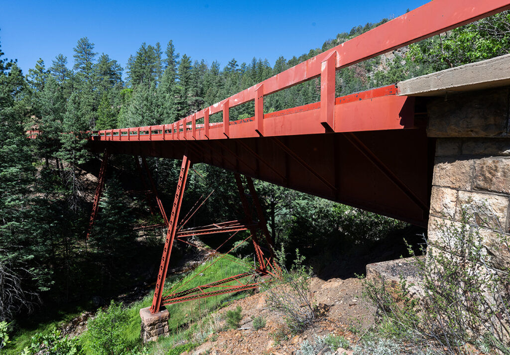
While Florence and Cañon City flourished, other stations and towns popped up along the railroad through Phantom Canyon. They are remembered by names marking the road today: McCourt Station, where there was a telegraph office; Wilbur, where families built a schoolhouse; and Adelaide, where other families lived around a post office.
This is where disaster struck the night of July 30, 1895.
A flood destroyed tracks and swept away buildings and people. Three perished in what was but one tragedy in the railroad’s history.

In 1901, the Florence Refiner reported on a wreck: “Nine loaded ore cars and the engine left the track and piled upon one another in a tangle of ore, twisted iron and timber. The engineer died, and the head brakeman was seriously injured.”
The railroad was able to recover from that and more bizarre incidents. Also in 1901, the local paper reported on the engineer blowing his whistle at two bighorn sheep on a slope above the train: “Scampering away, the sheep loosened a large rock that fell onto the track and derailed the engine.”
Later, in 1912, the railroad’s president was quoted following a reported 30-foot wall of water that came roaring down Phantom Canyon: “It is hardly believable. The flood took everything before it.”
That was the end of the train.
“By that time, the mining was dying, so they chose not to rebuild the railroad,” Bumgarner says. “But Florence merchants went in and turned it into what it is today: a tourist road.”
They had a model with the Cañon City and Cripple Creek Toll Road, built for sightseeing wagons and stagecoaches in 1892. It would later be named Shelf Road, for the perilous stretch along sheer rock. (As for the name Phantom Canyon, a description by John L. Sanford in 1905 offers a hint: “Any person blessed with a lively imagination can people its fantastic rocks, piled high in seried columns with all sorts of phantoms, goblins and spooks …”)
For those with the right vehicle and driving know-how, Bumgarner calls Phantom Canyon and Shelf Road “a perfect route.” The views and curiosities, however, are abundant across the tour’s entirety.
Trying to see it all? “I don’t advise trying in just a day,” Bumgarner says.

Gold Belt touring
Road details and maps of the Gold Belt Tour are posted at goldbeltbyway.com. Here are some itinerary ideas, starting from Cañon City ー assuming a proper vehicle and comfort driving rough, narrow and curvy roads:
Day 1
Drive Phantom Canyon’s 30 miles up to Victor. Consider hiking Vindicator Valley Trail, which loops 2 miles around old mining structures. Another option: the shorter hike to Rita the Rock Planter, the wooden troll perched on a scenic hilltop.
Whatever you do, make sure you’ve got energy and wits for the hair-raising drive back to Cañon City on Shelf Road. Before getting back to town, stop at Garden Park Fossil Area.
Considerations if you’ve got more time and skills: hiking at Red Canyon Park, mountain biking at Oil Well Flats and climbing at Shelf Road Recreation Area, where there are reservable and first-come, first-served campsites. Consider also a night at the historic, recently renovated Hotel St. Cloud downtown.
Day 2
Another leg of the Gold Belt Tour continues to nearby Florence, where you might start your morning. The tour’s loop continues on U.S. 50 toward Royal Gorge Bridge and Park, which also demands a stop.
U.S. 50 continues on more pavement: Colorado 9 to High Park Road and on to Teller County 1. Florissant Fossil Beds National Monument is ahead, with massive, petrified redwood tree stumps to see and 14 miles of trail to explore.
Teller County 1 continues to U.S. 24, where you can make your way back home.