


Additional 6-10″ of snow for Colorado as ‘risk of heavy snow’ forecast for week’s end

Winter conditions and the risk of heavy snow return to Colorado’s high country late week, with the southern mountains benefiting the most from the incoming storm.
A round of snow from Wednesday to Friday night should fill in more gaps on grassy slopes and atop more man-made snow at Colorado’s ski areas and resorts, plus it’ll give the next due-to-open resorts some new natural snow to work with for their opening days; five more resorts open this weekend.
More unsettled and stormy weather is possible just before Thanksgiving through the end of the month as November closes out on a snowy note.
Recap:
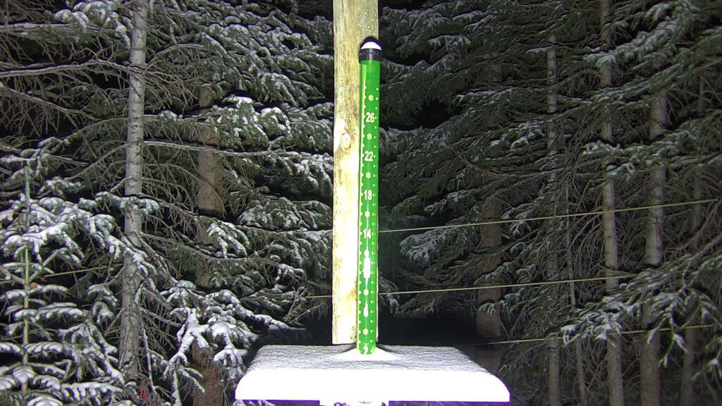
Monday started with a few inches of light fresh powder at the seven open ski areas in Colorado, even if only a few trails are currently open, but it’s a start.
Tuesday’s weather was more or less calm around the state’s high country with a high temperature of 38 degrees at Copper Mountain and 33 degrees at Telluride.
Forecast:
More openings: Monarch, Powderhorn, Purgatory, Steamboat and Wolf Creek all open over the weekend and should have some fresh snow.
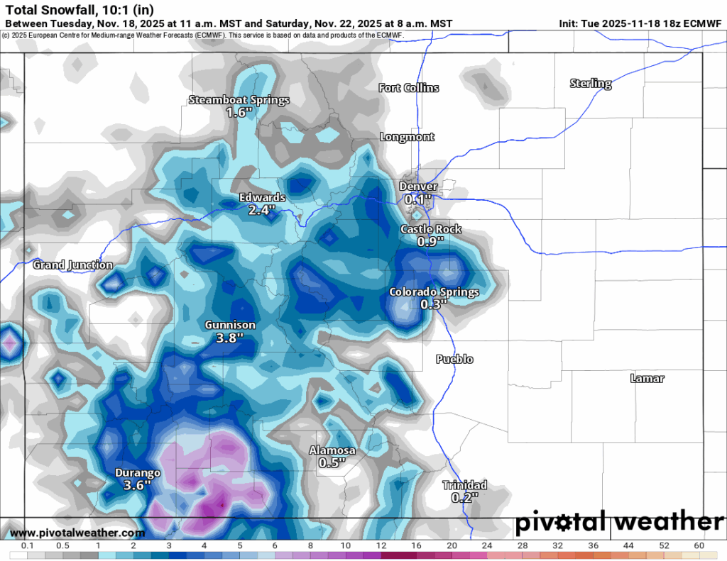
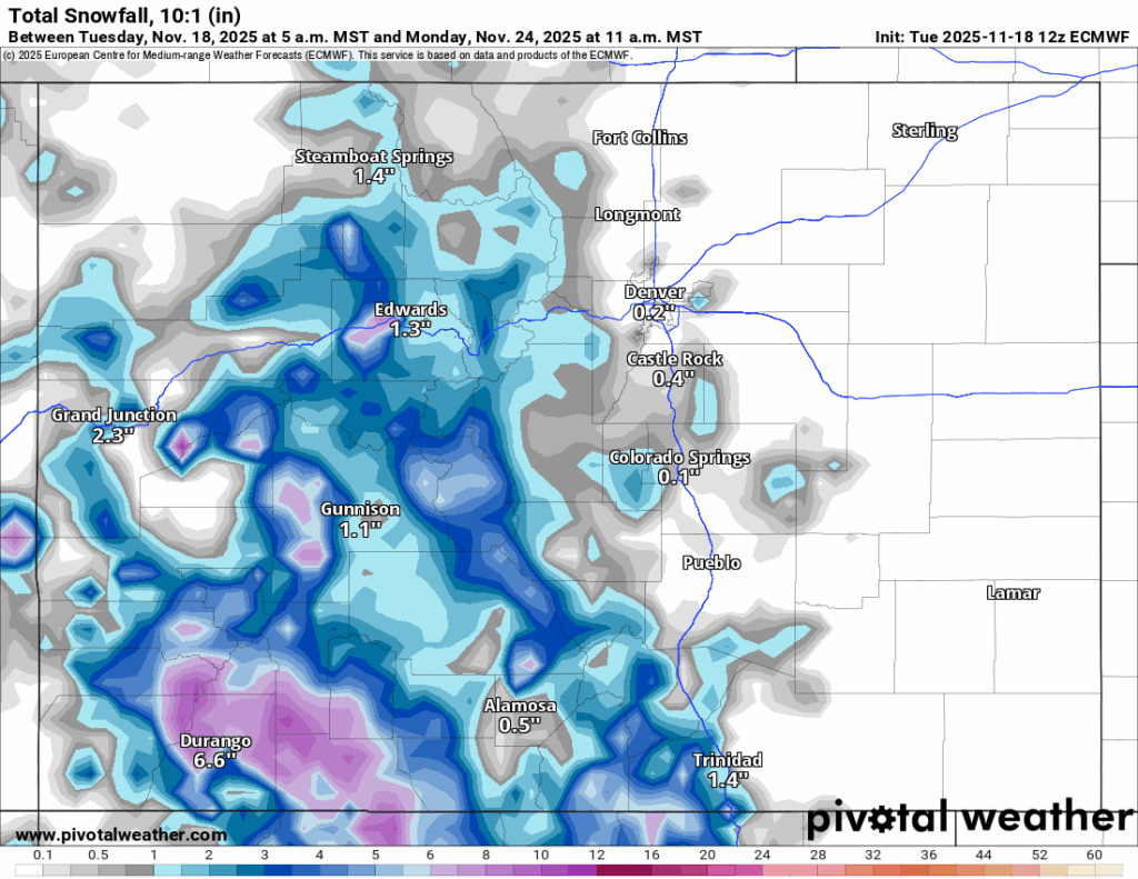
Snow is forecast to return to Colorado Wednesday through Friday night across all three mountain zones, with the highest totals in the southern, central and western northern mountains.
Forecasted snowfall amounts by Saturday morning from the ECWMF model in the southern mountains are between 6-12 inches, in the central mountains between 3-5 inches and in the northern mountains between 2-4 inches, with the highest amounts east of the Continental Divide and mostly south of Interstate 70.
From Saturday to Sunday late morning, the state will be between storms with day-time highs both weekend days in the upper 30s at most ski area bases.
Snow is forecast to develop again Sunday afternoon from a large area of low pressure pushing eastward across Arizona and New Mexico and bring snow showers to the southern mountains mostly through Monday afternoon.
Perhaps a bit of spill over into the southern central mountains (Monarch and Crested Butte) is possible, but the storm’s forecasted track stays rather south, looking to brush only the southern mountains.
Additional forecasted accumulations for the southern mountains are between 1-3 inches.
Long-term forecast:
After a calm Tuesday, two more waves of storm energy are forecast to push through Colorado starting Wednesday, Nov. 26 and lasting into Saturday, Nov. 29, with these storms coming in from the west and northwest and delivering snow to all three mountain zones, including the Front Range foothills and eastern Plains.
More accurate details regarding these Thanksgiving week storms will become more clear after more model runs render, including snowfall totals, duration of storm and timing.
Colorado ski resorts’ planned opening dates and 24-hour totals:
Arapahoe Basin – 0″
Aspen Highlands – Dec. 13
Aspen Mountain – Nov. 27
Beaver Creek – Nov. 26
Breckenridge – 0″
Buttermilk – Dec. 13
Cooper – Dec. 10
Copper Mountain – 0″
Crested Butte – Nov. 26
Echo Mountain – TBD
Eldora Mountain – 0″
Granby Ranch – Nov. 26
Hesperus – Closed for the season
Howelsen Hill – Nov. 29
Kendall Mountain – December
Keystone – 0″
Loveland – 0″
Monarch – Nov. 21
Powderhorn – Nov. 22
Purgatory – Nov. 22
Silverton – Private mountain after Dec. 1, Guided and Heli season Dec. 27
Snowmass – Nov. 27
Steamboat – Nov. 22
Sunlight – Dec. 12
Telluride – Nov. 27
Vail – 0″
Winter Park – 0″
Wolf Creek – Nov. 22