


Colorado snow forecast shows 3 rounds incoming, but accumulation expected to be minimal
As of Jan. 28, Colorado’s statewide snowpack level remains at an all-time low – about 58 percent of what’s typical for this point in the season. While there’s some snow in the short-term forecast, it’s unlikely this snow will be enough to result in much of a change. The long-term forecast, however, could be more promising.
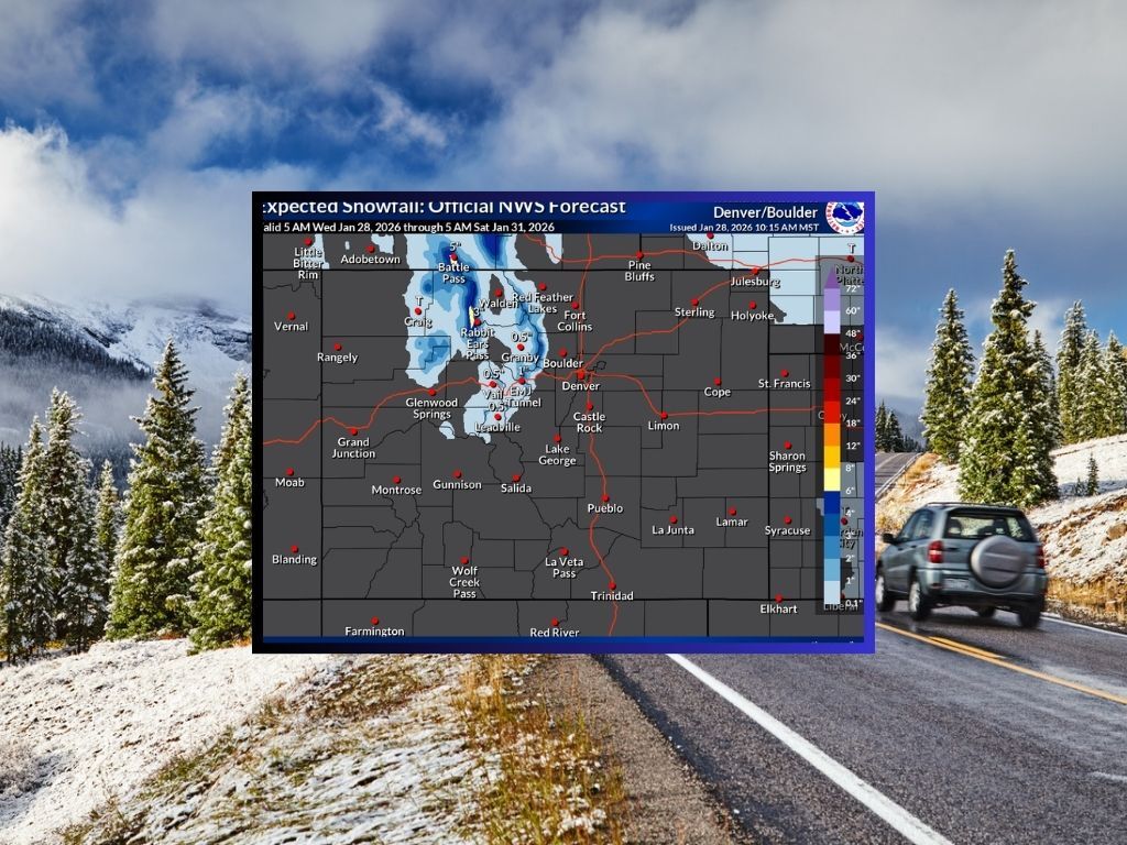
Through Saturday morning, the National Weather Service is calling for about 1 to 4 inches across a portion of Northern Colorado. Steamboat Springs could be an exception, with higher snowfall in the range of 6 to 8 inches expected.

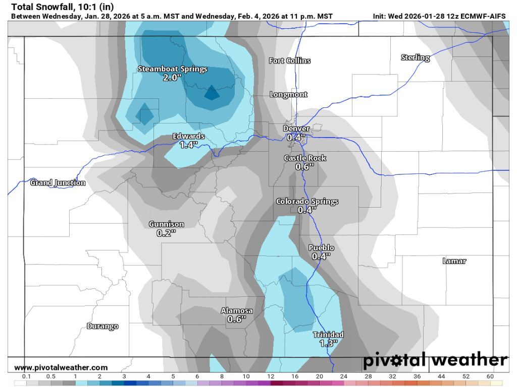
Looking farther ahead, more snow is expected between Feb. 3 and Feb. 4, though totals from this round of precipitation should be limited, as well. Snowfall during this date range should be restricted to northern Colorado and a pocket of southern Colorado that includes the Sangre de Cristos. Totals, however, shouldn’t be more a couple of inches.
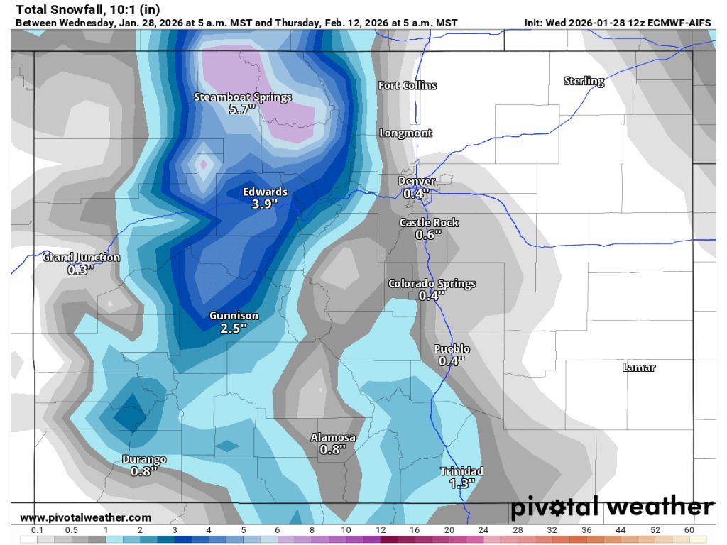
Following the wave of snow that should hit during the first week of February, a more significant storm is expected to hit from Feb. 9 until into Feb. 12, per Pivotal Weather reporting. Totals during this period should still be limited to a few inches, though this snowfall is predicted to include portions of southwest Colorado.
Perhaps the better news is that this later round of snow could start a snowier trend that may continue into the second half of the month. OpenSnow’s Joel Gratz indicates that signs point toward “stormier weather” during the last couple weeks of February.
Per Evan Wyloge’s reporting based on data from OnTheSnow, CSCUSA, and resort websites, no ski area in Colorado has gotten snowfall over the last 48 hours.