


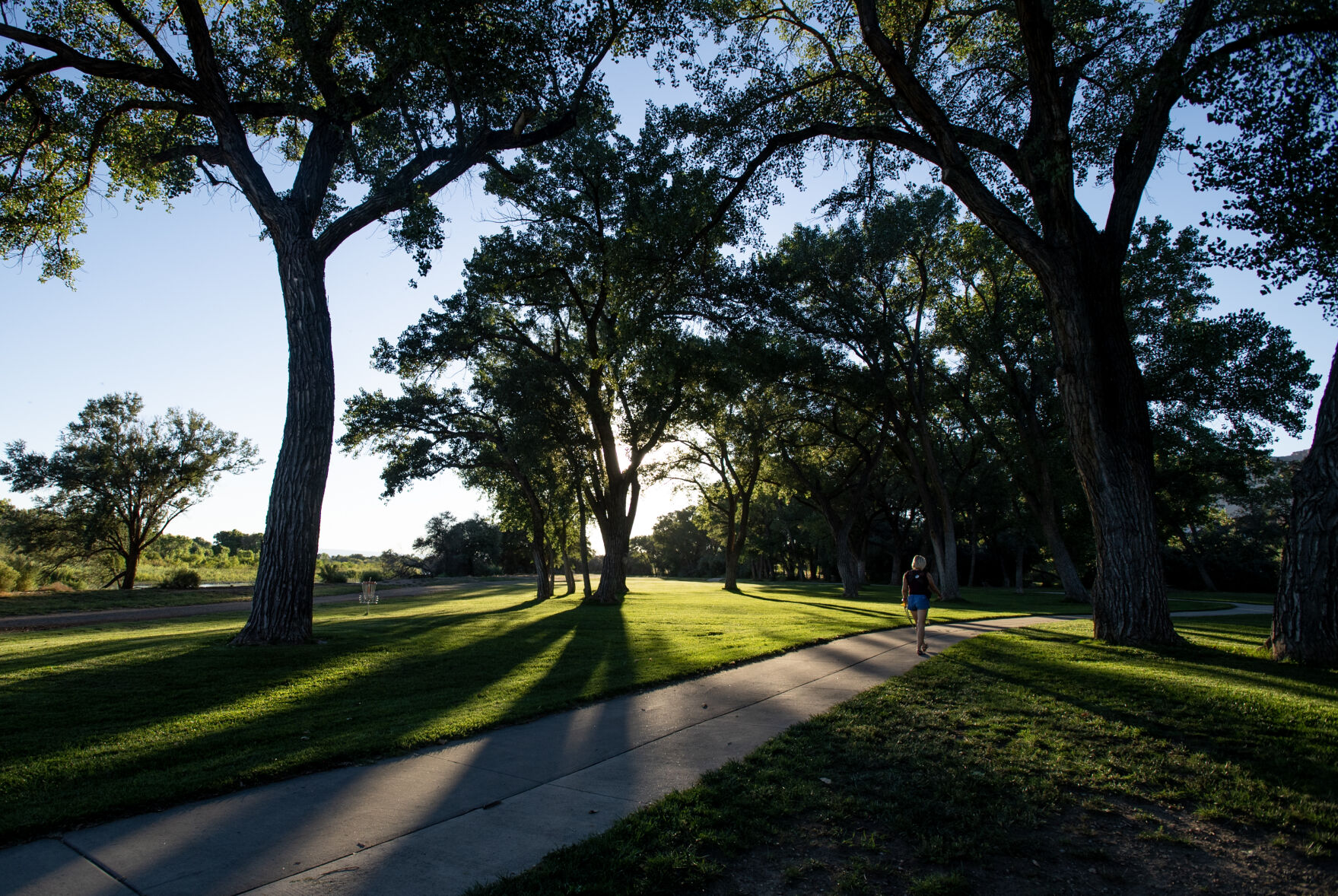
These 8 bike paths offer a true tour of Colorado — and they might be more important than ever
Those in the know will tell you the best way to see Colorado is on two wheels. Those like Rachel Hultin.
She’s the policy director for advocacy group Bicycle Colorado. It’s a role that has her singing the praises of the state’s bike paths — the paved, regional networks that grant us a scenic getaway in the slow lane.
“This is part of who we are as a state,” Hultin said. “Colorado bike culture really values these experiences of getting off the road and really connecting with the beauty that makes Colorado, in my humble opinion, the best state in the country.”
But an advocate never can be too satisfied. Hultin’s job is to push for a bigger, better, more connected network — as vital as ever, she insisted.
Hultin recently presented a slide show to lawmakers noting 2022 as the deadliest year on Colorado roads since 1981. Of the 745 killed, a record 36% were outside a vehicle, according to Colorado Department of Transportation data.
The cyclist toll has been relatively flat over the years — 12 last year — though Hultin said she is tracking an uptick in 2023.
“What we’re realizing is our roads are getting more dangerous, especially for people not inside a car,” she said.
And, she added, Bicycle Colorado’s surveys are showing another alarming trend based on safety concerns: “We’re seeing more and more people who are stepping away from riding.”
More, too, are opting for an e-bike — ideal for commuting on paths that Hultin and local groups are trying to make even more ideal.
Gaps continue to be filled toward long-held dreams: Peaks to Plains Trail, from the Denver metro to Loveland Pass; Eagle Valley Trail, from Vail Pass to Glenwood Canyon; and Front Range Trail, from Wyoming to New Mexico.
In the meantime, there is no shortage of opportunities:
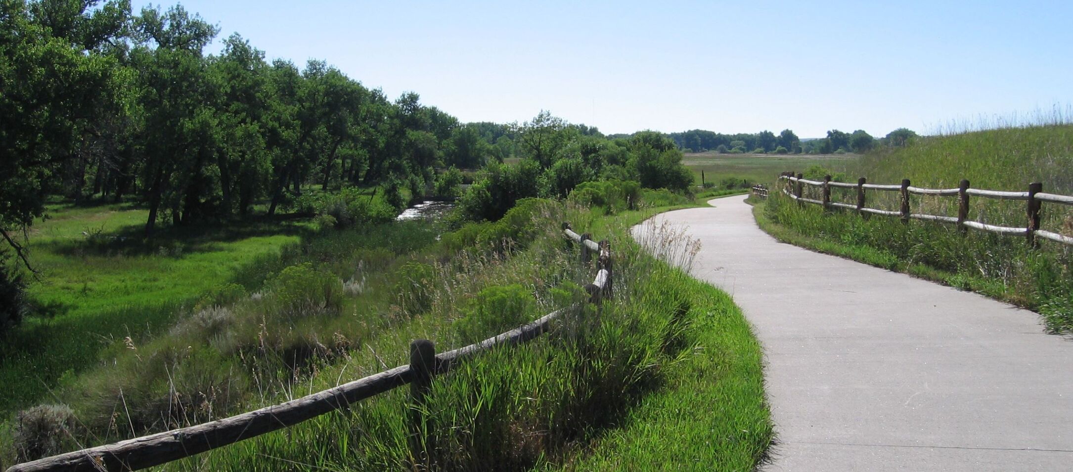
Cherry Creek Regional Trail
The city fades away the farther east you go on the trail stretching about 40 miles from Denver’s Confluence Park. The park marks the historic site from which Denver took shape. The trail beyond travels back through time, as well, if you can picture wagons rolling across the plains amid Parker’s urban sprawl. The trail reaches the more rural surroundings of Franktown.
Poudre River Trail
This is a chance to experience the often overlooked beauty of northeast Colorado. From Island Grove Regional Park in Greeley to Colorado 392 in Windsor, the pavement roams 21 miles past wide-open meadows, marshes, cottonwood stands and rolling, rocky bluffs. “Welcome to a whole new world,” goes the promise of advocates.
Pueblo River Trail System
The city maps more than 30 miles of paths paralleling Fountain Creek and the Arkansas River, wrapping around downtown and out to Lake Pueblo State Park. The Riverwalk is one spur along the way, as is the Nature and Raptor Center. The Arkansas River-lined path stretches close to 15 miles from downtown to Lake Pueblo, where riders can pedal onward along the shores.
Summit County Recreational Pathway System
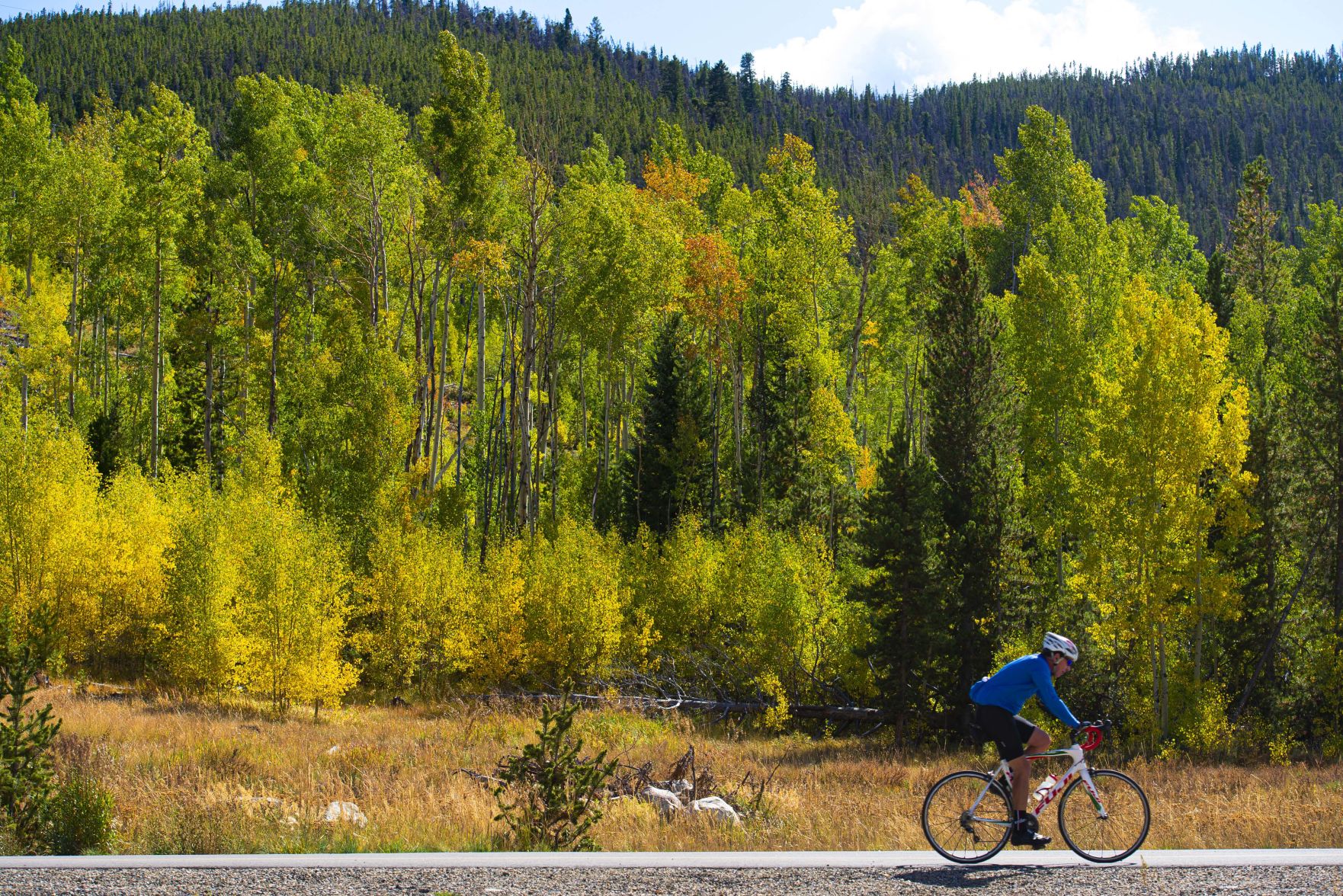
That’s the name on the county website, which includes a map detailing more than 50 miles of pavement exploring Breckenridge, Frisco, Dillon, Silverthorne, Keystone and Copper Mountain. Locals simply know it as the Recpath. They and tourists reportedly combine for an estimated 200,000-plus trips a year on the network affording an easy cruise around parts of Dillon Reservoir or a hard charge up Vail Pass.
Mineral Belt Trail
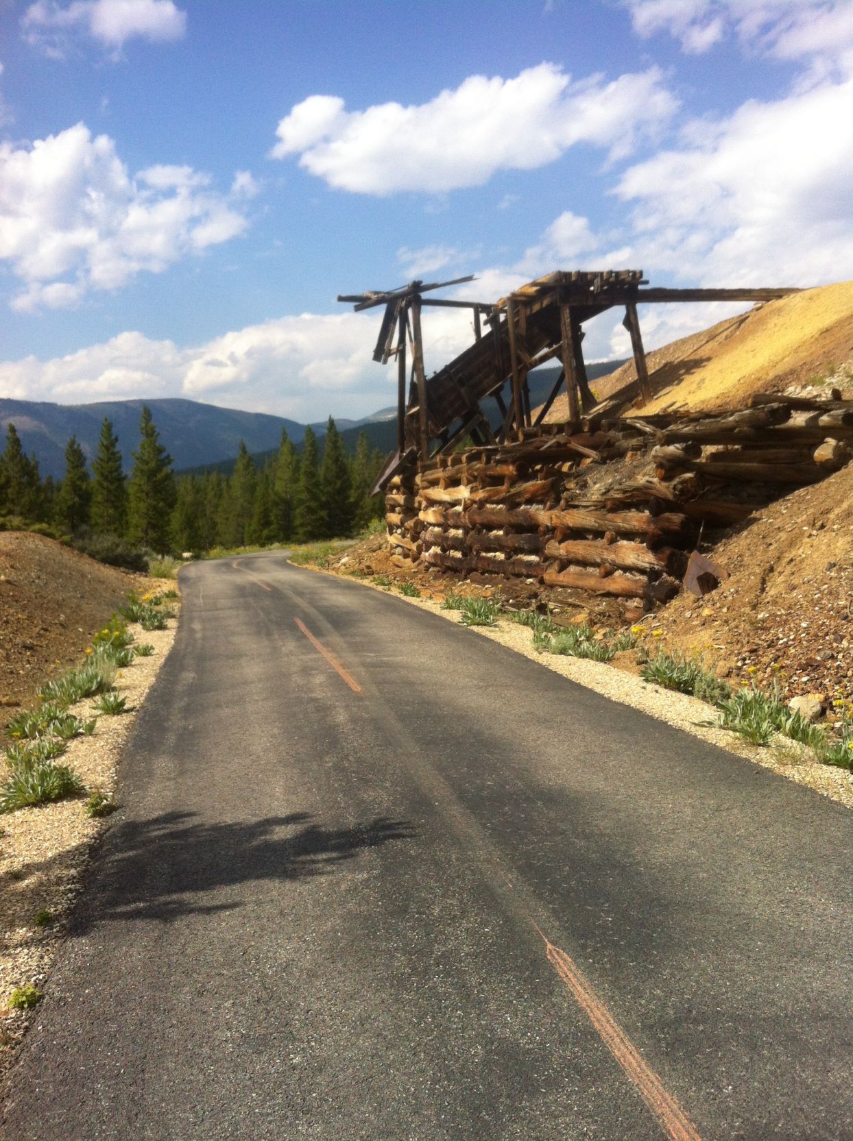
About half of the 11.6-mile trail loops through the Leadville Mining District, granting an up-close look at the historic industry that made this one of America’s most famous boom towns. At 10,200 feet, Leadville is North America’s highest incorporated town, meaning some lung power is needed for the Mineral Belt. The trail and big mountain views are available year-round; a snowcat grooms for cross-country skiing, snowshoeing and fat biking.
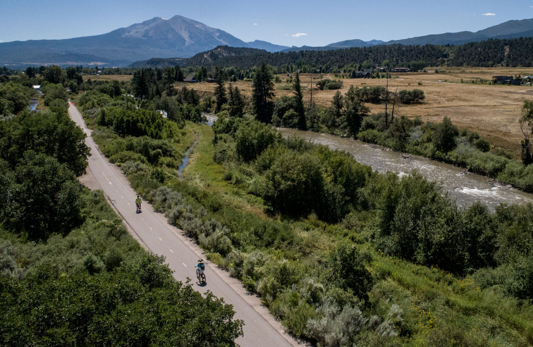
Rio Grande Trail
One terminus meets Glenwood Canyon Bike Path, a stunning destination of its own. The Rio Grande Trail flows beside Roaring Fork River from Glenwood Springs to Aspen. The downhill route is Aspen to Glenwood, but the uphill isn’t too demanding. Visit Glenwood Springs calls it “a gentle incline that makes for a pleasant ride” across 42 miles. The regal Mount Sopris looms in view, with the chance for bald eagle sightings.
Colorado Riverfront Trail
The 22-mile trail tours some of the Grand Valley’s more splendid outdoor attractions. That includes Palisade’s quaint Riverbend Park on one end and the Kokopelli Trail network on the other end toward Loma. Closer to the middle is Western Colorado Botanical Gardens and James M. Robb Colorado River State Park. Wooded sections offer shade from the desert heat — with the walls and cliffs of Colorado National Monument serving as the greatest reward.
Yampa River Core Trail

We all know Steamboat Springs as Ski Town USA, a reputation based on the historic Howelsen Hill Ski Area and the claim for producing Olympians left and right. Steamboat boasts another title: Bike Town USA. The Core Trail is a showcase. It runs 71/2 miles through town, crossing bridges over the Yampa River and aspen groves that glow in the fall.
Get OutThere
Signup today for free and be the first to get notified on new updates.
PREV
PREVIOUS

School choice foes turn to ballot referendums as states expand voucher programs
Voters in Nebraska are likely to weigh in on the state’s school choice program after a group submitted more than 100,000 signatures last week, seeking to force a ballot referendum. The effort seeks to repeal a state law passed this year that established a $25 million tax credit program for donors who give money to […]
Denver weather: Flirting near a daily high record Monday
A record high temperature for the date will not be reached today, but will flirt near the mark set in 1995. Denver residents can expect mostly sunny skies with a high near 90 Monday, according to the National Weather Service in Boulder. Breezy, with a south southwest wind 6 to 11 mph increasing to 13 to […]