


Snow totals for Colorado ski areas Tuesday | Whiteout snow report
Snow totals at Colorado’s ski areas and resorts for Tuesday are a touch higher than some of the weather models predicted, and skiers and riders will take it.
More snow is in the forecast for the weekend and heading into next week. December’s dryness has concluded.
Recap:
Snow fell about as predicted across Colorado from the Monday/Tuesday storm. The central mountains around Aspen and Snowmass received the most snow from the storm.
It snowed most of Monday in the high country and today is a light powder day close to Denver and a powder day in the central mountains near Aspen and in Eagle County (Beaver Creek and Vail).
The southern mountains faired Ok too, with Wolf Creek and Telluride receiving between 2-4 inches of snow.
Forecast:
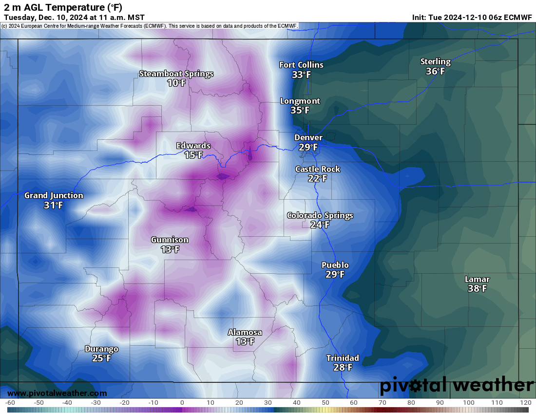
On Tuesday, cold temperatures and windy conditions will be present on mountain. Highs in the mountains will be in the single digits to low teens.
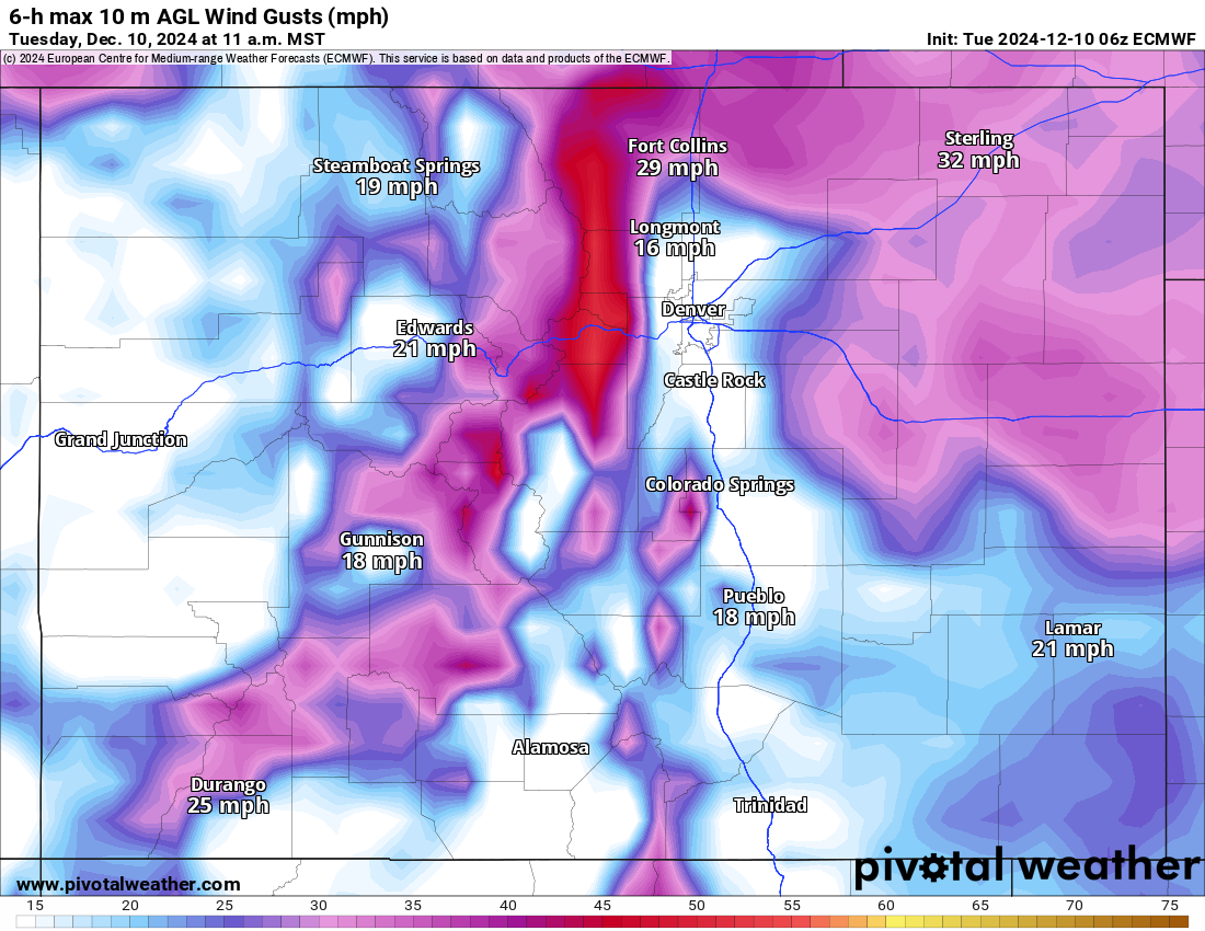
Wind gusts, especially along the northern Front Range Mountains, will exceed 45 mph at times, blowing snow across ridge tops and potentially affecting chair lift operations above treeline.
Snow will taper off Tuesday afternoon, but additional snow accumulations of between 1-4 inches in the northern and central mountains are possible.
Wednesday and Thursday are forecast to be dry and sunny, with some wind on Wednesday similar to Tuesday.
On Friday a short-duration and low impact storm arrives on a southerly path traveling through New Mexico with low snow accumulations possible; maybe a trace-1 inch in the northwestern and western mountains.
Saturday is looking like a transitional day as the state will be between storms.
Larger snow accumulations are forecast starting Sunday, lasting through Monday, and is forecast to focus on the northern, central and southern mountains, with the southeastern mountains being the exception and receiving very little new snow.
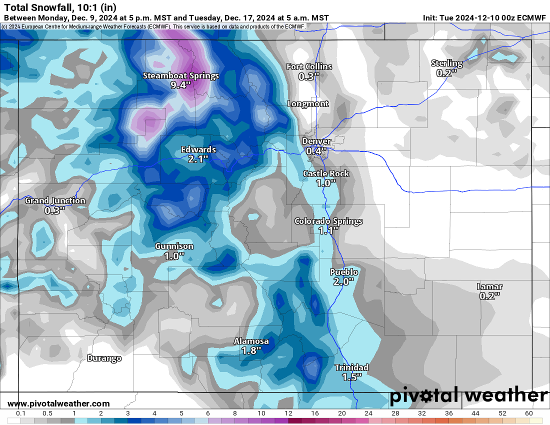
Forecasted snowfall totals in the northern mountains are between 3-6 more inches across the three mountain zones.
Long range:
From Tuesday, Dec. 17 through Thursday, Dec. 19, another round of wintry conditions will potentially affect Colorado. Details from this wave will become more clear as the date nears, including snow totals.
Today’s 24-hour snow totals from Colorado resorts:
Arapahoe Basin – 2″
Aspen Highlands – Opens Dec. 14
Aspen Mountain – 8″
Beaver Creek – 6″
Breckenridge – 5″
Buttermilk – Opens Dec. 14
Cooper – Opens Dec. 11
Copper Mountain – 4″
Crested Butte – 1″
Echo Mountain – Opens in December
Eldora Mountain – 1″
Granby Ranch – 0″
Hesperus – Closed for the season
Howelsen Hill – 2″
Kendall Mountain – Opens Dec. 20
Keystone – 3″
Loveland – 2″
Monarch – 3″
Powderhorn – 3″
Purgatory – 0″
Silverton – Opens Dec. 28
Snowmass – 8″
Steamboat – 5″
Sunlight – 0″, Open weekends, 7 days a week Dec. 13
Telluride – 4″
Vail – 6″
Winter Park – 2″
Wolf Creek – 3″