


Colorado Springs weather: Record-breaking temps give way to strong cold front
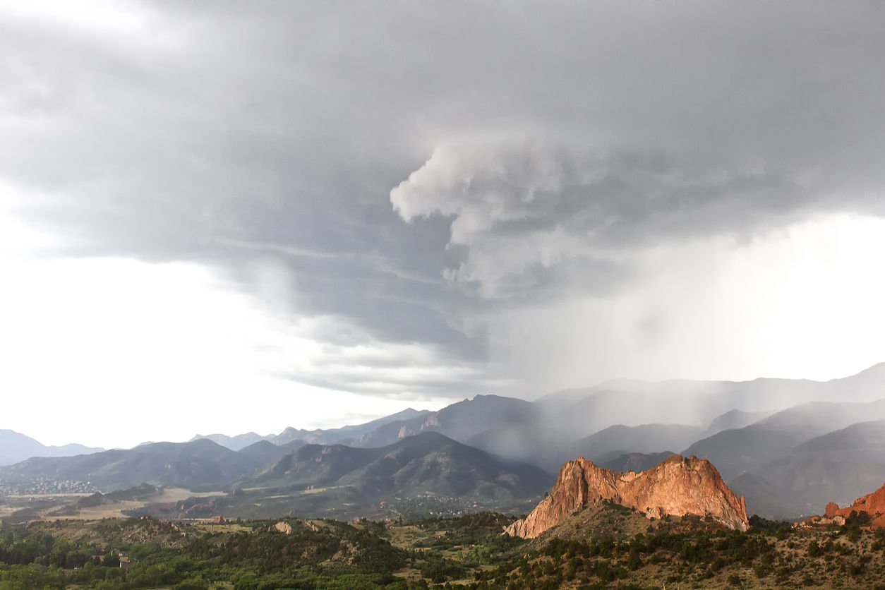
A cold front is expected to bring some relief to Colorado Springs residents Wednesday following a day of record-breaking heat, according to the National Weather Service in Pueblo.
Tuesday hit a temperature peak at 91 degrees around noon, breaking the city’s previous record for Sept. 20 of 90, last set in 2016, the service said. A steep temperature drop is expected Wednesday with a breezy high near 64.
Heavy rainfall is forecast for the central and southwest mountains, and while the NWS’s flood watch does not extend east into Teller or El Paso counties, the service said it is “closely monitoring” the Pikes Peak region, including Woodland Park and Colorado Springs, for heavy rains.
Showers are likely in the city and a thunderstorm is possible after 3 p.m.
Here is the full forecast from the National Weather Service.
Today: Showers likely, then showers and possibly a thunderstorm after 3 p.m. High near 64. Breezy, with a north wind 15-20 mph, with gusts as high as 35 mph. Chance of precipitation is 80%. New rainfall amounts of less than a tenth of an inch, except higher amounts possible in thunderstorms.
Thursday: Showers likely, with thunderstorms also possible after 3 p.m. Mostly cloudy, with a high near 55. South wind 10-15 mph. Chance of precipitation is 70%. New rainfall amounts between a tenth and quarter of an inch, except higher amounts possible in thunderstorms.
Friday: Sunny, with a high near 76. West northwest wind 10-15 mph becoming south southeast in the afternoon.
Saturday: Sunny, with a high near 75. Northwest wind 5-10 mph becoming southeast in the afternoon.
Sunday: Sunny, with a high near 68. North wind around 15 mph becoming south southeast in the afternoon.

Get OutThere
Signup today for free and be the first to get notified on new updates.
PREV
PREVIOUS
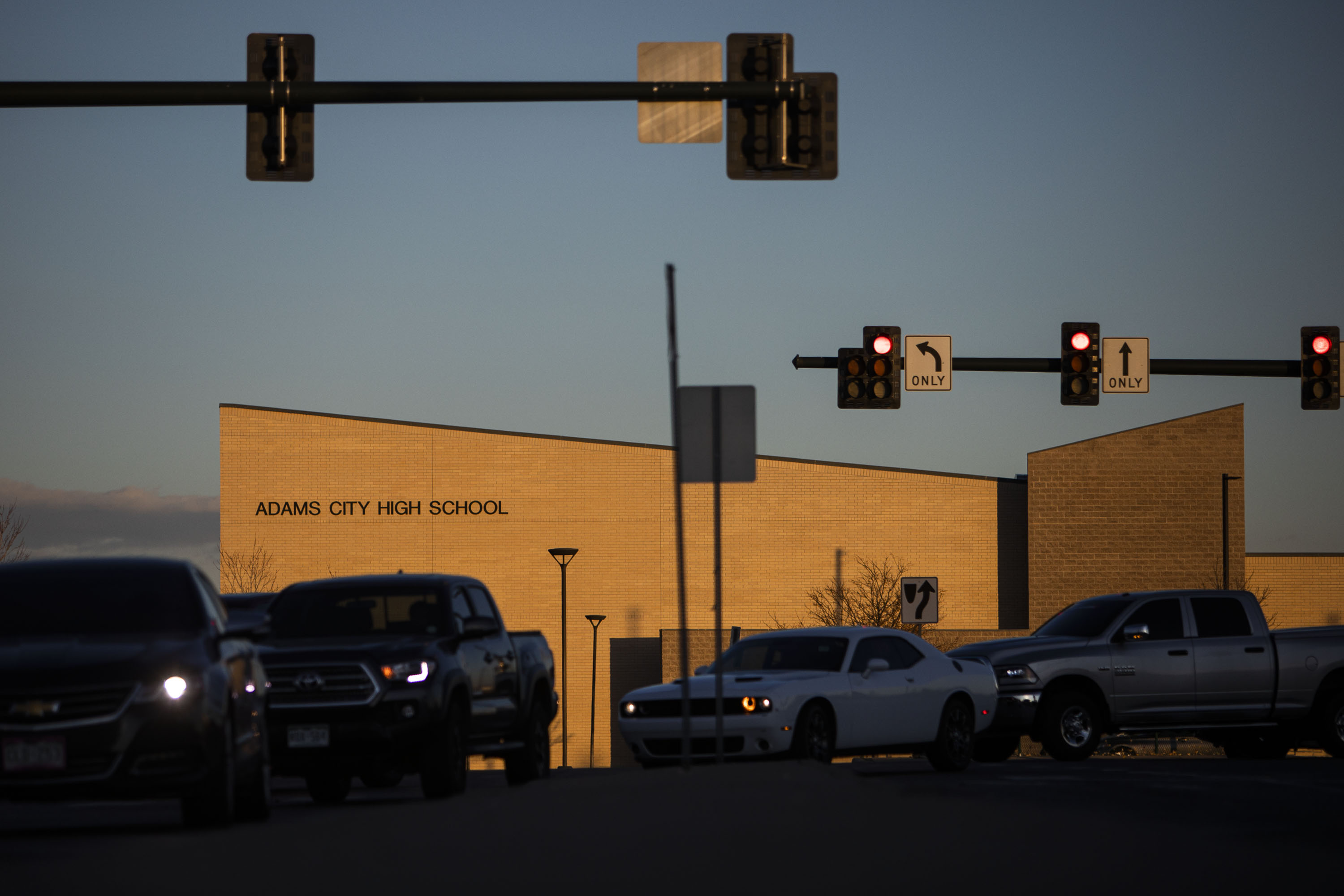
Classes to resume Thursday, threats against Adams City High School "unsubstantiated"
Adams City High School will resume classes as scheduled Thursday after police and school investigators found threats of violence that forced the Wednesday closure were unsubstantiated. Adams 14 School District Superintendent Dr. Karla Loria said the school was closed to facilitate a smooth investigation by the school district, Commerce City Police and the FBI. District spokesman […]
NWS tweet 092122
Heavy rainfall, 1-3 inches with locally higher amounts, expected across the southwest and central mountains tonight through Thursday leading to flash flooding and mudslide impacts. Temperatures will cool drastically the next couple of days, bringing more Fall like weather. #cowx pic.twitter.com/xbVBZnbUn5 — NWS Pueblo (@NWSPueblo) September 21, 2022