


18 inches of snow: Updated city-by-city breakdown of your chances
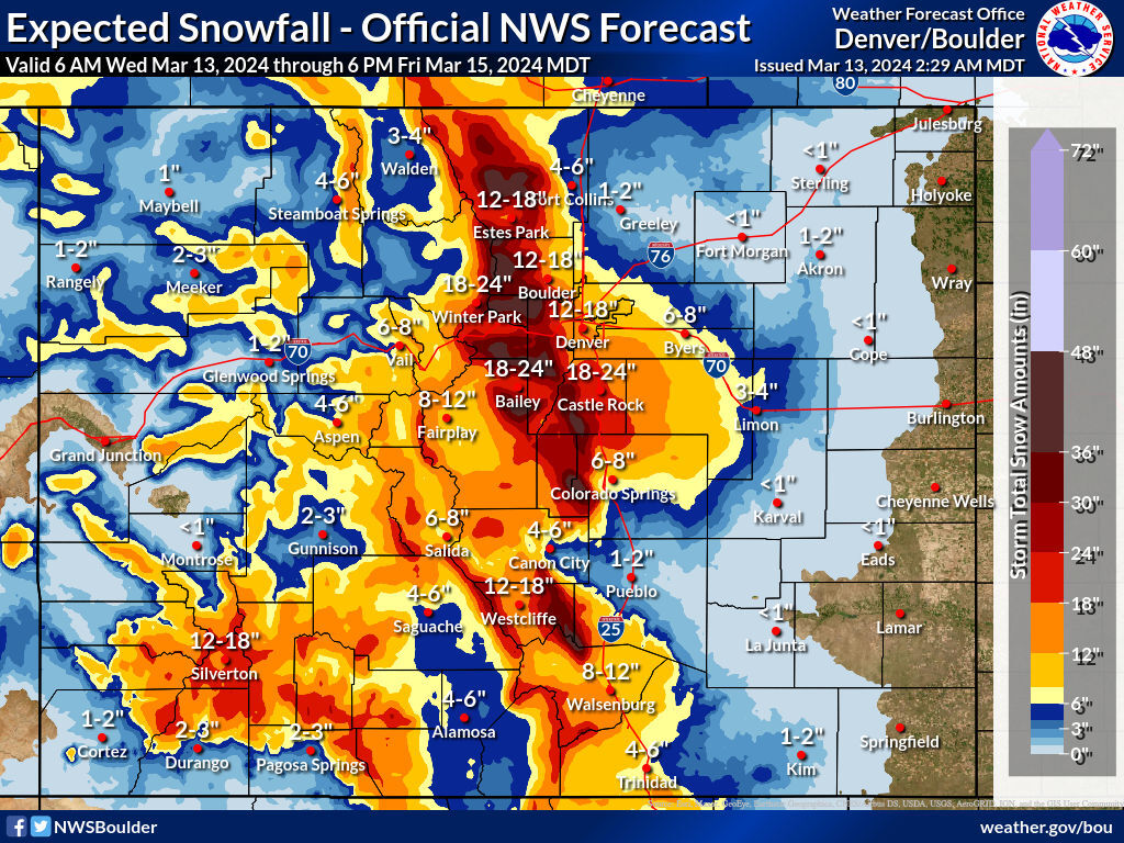
By now, Coloradans are well-aware of big snow that’s set to roll through the state from Wednesday through Friday. As tends to be the case with snowfall forecasts, they can change quite a bit in days and hours leading up to when the winter weather arrives.
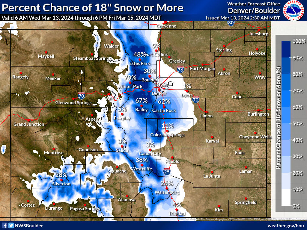
Here’s a look at the current percent chance for up to 18 inches of snowfall in various places around the state, compared to what that percent chance was on Tuesday afternoon, according to the National Weather Service.
Most notably, most places have less of a chance of 18 inches today compared to yesterday, though there has been an uptick in that probability in some spots, including Castle Rock, which tends to be a pain point for I-25 travelers.
A map of the probabilities around the full state from the National Weather Service can be seen at the top of this article, with a comparison to Tuesday’s percent chance found below:
- Aspen: 0 percent chance (no change)
- Bailey: 67 percent chance (-4 percent)
- Boulder: 30 percent chance (-14 percent)
- Castle Rock: 62 percent chance (+5 percent)
- Colorado Springs: 11 percent chance (-14 percent)
- Denver: 10 percent chance (-24 percent)
- Estes Park: 48 percent chance (+5 percent)
- Fort Collins: 5 percent chance (+5 percent)
- Grand Junction: 0 percent chance (no change)
- Pueblo: 0 percent chance (no change)
- Silverton: 28 percent chance (-3 percent)
- Steamboat Springs: 0 percent chance (no chance)
- Walsenburg: 25 percent chance (-15 percent)
- Westcliffe: 38 percent chance (+19 percent)
- Winter Park: 70 percent chance (-20 percent)
The most dangerous day to travel is expected to be Thursday. Travel may become extremely difficult to impossible.
Follow along on the National Weather Service website for the most up-to-date information.
Get OutThere
Signup today for free and be the first to get notified on new updates.
PREV
PREVIOUS
48 to 60 inches of snow could hit some mountain peaks in Colorado
As the major snowstorm that’s set to hit Colorado from Wednesday into Friday approaches the Front Range, the National Weather Service has upped the forecast for maximum snowfall amounts. Mapping published Wednesday morning by the NWS shows that the ‘high-end’ snowfall forecast now sits at 48 to 60 inches for peaks along the Continental Divide […]
Ski area could get 43 inches of snow over upcoming days in Colorado
With a major snowstorm set to bear down on Colorado, parts of the Front Range, Central Mountains, and Southwest are expected to get hazardous amounts of snow – potentially more than 48 inches. Travel is expected to become very dangerous, especially on Thursday, with snowfall set to take place between Wednesday and Friday. While this […]