


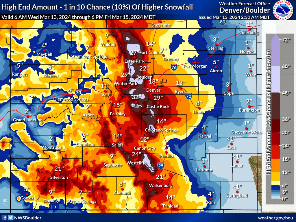
48 to 60 inches of snow could hit some mountain peaks in Colorado
As the major snowstorm that’s set to hit Colorado from Wednesday into Friday approaches the Front Range, the National Weather Service has upped the forecast for maximum snowfall amounts.
Mapping published Wednesday morning by the NWS shows that the ‘high-end’ snowfall forecast now sits at 48 to 60 inches for peaks along the Continental Divide (see map above). Meanwhile, the Front Range metro area along I-25 could still get big totals – 18 inches in Denver, 29 inches in Castle Rock, and 16 inches in Colorado Springs. It’s important to note that this ‘high-end’ scenario has a 10 percent chance of happening, but if it does, this will be one of the most notable March snowstorms to ever hit Colorado’s Front Range.
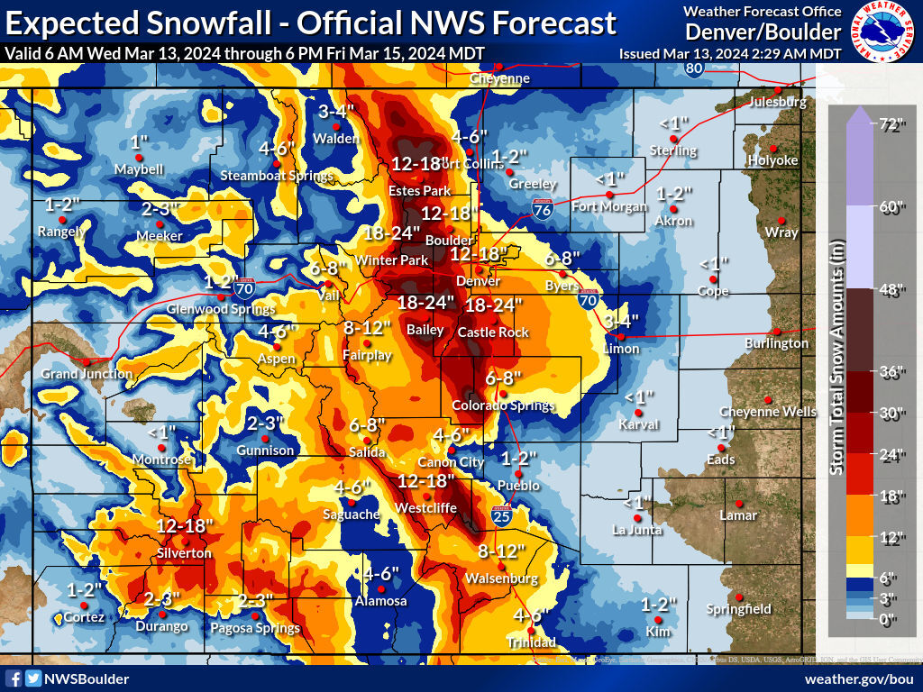
Even the ‘expected’ 80 percent chance scenario shows the potential for big totals – 12 to 18 inches in Denver and 18 to 24 inches in Castle Rock. That said, in the ‘expected’ scenario, Colorado Springs gets much less – six to eight inches.
Then there’s also the 10 percent-chance ‘low end’ scenario. If the storm fizzles out a bit, parts of I-25 still get up to 18 inches of snow. Totals in major cities are much less though – six inches in Denver, 11 inches in Castle Rock, and four inches in Colorado Springs.
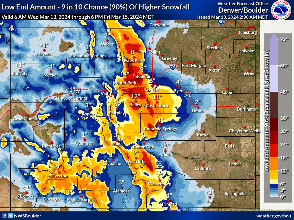
The southern I-25 corridor, along with the Central Mountain I-70 corridor will also get big snow in all three scenarios, as will southwest Colorado.
Expect travel to start getting difficult later on Wednesday, with the worst travel conditions set to hit on Thursday. The storm should ease up by Friday.
Follow along on the National Weather Service website for the most up-to-date information.
Get OutThere
Signup today for free and be the first to get notified on new updates.
PREV
PREVIOUS

Denver area events
If you have an event taking place in the Denver area, email information to [email protected] at least two weeks in advance. All events are listed in the calendar on space availability. Wednesday Arts in the Afternoon: Colorado Chamber Players — 1:30 p.m., Lone Tree Arts Center, Main Stage, 10075 Commons St., Lone Tree, $24. Tickets: […]
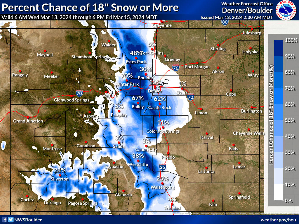
18 inches of snow: Updated city-by-city breakdown of your chances
By now, Coloradans are well-aware of big snow that’s set to roll through the state from Wednesday through Friday. As tends to be the case with snowfall forecasts, they can change quite a bit in days and hours leading up to when the winter weather arrives. Here’s a look at the current percent chance for […]