


Water’s scenic, surprising role at Colorado’s national parks

Across Colorado’s four national parks, water is both celebrated and overlooked.
Water is not necessarily at the forefront of the parks’ popular postcards. The parks find themselves in a semi-desert state, after all.
But if you venture far enough in some cases, if you visit at the right time and look closely in other cases, water’s role is clear: essential.
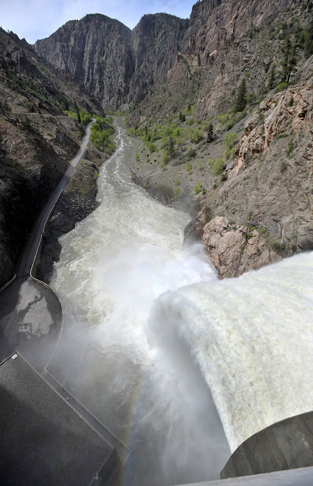
Black Canyon of the Gunnison: The park brochure tells of “The Song of the Gunnison.” The brochure implores one to be still and listen to the rush of wind through the deep, narrow canyon — and the rush of water some 2,000 feet below.
That’s the Gunnison River, which has long inspired romantic ruminations. It has inspired desperate, daring tales, including that of Abraham Lincoln Fellows. He is credited as the first to report surviving the passage from either end of the canyon. The river “reverberated and echoed like demons howling over their prey,” he wrote in 1901.
It’s language that serves as a warning to explorers today. “Kayakers run the river at their own risk,” reads the park website.
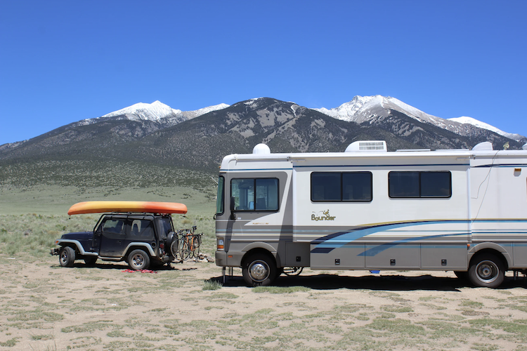
Great Sand Dunes: Here where North America’s tallest sand dunes rise with the surrounding Sangre de Cristo peaks, so too does a creek — sometimes appearing more like a river. It’s one more surprise of perhaps Colorado’s most surprising landscape.
Yes, at peak flows toward the end of May, Medano Creek can rise and surge, making waves for kids surfing on floats. That’s on the occasion that snowpack is plentiful. The water can otherwise appear like a modest stream, no less enjoyed by families who come as if to a beach.
It’s Medano Creek to thank for the sand dunes, you see. From the mountains, the water carries down sediment to be trapped and then built upward by swirling winds.
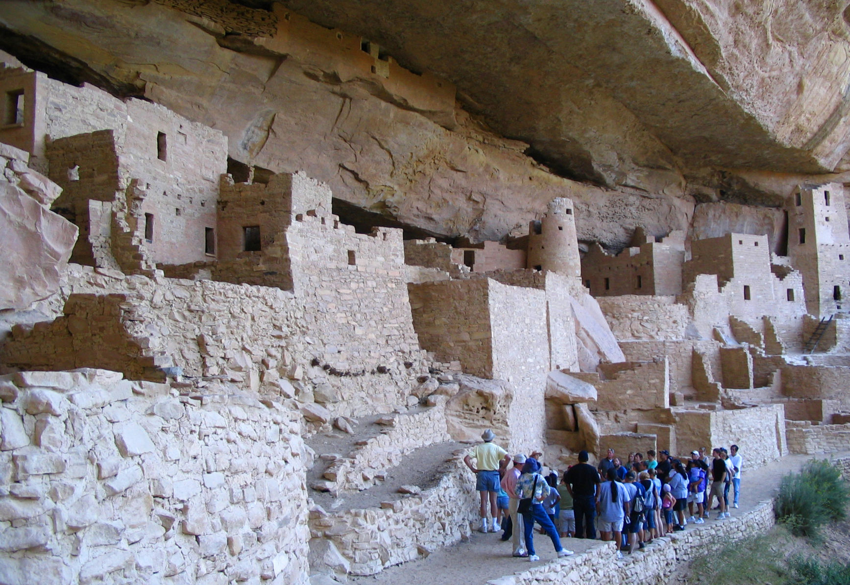
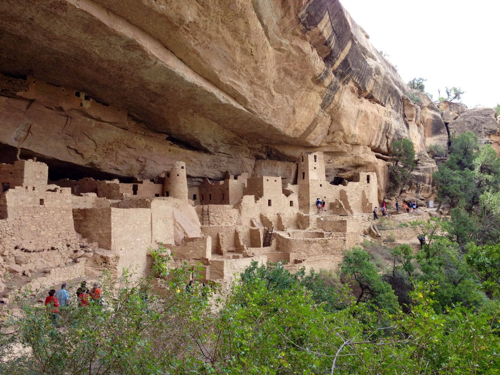
Mesa Verde: Water is not the attraction at this archaeological wonder in southwest Colorado. The attractions are the cliff dwellings, built and occupied by the Ancestral Puebloans beginning in the late 12th century. Look closely, and you’ll see how they got water.
The park points to small channels and depressions across the mesa’s vast rock. Those were hand-carved by the ancient people.
“The Ancestral Pueblo people likely knew the location of every seep spring on Mesa Verde,” the park notes. “They often managed the flow of water emerging from a cliff face by carving small depressions into the shale floor, channeling the water into small pools from which to collect the water.”
Rocky Mountain: Lakes and waterfalls are calling cards of the park. Bear Lake might just be the most photographed scene in Rocky, while others venture on to Dream Lake, Emerald Lake, Lake of Glass, Sky Pond or any of the several bodies of water spotting the alpine. Just as popular are a smattering of cascades: Alberta Falls, Ouzel Falls and Adams Falls among them.
Often missed is a fact that makes the park’s landscape of utmost importance: The Colorado River starts in these high boundaries. From the Continental Divide, the river winds its critical way through canyons, deserts and dams of the Southwest.
The headwaters of the Big Thompson and Cache La Poudre rivers also originate in the park.

Get OutThere
Signup today for free and be the first to get notified on new updates.
PREV
PREVIOUS
Colorado campsite known for 'starry night sky' ranked as '3rd-best camping spot' in US
Popular camping resource The Dyrt has released its 2024 rankings for the ‘top 10’ places to camp in the United States – and one Colorado spot made the cut to be included. Found near the town of Blanca in Colorado’s San Luis Valley, Sacred White Shell Mountain ultimately ranked 3rd on the nationwide list that […]
Biden frustrates his party with immigration plan to woo skeptical voters
President Joe Biden‘s looming executive order to shut down the border once entries exceed a certain point is leading to frustration among his Democratic allies. Biden is expected to sign the order Tuesday after years of intense pressure. Progressive Democrats are already voicing their criticism, comparing Biden to former President Donald Trump. “I think it’s […]