


RECORD SNOW: Colorado region hasn’t had this much ‘to-date’ snowpack since at least 1992
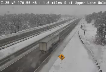
Wintery weather is raging in Colorado, packing on the powder and shutting down key roads around the state. While some snowfall can typically be expected during early November, the sheer amount of snowfall that’s landed along the I-25 corridor and in southern Colorado this week is fairly unprecedented, perhaps more typical of an above-average February snowstorm.
As of Friday morning, 18 to 30 inches of snow have fallen over the last 72 hours in this southern Colorado region with quite a bit more on the way, and a lot of this snow has landed in parts of the state that have yet to be favored by snowfall thus far this season.
At a statewide level, current snowpack sits at about 171 percent of the long-term norm for this point in the year, as of November 8. The biggest gap between the current snowpack and what’s typical is found in southwestern Colorado’s San Miguel-Dolores-Animas-San Juan River Basin, which currently sits at about 353% of the norm for the date. This puts this season’s snowfall in the 89th percentile compared to other years of recent history, with data collected in this region since 1987.
Perhaps more impressive, however, is another river basin that’s reached 30-plus year highs in terms of snowpack.
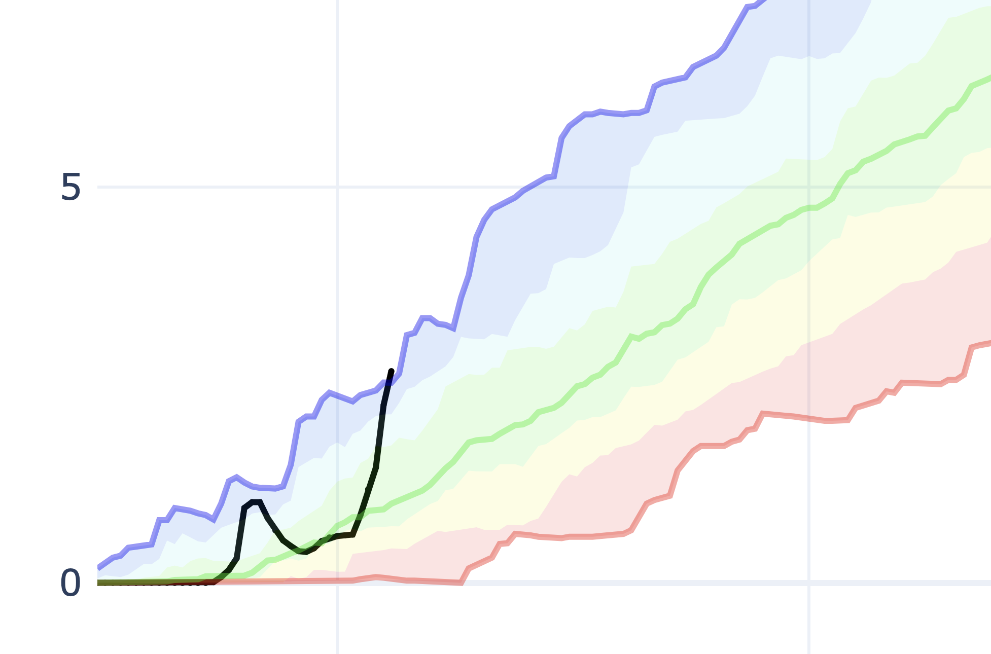
While the start of the snow season was rather lackluster in the Arkansas River Basin – home to cities like Colorado Springs, Pueblo, and Trinidad, this week’s storm has changed that in a big way.
As of November 8, snow water equivalent in this part of the state has skyrocketed to 2.7 inches compared to a long-term norm of one inch, which 267% of the long-term norm and an all-time-high since the USDA started publishing data for this region in 1992.
A few years have come close to the same snowpack level at this point of the year – the 1996-1997 snow season, the 1998-1999 snow season, and the 2011-2012 snow season – but none have topped the to-date snowpack that’s currently present in this southern Colorado region as of November 8. And keep in mind – more snow is on the way, with the National Weather Service calling for another 12-plus inches of snow in this region over the next 24 hours or so.
Expect this gap between the current snowpack and the typical snowpack in the Arkansas River Basin to continue to widen – at least through Saturday.
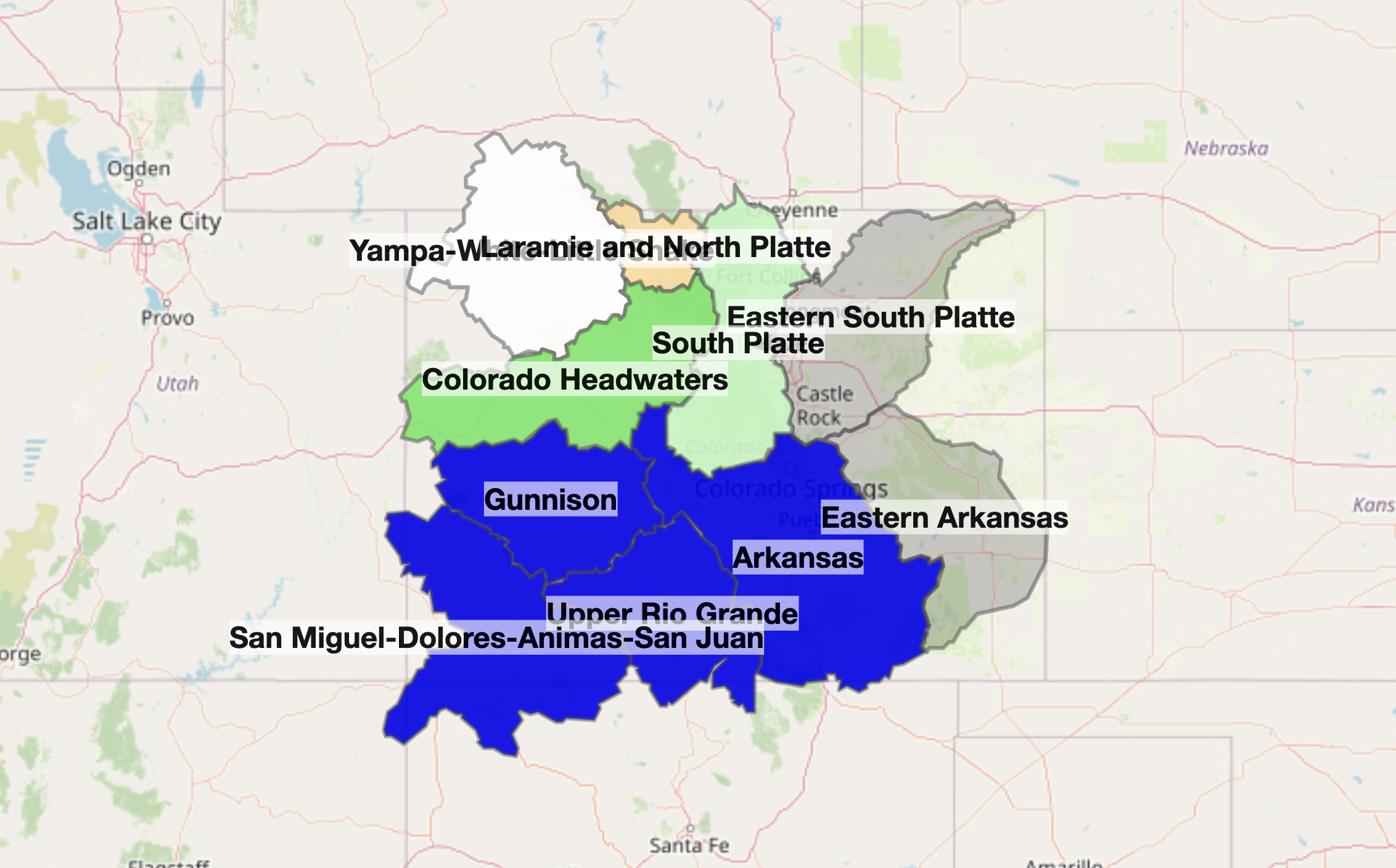
Here’s a breakdown of what snowpack looks like around the state:
- San Miguel-Dolores-Animas-San Juan River Basin (southwest Colorado): 353% of norm
- Upper Rio Grande River Basin (southern Colorado): 316% of norm
- Arkansas River Basin (southern/southeast Colorado): 267% of norm
- Gunnison River Basin (western Colorado): 208% of norm
- Colorado Headwaters (western Colorado): 136% of norm
- South Platte River Basin (central Colorado): 111% of norm
- Yampa-White-Little Snake River Basin (northwest Colorado): 96% of norm
- Laramie and North Platte River Basin (northern Colorado): 80% of norm
Find additional weather information on the National Weather Service website.
Get OutThere
Signup today for free and be the first to get notified on new updates.
PREV
PREVIOUS
Road closures around Colorado: Updated list, including U.S. 24 east of Colorado Springs
While the big snow storm that dumped more than 20 inches of snow in some metro areas around Colorado is over, several weather-related highway closures remained as of 9 a.m. Saturday. U.S. 24 remained closed in both directions between Colorado Springs to Limon, and southbound Interstate 25 from Pueblo New Mexico was also closed Saturday […]