


Storm likely to bring widespread snow to Colorado’s mountains – here’s how much to expect
Per mapping from the National Weather Service, another October storm system is set to bring widespread snow to Colorado’s mountains. While totals should be relatively low, it could still be enough to impact outdoor recreation.
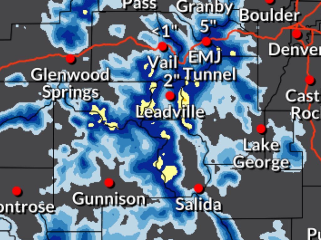
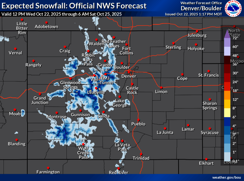
Both the more likely ‘expected’ snowfall scenario (80% chance) and the ‘high-end’ scenario (10% chance) show a similar swath of the state getting hit with snow between Wednesday and Saturday morning, favoring the central and southwestern mountains. In the high-end scenario, totals top out in the range of eight to 12 inches, while in the ‘expected’ scenario, those totals top out between six to eight inches. It should be noted, however, that in both scenarios, those upper-end totals are restricted to a select few central mountain peaks.
Meanwhile, the rest of the central and southwestern Colorado regions outside of those limited peaks should get snow in the range of one to six inches, with points of higher elevation getting more snow.
Mapping of both scenarios can be seen below:

Whether it’s the ‘high-end’ or ‘expected’ snowfall scenario occurring, this snow could impact outdoor recreation plans, with campers and hikers being two groups that should pay close attention to the forecast.
Trails could be slick and roads into remote areas could get snowy and wet. Proceed with caution and pack gear accordingly.
Find additional forecasting information on the National Weather Service website.
Get OutThere
Signup today for free and be the first to get notified on new updates.
PREV
PREVIOUS

Tickets on sale for fest that hosts 'world's largest naked ski lap' in Colorado
The date has been set for the 6th annual ‘Boot Tan Fest,’ set to take place at Sunlight Mountain Resort near Glenwood Springs next spring. The popular event is billed as an “empowering, safe, and wildly fun space where women and nonbinary folks come together to celebrate their love for the mountains,” and this ski […]

Popular reservoir with 'dog beach' to permanently close amid toxic cyanobacteria and E. coli concerns
Once a popular destination for pet owners in Colorado Springs thanks to its beach and dog-friendly nature, South Suburban Reservoir is set to be permanently closed to the public – four-legged friends included. The reservoir is found in Stratton Open Space and has served an important role in providing local residents with safe drinking water […]