


12-day stretch set to bring ‘risk of heavy snow’ to Colorado mountains

It’s been a dry fall thus far in Colorado, but hopeful slopesport enthusiasts should keep their fingers crossed as mid-November hits. Per mapping from the National Weather Service, there’s an extended chance of heavy snow hitting the state’s mountains over upcoming days.
Each day during the snow season, the National Weather Service publishes a ‘risk of heavy snow’ map that basically looks a few days ahead and highlights where heavy snow may occur around the country. Mapping published in recent days (seen above) shows that a risk of heavy snow could stretch from November 14 through November 26 if forecasting holds true.
The most recent mapping, published on Wednesday, depicts what’s perhaps the most widespread risk of heavy snow over upcoming days, encompassing the entire Western Slope and stretching as far east as the I-25 corridor. The risk depicted in that map would be present from November 20 through November 26 – still more than a week out and subject to change, but that could be big news for Thanksgiving skiers.

Snowfall forecasting will get more specific as the aforementioned dates approach, but as it stands now, anything would likely be welcomed by eager Centennial State skiers and snowboarders. Statewide, snowpack is at just 19 percent of the norm for the date, with some regions quite a bit below that. Southwest Colorado, for example, is at just 13 percent of the norm, with 92% of snow seasons since records started in 1987 having more snow by this point in the year.
Find additional reporting related to potential incoming snow on the National Weather Service website.
Get OutThere
Signup today for free and be the first to get notified on new updates.
PREV
PREVIOUS
Aurora forecast intensifies for Wednesday night, likely indicating another colorful show in Colorado
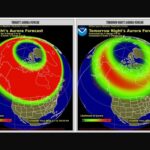
In case you missed the big show from the Northern Lights above Colorado on Tuesday night, it’s looking like you’ll have another chance to catch a colorful sky. A recent update from the National Oceanic and Atmosphere Administration indicates that the forecasted Kp score of the aurora for Wednesday night is now an ‘8’ of […]

Massive vinyl record event set to return to Colorado Springs
The Colorado Record Show, Southern Colorado’s largest vinyl record event, is returning to Colorado Springs on Nov. 22, set to take place at the Antlers Hotel. The event will include around 100 tables filled with records, CDs, cassettes, posters, music memorabilia, and more from vendors all around the state. According to the Colorado Record Show […]