


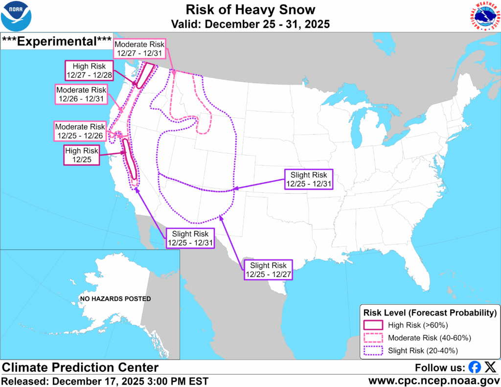
12″ of snow possible in northern Colorado ahead of ‘risk of heavy snow’ during Christmas week

A bit more snow is expected to fall through this weekend in northern Colorado ahead of what could be a snowy end to the month.
According to the National Weather Service, about six to eight inches of snow should hit peaks along the Continental Divide (north of I-70) and Park Range through Sunday morning, with the latter region having a chance of seeing snow in the 12 to 18 inch range in some select high-elevation areas. Meanwhile, the rest of the central and northern mountains should get between one to six inches.
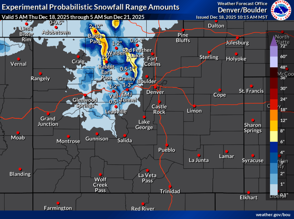
Per the OpenSnow report, Steamboat Resort should get the most snow among Colorado’s ski areas over the next five days, though Joel Gratz calls for this to be limited to about six inches. Find OpenSnow’s full resort-by-resort breakdown here.
Following a snowier period from Friday to Saturday night, a chance of bigger snow comes around Christmas and during the following week.
The National Weather Service features the western half of Colorado on their ‘risk of heavy snow’ map for the dates of December 25 through December 31, as seen below:
Find additional forecast information on the National Weather Service website.
STAY INFORMED: Get free Colorado news with our daily newsletter (Click here)
Get OutThere
Signup today for free and be the first to get notified on new updates.
PREV
PREVIOUS

Winds hit 124 MPH at Colorado ski resort – same speed as Category 3 hurricane
As most Coloradans know by now, extremely strong winds scraped the state on December 17, reaching above 100 miles per hour in numerous locations. Trees were toppled, power was shut off for more than 90,000 residents, and debris posed a hazard for travelers. Colorado’s resorts didn’t escape without damages either, with Keystone Resort warning guests […]
$956,277 worth of bicycles stolen in Colorado city of 108,000 residents thus far in 2025
As any Coloradan who owns a bike should be aware of, bike theft in the Centennial State is no joke. Property theft rates in Colorado tend to be on the higher side compared to other places around the country and with many local outdoor recreation enthusiasts opting to invest in high-performance gear, bicycles can be […]