


Double-digit snow totals likely to make travel “difficult to impossible” in parts of Colorado this weekend
It looks like a bit of a post-Christmas weather turnaround as promised by forecasters will be taking place after all, with snow expected to hit Colorado over upcoming days – Denver and the Front Range included.
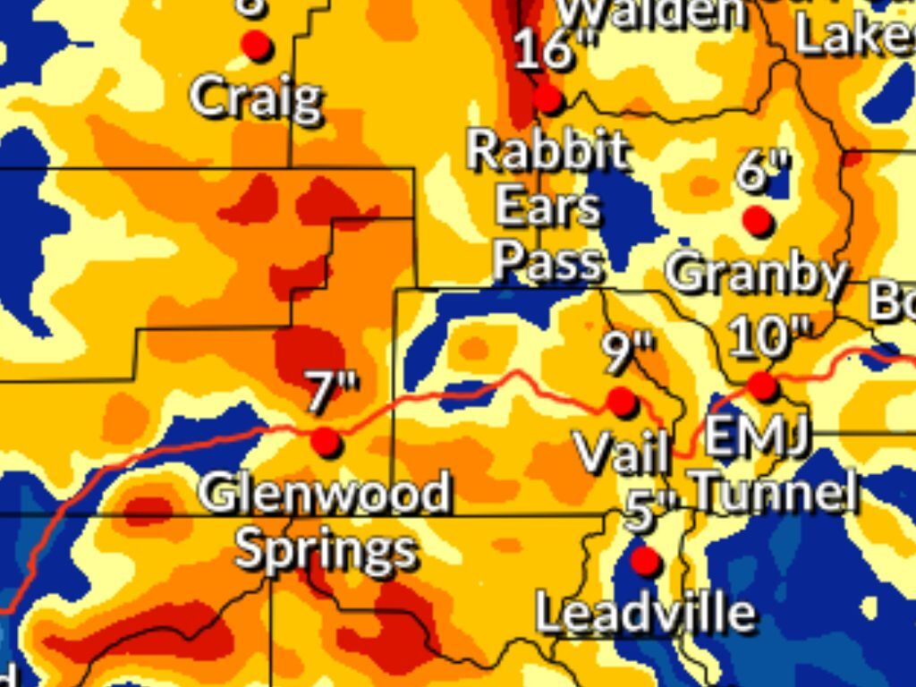
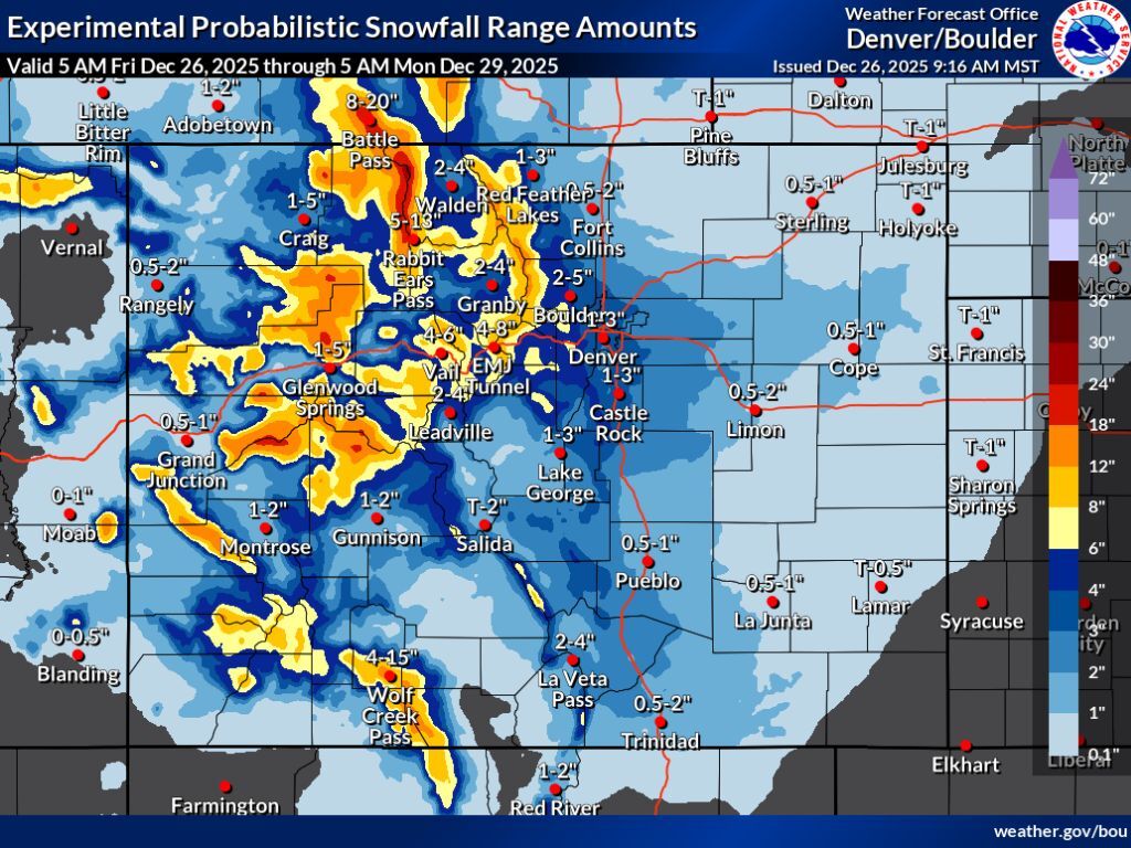
In the most likely scenario, widespread totals of about 12 to 18 inches are expected to land on many Colorado peaks through Monday morning (mapping found below in article), with most of that snow falling from Friday night into early Sunday hours. Totals on some peaks, especially those in the Park Range near Steamboat Springs, could reach higher than that, too, into the range of 18 to 24 inches. Meanwhile, Denver gets about one to three inches while Boulder gets two to five. It’s also worth noting that in this most likely scenario, parts of I-70 get snow in the range of eight to 12 inches, thus travel concerns can be expected in the mountains. Notably, Rabbit Ears Pass could get up to 13 and Wolf Creek Pass could get up to 15.
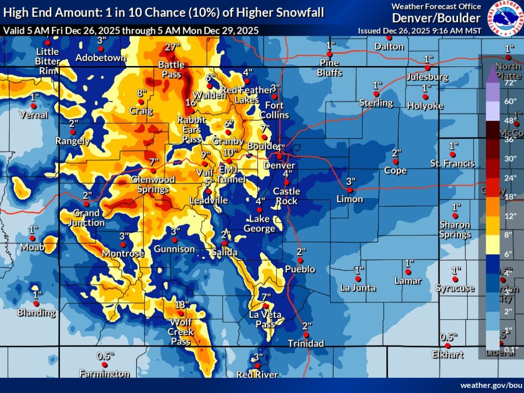
The high-end scenario (10% chance) is where things get particularly interesting, with the possibility of totals of about a foot being much more widespread throughout the mountains, with more peaks in that 12 to 18-inch range, as well as that 18 to 24-inch range. In this high-end scenario, the Park Range gets between 24 and 30 inches.
This high-end scenario would also be more impactful when it comes to travel – much of the mountainous I-70 drive gets about a foot of snow, with Rabbit Ears Pass getting 16 inches and Wolf Creek Pass getting 18 inches. The Front Range gets hit a bit harder, too, with Boulder having a chance for seven inches and Denver getting four.
See both forecasts depicted on mapping below, starting with the more likely scenario and then showing the high-end scenario with a 10% chance:
In addition to the snow, strong winds are expected in Colorado’s mountains, as well, prompting the National Weather Service to issue various winter weather advisories and storm warnings. Travel in impacted areas is expected to be difficult to impossible – find those alerts in detail by clicking into specific regions on the NWS homepage map.
As far as the state’s resorts go, Steamboat is expected to get the most snow over the next five days, according to OpenSnow – about 12 inches. Find OpenSnow’s full resort-by-resort breakdown here.
After a Christmas Day storm didn’t amount to much fresh snow, Colorado’s snowpack remains at about 54 percent of the norm for the date as of December 26, per the USDA.
Find additional weather information and forecasting from the National Weather Service here.
STAY INFORMED: Get free Colorado news with our daily newsletter (Click here)
Get OutThere
Signup today for free and be the first to get notified on new updates.
PREV
PREVIOUS
24-plus inches of snow possible in Colorado over next few days
Two waves of snow that are set to hit the state between Christmas Day and Sunday morning could bring snow in the range of 18 to 30 inches to some parts of the state, according to the National Weather Service. In the more likely scenario, most of Colorado’s mountain ranges get snow in the range […]

$86 filet mignon at Colorado fine-dining spot said to be 'best in state' – and it's not in Denver
Known for typically being the most tender cut of meat one can get at a steakhouse, the filet mignon is prized among American meat lovers. It’s lean, it has a delicate flavor, and when correctly prepared, it has a ‘melt-in-your-mouth’ feel. That said, it’s often one of the most expensive cuts, too, making it worth […]