


Two waves of snow expected with 18 to 30 inches possible on Colorado range
Colorado’s statewide snowpack is near all-time lows, at about 61 percent of its to-date long-term median and at a lower point than all but two of the last 39 years for January 5 (2000, 2018). On top of that, the National Weather Service maintains an outlook that calls for the likelihood of a drier-than-normal first half of January in Colorado and hotter-than-normal temperatures for the entirety of the month. Not great news for winter slopesport enthusiasts headed to the Centennial State. That said – there may be a little relief from the awful snow conditions on the way, at least for a portion of the state.
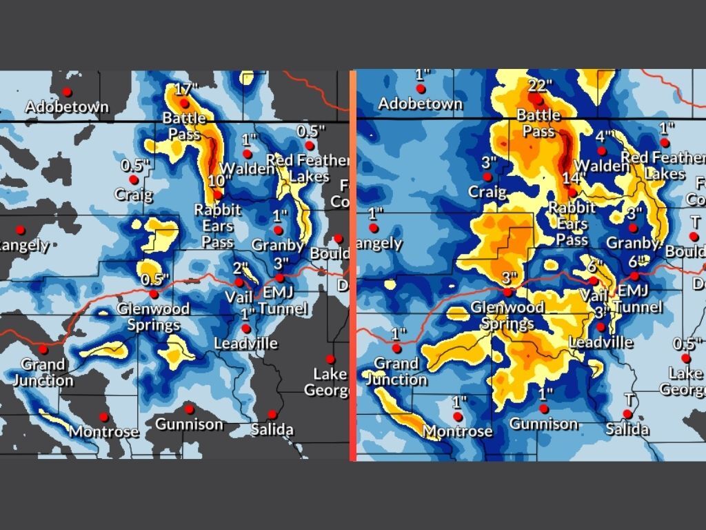
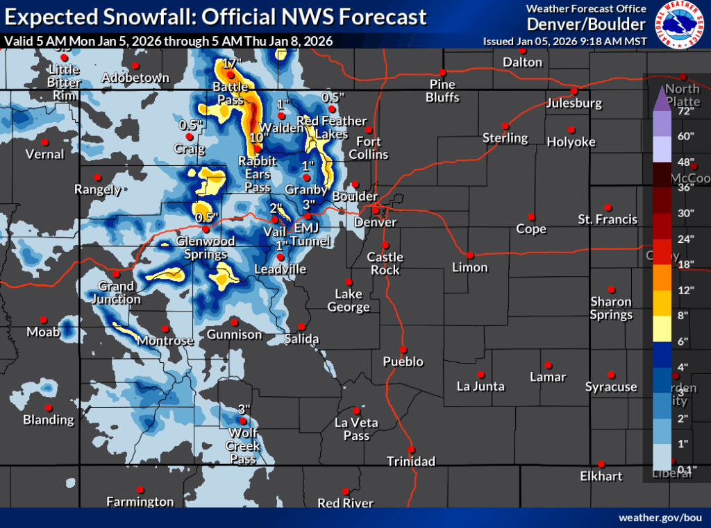
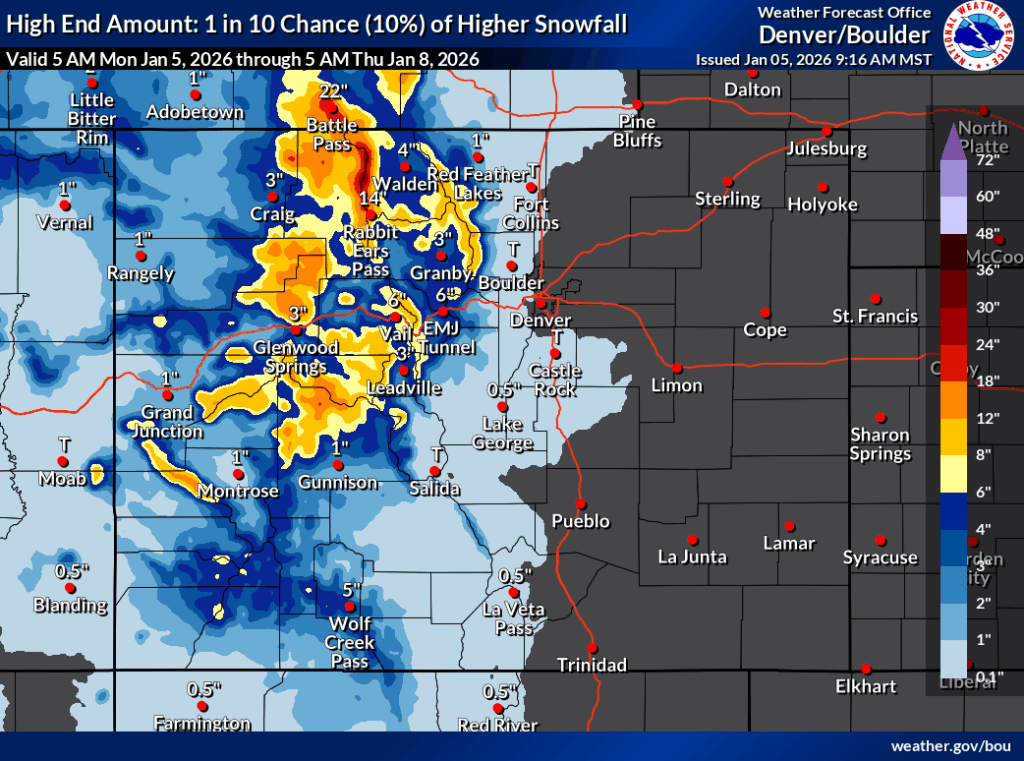
Per the National Weather Service, snow is set to move through the state in two waves over upcoming days, with a first round of snow expected on Monday into Monday night and a second round of snow expected to start at some point during the day on Wednesday and likely stretching into Friday. In mapping that’s been released by the service that only accounts for snowfall through Thursday morning, up to 24 inches or more could fall on some peaks if the ‘high-end’ snowfall forecast holds true (10% chance).
Let’s start with the more likely ‘expected snowfall’ scenario though, which has an 80 percent chance of coming to fruition.
In this scenario, widespread snow in the range of one to six inches falls on many peaks through Thursday morning (and remember, more snowfall through Friday, too). Some peaks in the state’s northwest quadrant, however, are outliers, with peaks in the Flat Tops, those near Aspen, and those along the Continental Divide north of I-70 having potential for up to a foot of snow during this period. The Park Range, near Steamboat Springs, is favored to get the most snow though, with potential totals in the 18 to 24-inch range.
See mapping of this ‘expected’ scenario below and keep scrolling for a breakdown of the ‘high-end’ forecast:
In the ‘high-end’ forecast, deeper totals in the range of eight inches to a foot of snow are much more widespread, with peaks near Aspen and those of the Flat Tops also having the potential for between 12 and 18 inches of snow. The Park Range remains favored, expected to get snow in the range of 18 to 30 inches if this high-end scenario holds true – and remember, this mapping product only accounts for snow through Thursday morning with more snow expected in hours to follow that.
See the high-end forecast map below and keep scrolling for a look at another big storm that might be on the way:
As can be seen in the maps above, there’s a glaring omission as far as the upcoming snow goes: the southwestern portion of the state – home to Telluride, Durango, and Wolf Creek – isn’t expected to get much snow during this round of fresh flakes. The Front Range peaks will be lacking even moreso, with hardly any snow hitting this part of the state and the I-25 corridor in both scenarios.
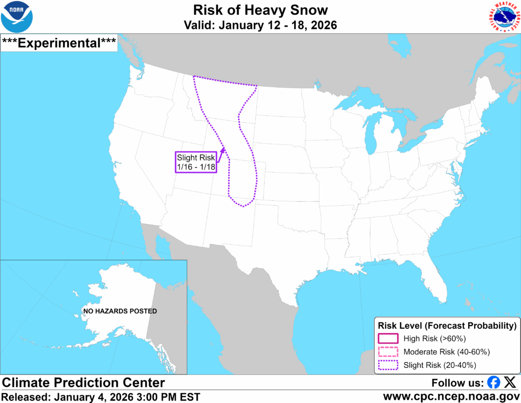
The National Weather Service is, however, showing that a ‘risk of heavy snow’ could be present in Colorado Springs and Denver mid-month, along with a stretch of Colorado that could be described as its ‘middle third.’ This risk comes from January 16 to 18 and is described as ‘slight.’
See this ‘risk of heavy snow’ depicted on the map below:
As far as the next five days go, OpenSnow is calling for Steamboat Resort to get the most powder – about 19 inches, with several other spots expected to get snow in the double-digits, too. Unfortunately, for many weekend warrior skiers and snowboarders in the Denver and Colorado Springs areas, the Summit County spots aren’t expected to get much with Breckenridge leading that charge with about six inches expected over five days. Find OpenSnow’s full resort-by-resort breakdown here.
While some snow is moving into the state this week, it doesn’t sound like it will be a statewide blast that’s dropping double-digit totals over all mountains. Front Rangers probably won’t see much of an impact, if an impact at all, unless they’re headed west to ski.
Find additional forecasting information from the National Weather Service here.
STAY INFORMED: Get free Colorado news with our daily newsletter (Click here)
Get OutThere
Signup today for free and be the first to get notified on new updates.
PREV
PREVIOUS

Puppies rescued from fire in Adams County home
Five puppies were rescued when a fire broke out inside a mobile home in Adams County on Saturday night. Crews with Adams County Fire responded to a report of the fire inside the mobile home in the 6800 block of Ruth Way at about 8:30 p.m. According to an X post from Adams County Fire, […]

Less than 10% of trails open at some Colorado resorts amid snowpack near record lows
With Colorado’s statewide snowpack near all-time lows – at about 61 percent of its to-date long-term median and at a lower point than all but two of the last 39 years for January 5 (2000, 2018), here’s how much terrain is open at Colorado’s resorts as of January 5, 2025: Editor’s Note: These numbers are […]