




Double-digit snow totals expected this week as more winter weather approaches Colorado
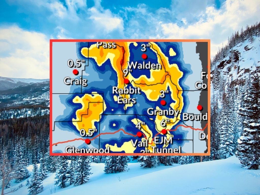
Following big snow last week, it’s looking like more wintery weather will be rolling into Colorado over the next few days.
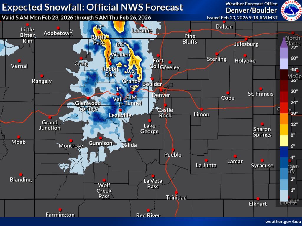
Per National Weather Service reporting, the most likely snowfall scenario will mean that about eight to 18 inches of snow hits peaks in northern Colorado through Thursday morning. Snow should be minimal south of I-70, limited to about three to six inches on some central mountain peaks while missing southern Colorado altogether for the most part. The brunt of this snow should hit between Tuesday night and Thursday morning.
Here’s a map of the ‘expected’ snowfall scenario (80% chance), keep scrolling for the ‘high-end’ snowfall prediction:
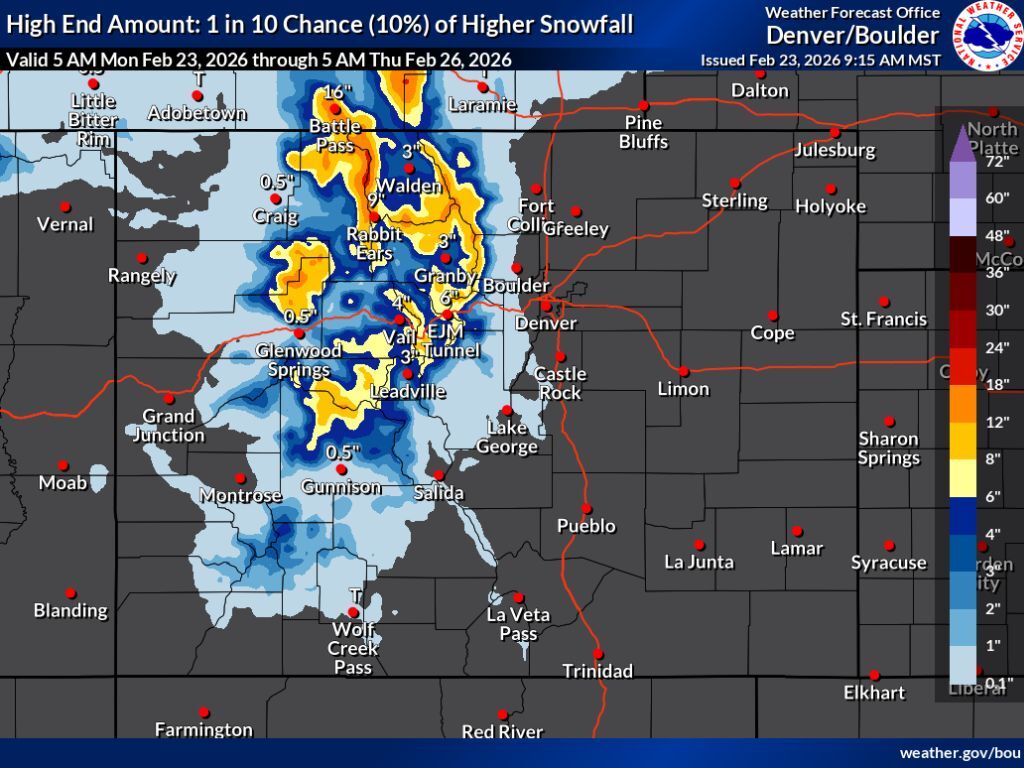
The ‘high-end’ snowfall prediction – with a 10 percent chance of coming to fruition – points to some central mountain peaks getting snow in that same eight to 18-inch range, as well. Snow would still be limited in southern Colorado. In both scenarios, the I-25 metro corridor gets missed.
Here’s a look at the ‘high-end’ snowfall forecast:
Per the OpenSnow report, Steamboat Resort gets the most snow over the next five days among the state’s ski areas – about 10 inches.
As of February 23, statewide snowpack is at 63 percent of the norm for the date, with a streak of record-low snowpack that started on January 13 still active. Looking ahead, the streak is getting close to previous record-low numbers, and could pop ahead of that if incoming snow hits on the heavier side in days to come.
Find additional weather forecasting on the National Weather Service website.
STAY INFORMED: Get free Colorado news with our daily newsletter (Click here)
Get OutThere
Signup today for free and be the first to get notified on new updates.
PREV
PREVIOUS

Little-known legend of Colorado Nick to be celebrated at Colorado Springs Pioneers Museum
For years in Colorado Springs, Scott Boyer had been learning little by little about a tattoo artist in local lore who went by Colorado Nick. His real name was Leonard Newell Wisner, Boyer learned. And in learning this he learned the man was buried at Evergreen Cemetery. Boyer came to an unmarked grave. “Here was […]

Jungle Reef aquarium to bring family fun to Chapel Hills Mall, emphasis on giving animals a 'second chance'
With some traditional retailers looking for the exit doors at shopping malls across the country or vanishing completely, malls can be forced to evolve or die. Change has become the norm at Chapel Hills Mall, on Colorado Springs’ north side. One of its anchor stores, Kmart, closed in 2009, making way for an AMC movie […]