


Wolves detected in heavily-populated Colorado county
Colorado Parks and Wildlife has released an updated map related to wolf activity in the Centennial State, reflecting data that was collected between January 23 and February 27. Compared to a previously released map reflecting data from December 18 to January 22, it shows that Colorado’s wolves are already on the move.
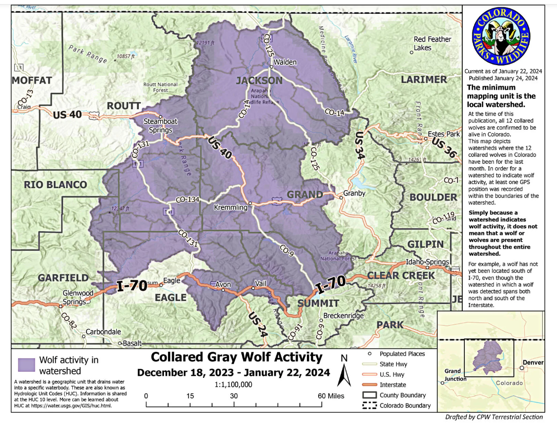
The initial map that was released showed that wolves were previously present in portions of Jackson, Grand, Summit, Routt, and Eagle counties, as well as smaller portions of Garfield and Rio Blanco counties.
With the new map, it has been revealed that wolves have roamed west into Moffat County, as well as a larger portion of Routt County, a larger portion of Rio Blanco County, and more of Jackson County. Wolves have also been detected roaming east of where they were originally present into Larimer County, which is home to Fort Collins.
That being said, the wolves have been detected in the northern, less populated portion of the 366,000-resident Larimer County, near the unincorporated town of Red Feather Lakes. Larimer County is the 7th-most populated county among Colorado’s 64 counties and by far the most populated county where wolves have been detected. While this county is heavily populated, the wolves were detected in a remote area. Experts believe Colorado’s wolves will avoid human civilization, as tends to be typical behavior of the gray wolf species.
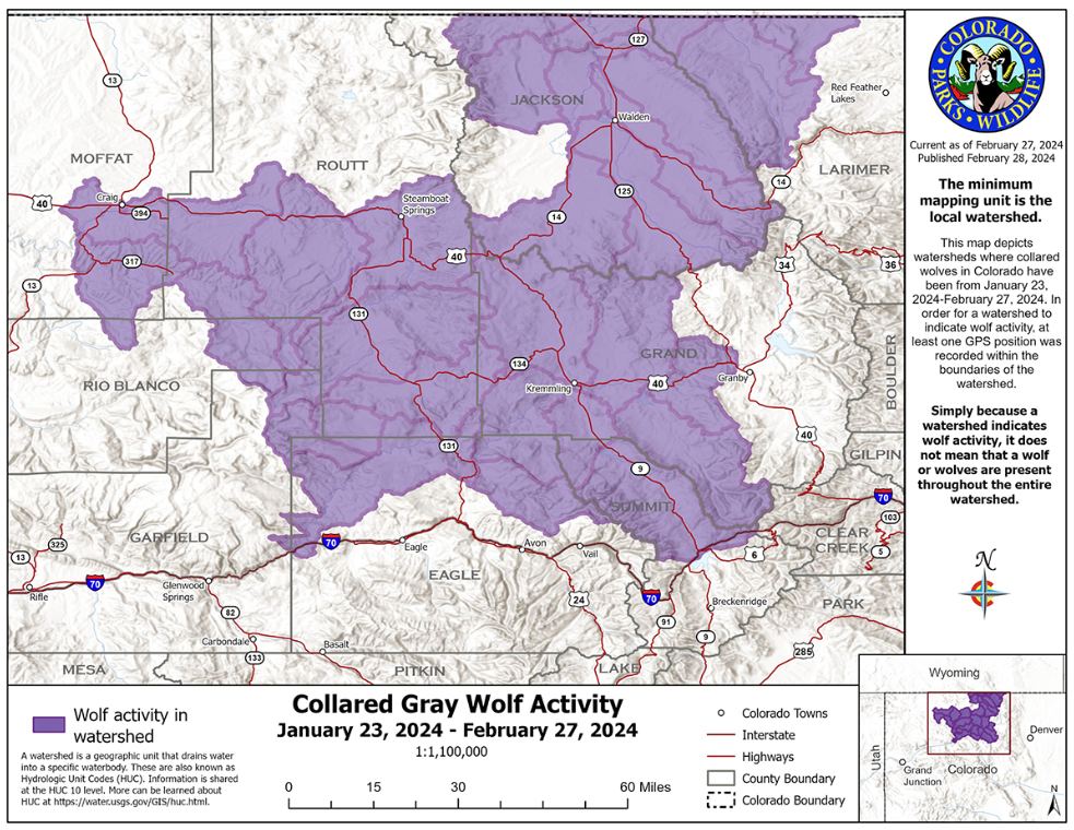
It’s also worth noting that the updated map shows that wolves were not detected in a larger portion of terrain south of I-70 in Eagle County in most recent data.
The wolf-tracking map is created based on data collected from GPS collars that have been placed on 12 wolves in Colorado, including the 10 that were systematically introduced to the state plus two wolves that naturally migrated into the state, residing in the North Park area. It’s also worth noting that this map is based on watershed regions, with indicators that a wolf is present in a watershed area not meaning that wolves are present in the entire watershed region highlighted on the map.
Authorities are able to see where wolves have been, but not in real time. They are also unable to predict where wolves will go next.
Find updates to this map, posted on the fourth Wednesday of each month, here.
STAY INFORMED: Sign-up for the daily OutThere Colorado newsletter here
Get OutThere
Signup today for free and be the first to get notified on new updates.
PREV
PREVIOUS

2 Denver officers won't be charged in November shooting
The officers shot and injured a man with a handgun in his waistband on Nov. 27
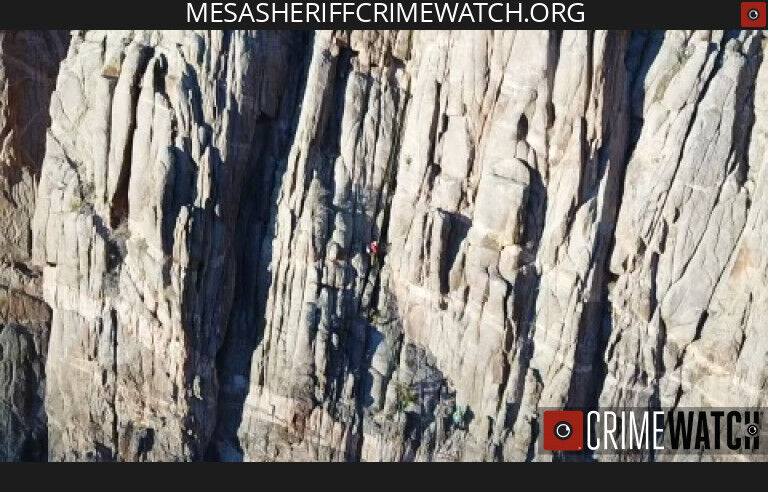
Man somehow survives 120-foot-fall from cliff face in Colorado
Mesa County Sheriff’s Office Search and Rescue volunteers responded to a scary incident in western Colorado on February 17, following reports of a climber taking a massive fall. The 48-year-old male climber out of Grand Junction “fell at least 120 feet” from a climb called Tooth and Claw in the area of Mother’s Buttress, which […]