


Snow returns to Colorado for New Year’s Day to the tune of 4-10 inches

Snow is back in the forecast to start 2026 as a New Year’s Day storm should bring up to 10 inches of snow to the northern half of the state.
Three more chances of stormy conditions (Jan. 5, Jan. 7-9 and Jan. 11-12) are forecast over the first 10-12 days of January, with all three mountain zones receiving snow during that time period.
Seasonal day-time highs and night-time lows are expected over the next two weeks, suggesting most snow that falls won’t melt off, however, longer periods of snowless days with a low snowpack and exposed slopes could keep the overall snowpack in the red as 2026 starts.
Recap:
Monday and Tuesday were cool in the state’s mountains and among the ski areas. The high temperature at Copper Mountain on Monday was 28 degrees and on Tuesday was 33 degrees. The high temperature at Telluride on Monday was 32 degrees and on Tuesday was 36 degrees.
Unfortunately, no snow fell anywhere in the state, with sunny and calmer conditions throughout.
Forecast:
On Wednesday, forecasts indicate another even warmer day in the high country as high temperatures will reach into the upper 30s to lower 40s at most base areas as sunny skies dominate the day.
Early Thursday morning, New Year’s Day, snow is forecast to develop in the western reaches of Colorado’s mountains first, then push snow eastward toward the Continental Divide throughout the day and into Friday.
Forecasted snowfall totals using the ECWMF model for Friday’s first chairs in the northern mountains are between 2-10 inches with the highest amounts in the Park Range near Steamboat, in the central mountains between 2-10 inches with the highest amounts in the West Elk and Elk mountains near Aspen and Crested Butte and in the southern mountains between 2-5 inches with the highest amounts in the northern San Juan Mountains near Silverton and Telluride.
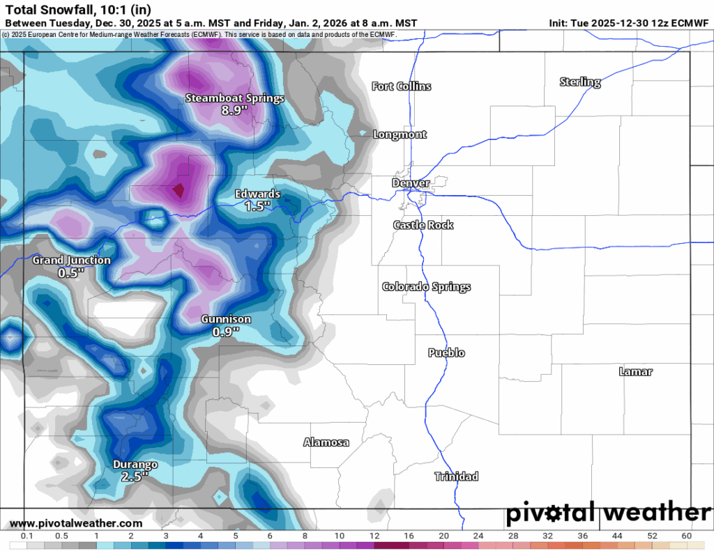
Light snow is forecast to fall into Friday night, with another 1-2 inches possible, mostly in the northwestern and west-central mountains.
Saturday and Sunday are forecast to be calm and quiet ahead of another storm entering Colorado on Monday.
The Monday storm is a fast moving, northern-Colorado clipping wave of energy that is forecast to bring maybe 1-2 inches of snow.
On Tuesday, the state will be in between storms once again, but could be partly cloudy ahead of a larger, prolonged storm entering the state late Tuesday night/overnight Wednesday.
Long-term forecast:
Overnight Wednesday, precipitation is forecast to funnel into Colorado via a large area of low pressure off the southern California coast.
This storm will begin wandering across the desert southwest Wednesday through Friday, Jan. 9 evening, delivering snow to all three Colorado mountain zones.
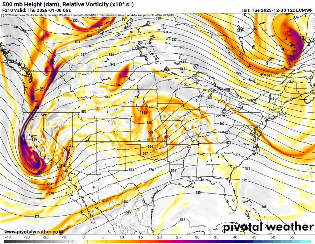
Snowfall totals for all three mountain zones generally are forecasting toward 3-6 inches, but with this storm system about 7-9 days out, more model runs will need rendering to hone in details regarding accumulations, duration and timing of the storm.
More snow is possible Sunday, Jan. 11 through Monday, Jan. 12.
Colorado ski resorts 24-hour totals:
Arapahoe Basin – 0″
Aspen Highlands – 0″
Aspen Mountain – 0″
Beaver Creek – 0″
Breckenridge – 0″
Buttermilk – 0″
Cooper – 0″
Copper Mountain – 0″
Crested Butte – 0″
Cuchara – 0″
Echo Mountain – 0″
Eldora Mountain – 0″
Granby Ranch – 0″
Hesperus – Closed for the season
Howelsen Hill – 0″
Kendall Mountain – 0″
Keystone – 0″
Loveland – 0″
Monarch – 0″
Powderhorn – 0″
Purgatory – 0″
Silverton –
Snowmass – 0″
Steamboat – 0″
Sunlight – 0″
Telluride – 0″
Vail – 0″
Winter Park – 0″
Wolf Creek – 0″