


La Plata Peak

La Plata Peak
.attraction-map-buttons-container {
display: flex;
flex-wrap: wrap;
justify-content: center;
margin: 20px 0 10px;
}
.attraction-map-buttons-container a {
flex-grow: 1;
flex-shrink: 1;
flex-basis: 150px;
max-width: 200px;
margin: 0 7px 10px;
font-weight: normal;
}
.attraction-activities-btns-container {
display: flex;
flex-wrap: wrap;
justify-content: center;
}
.attraction-activities-btns-container a {
flex-grow: 1;
flex-shrink: 1;
flex-basis: 150px;
max-width: 200px;
margin: 0 7px 10px;
font-weight: normal;
overflow: hidden;
text-overflow: ellipsis;
}
Things To Do
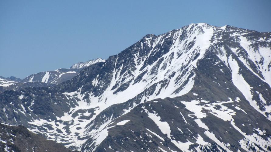
Unlike most 14ers, this trailhead starts at a paved road (Colorado Highway 82 between Twin Lakes and Aspen), but that doesn’t mean it’s any easier. You’ll gain 4,500 often brutally steep feet en route to La Plata’s 14,336-foot summit. It starts out easy as a stroll through the woods, but there are seemingly endless switchbacks that make this a very long day. The summit views, of course, are worth the labor. The Elk Mountains loom to the west, the Sawatch to the north and south and to the east the Arkansas Valley and the Mosquito Range. You’re in practically the center of the Colorado Rockies. Enjoy it.
I awoke especially early at my campsite a few miles down the road, knowing I was in for a long day above timberline. I was so tired I nearly hit a massive pothole in the highway. Many hours later, on the summit, I met a couple who were lamenting their two flat tires waiting for them at the trailhead. “Lemme guess, you hit that pothole,” I said. They had. But still they went on with the climb, a good lesson in not letting adversity stop your adventure.
Pro Tips
Recommended season(s): Summer – early fall.
—R. Scott Rappold