


Parts of Manitou Springs Evacuated Due to Flooding; US 24 Closed Following Mudslide
Flash flood and severe thunderstorm and tornado warnings kicked off a week of wet weather expected in Colorado Springs and surrounding areas. Here’s a roundup of the weather.
—
5 p.m. update
Colorado Springs firefighters are responding to reports of stranded vehicles near North 19th and Unitah streets, police said.
The American Red Cross has opened an evacuation center at Community Congregational Church, 103 Pawnee Ave. in Manitou Springs. “If you are in need of shelter or evacuation you can go there for support,” the organization tweeted.
—
4:52 p.m. update
U.S. 24 is closed in both directions between Crystola and Cave of the Winds, the Teller County Sheriff’s Office reported.
—
4:46 p.m. update
Heavy rain and pea-sized hail have been reported across Colorado Springs, officials say.
Manitou Springs City Hall is closed until further notice.
—
4:45 p.m. update
The Colorado Springs Police Department has gone on accident alert status. “We recommend citizens avoid all travel on the roadways,” police tweeted.
When the Police Department is on accident alert status, people involved in a crash that doesn’t involve injury, drugs or alcohol or damage to public property are asked to exchange information and submit a traffic accident report form.
—
4:40 p.m. update
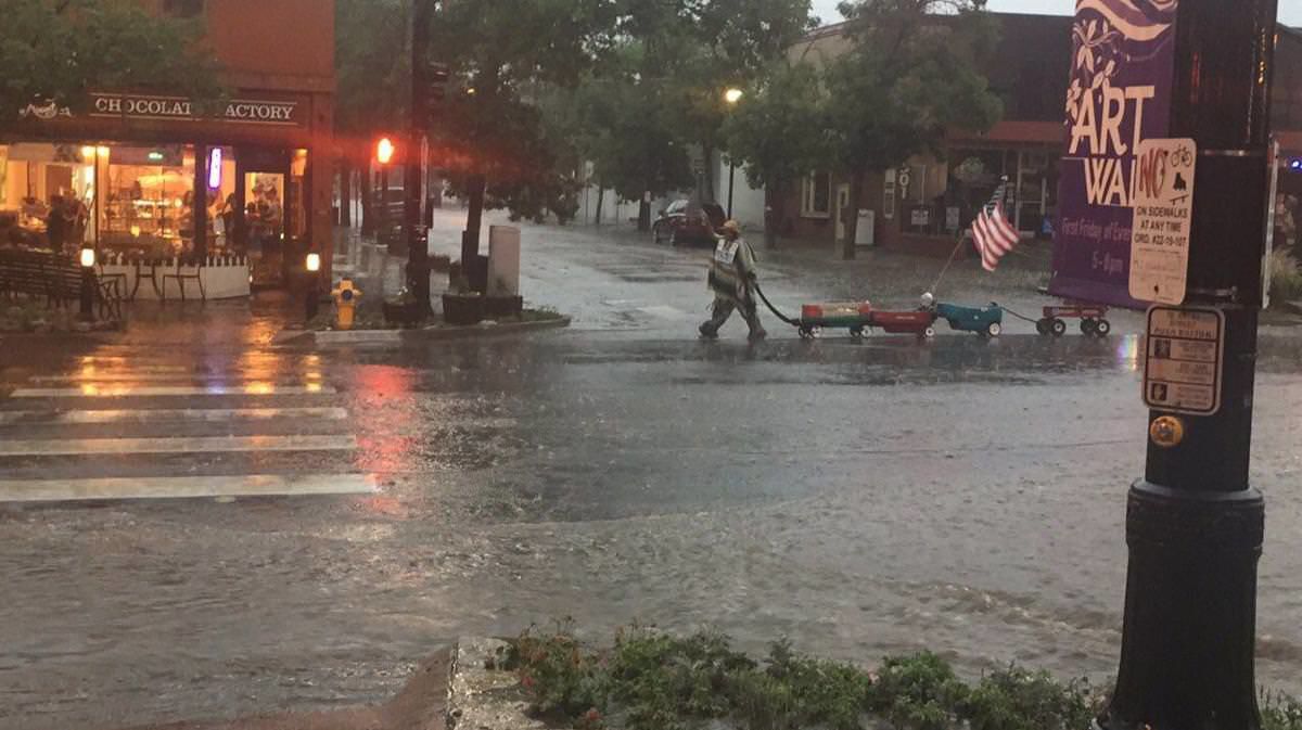
The El Paso County Office of Emergency Management has activated its Emergency Coordination Center in response to the severe weather in the county. Flash flooding was reported along the west U.S. 24 corridor, and Manitou Springs has activated flood sirens to evacuate low-lying areas.
—
4:35 p.m update
“This is an extremely dangerous situation with the flooding,” Teller County sheriff’s spokesman Cmdr. Greg Couch tweeted. “Please stay home do not drive into any rushing water.”
—
4:30 p.m. update
A mudslide was reported on westbound U.S. 24 near Chipita Park, according to the Colorado Springs Traffic twitter account. “Please avoid the area.”
—
3:50 p.m. update
A tornado warning was issued for a section of El Paso and Teller counties including Colorado Springs and Manitou Springs, the National Weather Service reported.
Funnel clouds have been reported just southwest of Green Mountain Falls, said Klint Skelly, a weather service meteorologist.
A flash flood warning for El Paso County and Colorado Springs has been extended until 7 p.m.
—
3 p.m. update
A severe thunderstorm warning continues for Colorado Springs and Black Forest in El Paso County and for Woodland Park in Teller County. Golf ball-sized hail and wind up to 70 mph is possible. The warning is in effect until 4:15 p.m.
—
2:30 p.m. update
A severe thunderstorm warning is issued for Woodland Park, Divide and Florissant in Teller County until 3 p.m., according to the National Weather Service.
A severe thunderstorm warning is in effect for the towns of Williamsburg, Silver Cliff and Westcliffe in Fremont and Custer counties.
—
The National Weather Service in Pueblo emphasized on its website Monday that “flash flooding is a very dangerous situations.”
A flash flood watch is issued when conditions might develop that lead to flash flooding. A flash flood warning is issued when a flash flood is imminent or occurring.
“Monsoon moisture combined with upslope flow will lead to an enhanced risk for thunderstorms capable of producing flash flooding across all of the southern mountains and plains this afternoon and evening,” said the Monday flash flood watch, issued for El Paso and Teller counties, as well as much of southeast Colorado. “Locally very heavy rainfall will be possible. Urban areas and burn scars will be most susceptible to flash flooding.”
Heavy rain was forecast over some of the state’s burn scars, including the Waldo Canyon burn scar.
Despite the risk of flooding, rain is sorely needed as wildfires continue to burn across the state.
The southernmost sliver of El Paso County is in extreme drought, the second-highest designation, according to the U.S. Drought Monitor’s most recent report. The bulk of the county is in moderate drought, while a small northwest portion is in moderate drought.
At this time last year, about 65 percent of the state was not experiencing any drought conditions. But now, only 17.5 percent is without drought.
A third of an inch of rain fell Sunday, bringing the monthly total of precipitation up to 2.3 inches, less than the monthly average of 2.84 inches, weather service data show.
It’s been a hot, dry summer so far in the Pikes Peak region. In Colorado Springs, only 1.43 inches of rainfall fell in June — far below the monthly average of 2.5 inches.
“Daily rounds of afternoon and evening storms will remain in the forecast through next week,” Gazette news partner KKTV reported. “Our stormiest days are looking to be Thursday and early into the weekend. Temperatures will be cooler too, into the 70s and 80s for most of the week.”
Tuesday brings a 30 percent chance of thunderstorms after noon and at night, the weather service said. Wednesday has a 40 percent chance in the afternoon, followed by a 30 percent chance at night.
Thursday has a 40 percent chance of thunderstorms in the afternoon and at night.
Temperatures are expected to reach 81 degrees Tuesday, 86 degrees Wednesday and 78 degrees Thursday.
—
The Gazette’s Tony Peck contributed to this report.