


Colorado storms to bring severe hail, ‘deadly lightning,’ and gusty winds this week
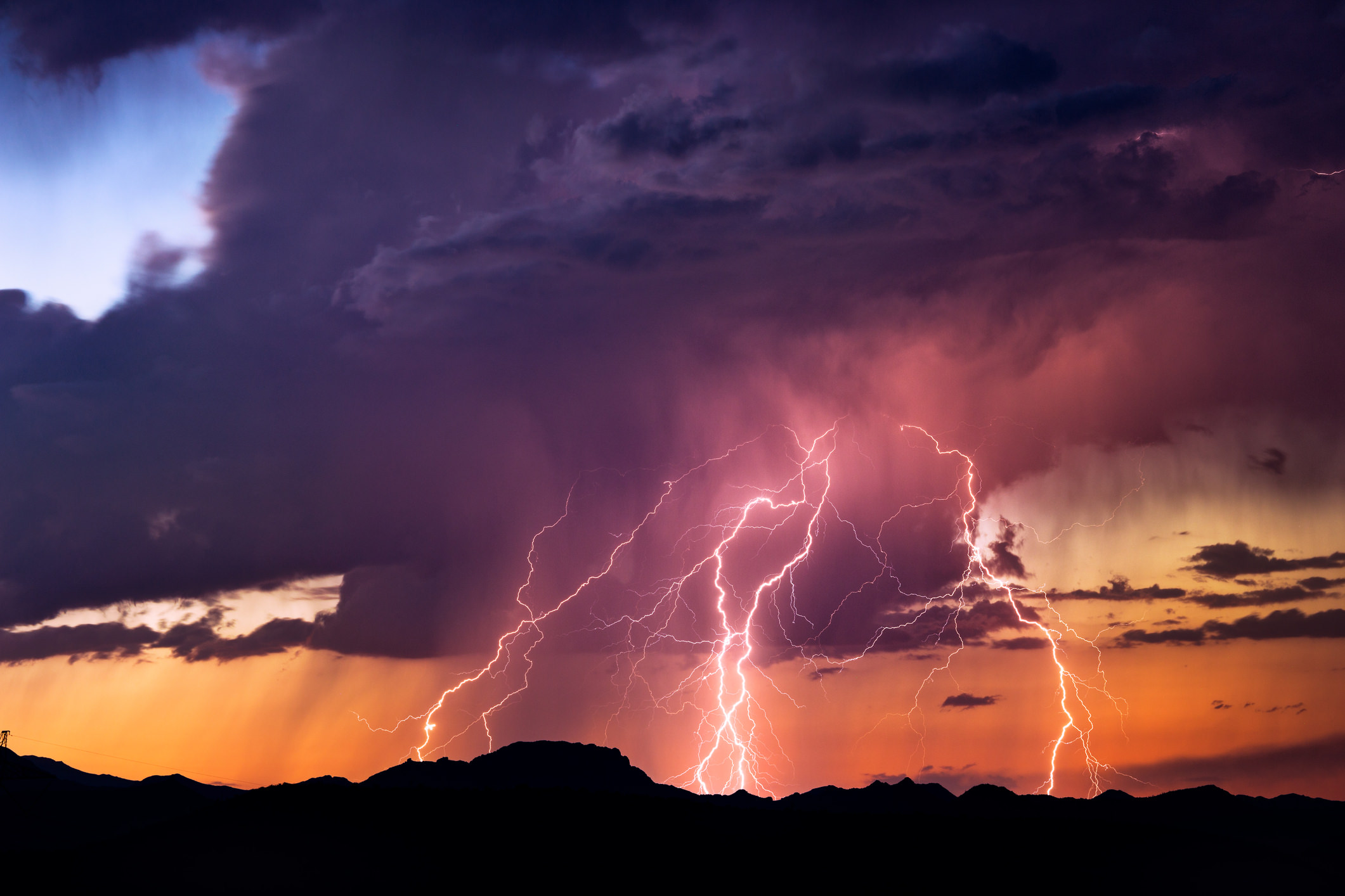
Colorado could be hit with “deadly lightning,” severe hail up to half dollar to ping pong ball-size, and damaging winds as wild weather rolls through parts of the state for the second week in a row.
Strong to severe thunderstorms expected to rumble across the eastern plains on Monday afternoon and early evening could bring ping pong ball-sized hail and winds gusting up to 60 mph. Isolated storms are also possible over the Continental Divide and in the San Luis Valley.
“Storms will be capable of light to moderate showers, deadly lightning, and gusty winds,” according to a hazardous weather outlook issued by the National Weather Service.
Counties that may see impacts from the storms include Lake, Chaffee, Saguache, Fremont, Teller, Crowley, Otero, Kiowa, Pueblo, Bent, Las Animas, Prowers, El Paso, Grand, Jackson, Larimer, Boulder, Clear Creek, Gilpin, Summit, Park, Jefferson, Douglas, Adams, Denver, Weld, Douglas, Arapahoe, Elbert, Logan, Washington, Sedgwick, Phillips, and Lincoln.
High country impacts include the Mosquito Range, Sawatch Mountains, Continental Divide, La Garita Mountains, Upper Rio Grande Valley, San Juan Mountains, San Luis Valley, Sangre de Cristo Mountains, Wet Mountains, Pikes Peak, and the Upper Huerfano River Basin.
The lack of rainfall combined with lightning and gusty outflow winds could also lead to fire starts, especially across the eastern San Juan and La Garita Mountains.
More of these storms are expected to develop Tuesday through the southeast mountains and eastern plains. There is a risk for a few storms over the plains to become strong to severe, mainly in the afternoon and early evening. 60 mph winds and hail up to the size of half dollars are the main threats. There’s also a chance of flash flooding to occur on burn scar areas.
You’ll want to keep your raincoats handy, as this week’s mountain forecast is also calling for storms with chances from Wednesday into Saturday. If you’re entering the outdoor area, be aware of lightning risks. Monitor the weather closely and know what to do if an unexpected storm suddenly creeps up.
Editor’s Note: All weather statements are subject to change. Planning on hiking or camping in the mountains this week? If so, always check the forecast before you head out and be prepared for rapidly changing conditions.
Get OutThere
Signup today for free and be the first to get notified on new updates.
Colorado storms to bring severe hail, ‘deadly lightning,’ and gusty winds this week
Thunderstorms possible this afternoon, dry thunderstorms west, strong to severe on the Plains. #COWX pic.twitter.com/TEwtZrwvLQ — NWS Pueblo (@NWSPueblo) June 22, 2020
Get OutThere
Signup today for free and be the first to get notified on new updates.
Colorado storms to bring severe hail, ‘deadly lightning,’ and gusty winds this week
A Red Flag Warning is in effect for the #SanJuanNF today. Fire danger is EXTREME and the Forest remains in fire restrictions: NO campfires and charcoal grills are allowed. NO smoking on the San Juan NF, except within an enclosed vehicle, trailer or building. pic.twitter.com/jRv3A9TR3b — SanJuanNF (@SanJuanNF) June 22, 2020
Get OutThere
Signup today for free and be the first to get notified on new updates.
Colorado storms to bring severe hail, ‘deadly lightning,’ and gusty winds this week
Hot and dry today with isolated #storms possible over the divide. Critical #FireWx conditions over SW #COwx valleys. #UTwx pic.twitter.com/Nv3fRVa77s — NWS Grand Junction (@NWSGJT) June 22, 2020
Get OutThere
Signup today for free and be the first to get notified on new updates.
PREV
PREVIOUS
Colorado storms to bring severe hail, ‘deadly lightning,’ and gusty winds this week
A Red Flag Warning is in effect for the #SanJuanNF today. Fire danger is EXTREME and the Forest remains in fire restrictions: NO campfires and charcoal grills are allowed. NO smoking on the San Juan NF, except within an enclosed vehicle, trailer or building. pic.twitter.com/jRv3A9TR3b — SanJuanNF (@SanJuanNF) June 22, 2020
Denver Mayor Hancock wants to rename landmarks, public spaces affiliated with racist history
Denver Mayor Michael Hancock announced on Friday that he has tasked an advisory group to identify, with the community’s help, any city property named for individuals associated with racism. The advisory board of the Agency of Human Rights and Community Partnerships, an agency created in 1948 out of a need to address racial tensions in […]