




Happy Trails: Nothing wrong with admiring this Colorado Springs peak from down low
photos by Seth Boster, The Gazette
Blodgett Trail
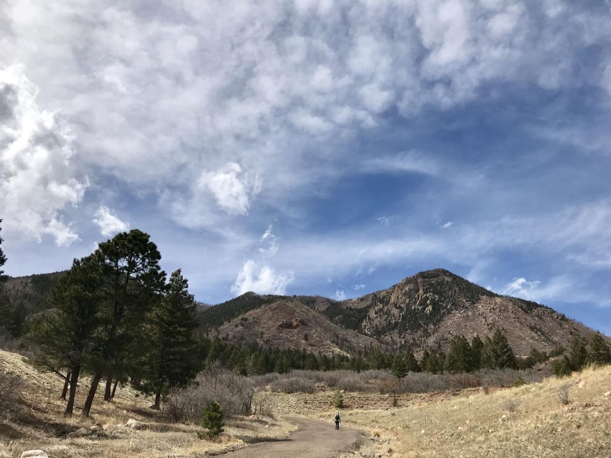
Blodgett Peak commands attention on the north side of Colorado Springs. Its pointy, craggy profile stands out among the green foothills, calling to explorers who should not underestimate its summit, however humble near 9,500 feet.
The namesake open space at Blodgett’s base includes a trailhead that warns of the “treacherous” venture to the top. Injuries have been dealt, as well as fatalities.
From city park boundaries, a trail scampers up Pike National Forest and often disappears amid rocks and loose soil along harsh grades. We tracked a trip once as about 8 miles and 2,600 feet of elevation gain.
But no, for this installment of our Happy Trails series, we’re not spotlighting that hard journey. After all, one can be happy on much gentler ground, such as that at Blodgett’s base. The simple loop is a great way to admire the peak, great, too, for the whole family.
It begins up the wide gravel path from the trailhead, from where the mountain looms large between this section of Rampart Range mostly spared from 2012’s Waldo Canyon fire. The uphill doesn’t seem like much, but it’s easy to feel spoiled by the views looking south upon the range toward Cheyenne Mountain and those looking east to Black Forest and the plains.
The trail skirts the edge of tall evergreens. At about a half-mile, the Hummingbird Trail begins to the left, the popular way to the summit. About a quarter-mile farther, the trail veers right for Peregrine Trail, descending rather sharply between Douglas fir and ponderosa pine.
The creek sometimes runs in the woods, though we’ve never found it to be much. Veering right for the Ponderosa Trail will get you back to the parking lot, as will staying straight on Peregrine.
While around, extend your outdoor time by checking out the newest addition to the open space, 64 acres with some flowy singletrack. The South Blodgett trails can be reached from another parking lot just down Woodmen Road; turn for Blodgett Ranch Trail.
Trip report: 1½ miles round trip (loop), 329 feet elevation gain
Difficulty: Easy
Getting there: Trailhead at 3786 W. Woodmen Road
FYI: Hiking, biking, horses. Dogs on leash. Open dawn to dusk.
SETH BOSTER, THE GAZETTE
Get OutThere
Signup today for free and be the first to get notified on new updates.
PREV
PREVIOUS
The interesting way Colorado's Chalk Cliffs were formed
Facebook Twitter WhatsApp SMS Email Print Copy article link Save Facebook Twitter WhatsApp SMS Email Print Copy article link Save The 14,197-foot summit of Mount Princeton is the perfect backdrop for the breathtakingly beautiful Chalk Cliffs in the Sawatch Range and Collegiate Range of Colorado. Strikingly white, the Chalk Cliffs are among Colorado’s most unique natural wonders. Not actually chalk […]
12 tips for preventing a trail attack
Facebook Twitter WhatsApp SMS Email Print Copy article link Save Facebook Twitter WhatsApp SMS Email Print Copy article link Save As one is exploring the outdoors, trail safety should be at top of mind. While human attacks on most Colorado trails are quite rare, it’s important to know what can help prevent one from happening. […]