


Denver could get up to 6 inches of snow by Monday morning
One week after Denver was hit with the fourth-largest snowstorm in its history, the metro area is expected to receive even more snow Sunday night into Monday morning.
The National Weather Service and Weather 5280 predict Denver will get up to 6 inches of snow Sunday night into Monday morning.
The NWS issued a winter weather advisory for Boulder and Denver from 6 p.m. Sunday until noon Monday.
A winter storm warning has also been issued Sunday night for the Palmer Divide between Denver and Colorado Springs and the Interstate 70 corridor of the Front Range.
Rain and snow showers are predicted to begin Sunday about 4 p.m. and last until 8 a.m. Monday. The heaviest snow is expected to fall between 5 p.m. and 2 a.m. in Denver.
Denver weather: Warm and sunny with spring arriving, but snow looms
Weather 5280 predicts the heaviest snow will fall south and southeast of Denver across the Palmer Divide, including Evergreen, Parker and Castle Rock. In these areas, peak snowfall could drop up to 2 inches per hour.
“While there’s certainly some high-end potential, we think the most likely area for the heaviest band to set up is not over Denver proper, and that warm temperatures will knock down totals at least initially,” Weather 5280 said.
Denver and Colorado Springs can expect about 6 inches of snow and high-end storm predictions call for about 9 inches across the Palmer Divide, according to Weather 5280.
The NWS said residents should avoid mountain travel after 3 p.m. Sunday and prepare for an impacted commute Monday morning.
Similarly, Weather 5280 predicts the largest impacts of the storm will be on road conditions between 5 p.m. Sunday and 9 a.m. Monday as snow increases and temperatures drop.
Road closures, power outages and more as Front Range digs out after weekend snowstorm
The Colorado Department of Transportation is asking Coloradans to prepare for the snow and avoid driving if possible, especially along the I-70 mountain corridor and Interstate 25 corridor at Monument Hill.
“Springtime in the Rockies means more snow and motorists can’t let their guard down when traveling to and from their mountain destinations,” said CDOT director of maintenance and operations John Lorme.
“Whether it is feet or inches of snow, driving conditions can be slick and treacherous.”
CDOT urges drivers to avoid driving during the worst of the storm, plan for extra travel time for Monday commutes, drive slowly, keep an emergency kit in cars and do not try to drive passed plows on the road.
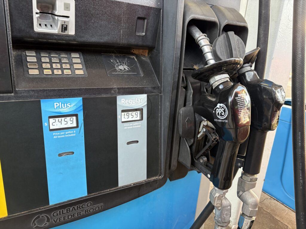
Denver gas prices surge — but diesel mix-up not to blame, expert says
Daniel Boniface
dan.boniface@denvergazette.com
Updated 2 hours ago
Denver gas prices surged 16.6 cents per gallon last week, but one expert said the public should not blame the hike on a recent diesel mix-up that damaged hundreds of vehicles and contaminated nearly 50 gas stations. “No, it has...
Daniel Boniface
Reporter
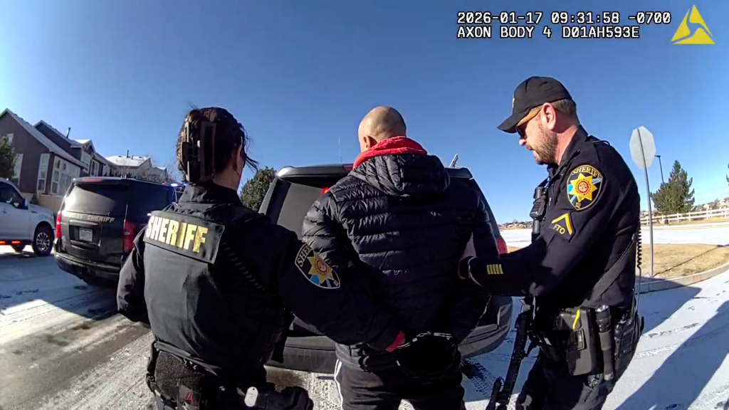
Flock cameras assist in road rage shooting arrest in Douglas County
Daniel Boniface
dan.boniface@denvergazette.com
Updated 22 minutes ago
Douglas County deputies on Monday said Flock Safety cameras were critical in an investigation that led to the arrest of a road rage shooting suspect. Deputies with the Douglas County Sheriff’s Office said 43-year-old Mitchell Aaron Weber was arrested Saturday...
Daniel Boniface
Reporter
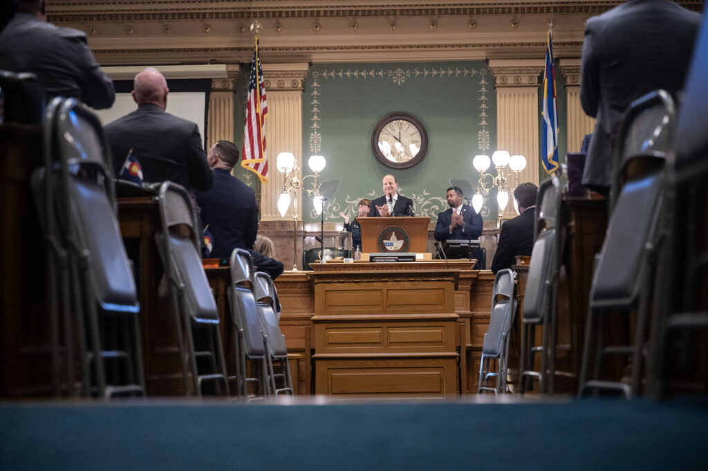
Colorado governor insists local officers can work with DEA agents amid non-cooperation law
The Denver Gazette
the-denver-gazette@denvergazette.com
Updated 18 minutes ago
Gov. Jared Polis on Friday insisted that local law enforcement officers in Colorado can — and should — work with federal drug enforcement authorities in going after criminal activities. An official of the U.S. Drug Enforcement Agency earlier said Colorado’s...
The Denver Gazette
Reporter
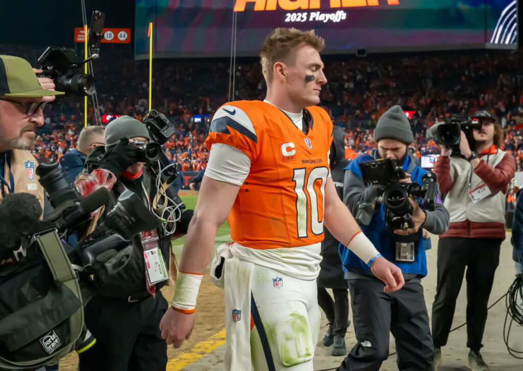
PHOTOS: Broncos Defeat Bills in Divisional Playoff
Jerilee Bennett
jerilee-bennett@denvergazette.com
Updated 1 hour ago
Jerilee Bennett
Reporter
Is a pardon for Tina Peters coming? Colorado governor confirms he is weighing options
The Denver Gazette
the-denver-gazette@denvergazette.com
Updated 1 hour ago
Gov. Jared Polis on Friday strongly indicated he is considering clemency for Tina Peters, the former county clerk convicted of a security breach at her election office. When pressed about the matter, Polis didn’t offer an explicit answer, but he...
The Denver Gazette
Reporter
Denver weather: Snow and chilly temperatures on MLK Day
Daniel Boniface
dan.boniface@denvergazette.com
Updated 7 hours ago
Light snow is expected to clear out of Denver on Monday morning but the chilly temperatures will hang around throughout the Martin Luther King Jr. Day holiday, meteorologist said. The National Weather Service in Boulder said to expect the snow...
Daniel Boniface
Reporter

2-year-old dead in Denver; man arrested
Daniel Boniface
dan.boniface@denvergazette.com
Updated 8 hours ago
Police have launched a homicide investigation after a 2-year-old was found dead Sunday in Denver. The Denver Police Department said they were called out to a home in the 100 block of South Vrain Street on a report of a...
Daniel Boniface
Reporter
‘A major accomplishment’: Poudre River Trail nears completion, touring 45 miles in northern Colorado
Seth Boster
seth-boster@denvergazette.com
Updated 7 hours ago
In northern Colorado, around a leafy preserve fed by the Poudre River and old farmland left between ever-growing neighborhoods, crews have been building a trail that will stretch about a mile. Only about a mile ー fairly small in one...
Seth Boster
Reporter

Cleo Parker Robinson Dance studio shines in Denver’s Five Points neighborhood
Dennis Huspeni
dennis.huspeni@gazette.com
Updated 1 hour ago
When people walk by the new Cleo Parker Robinson Dance Center for the Healing Arts expansion building, they’ll pass colorful dots they might not realize are instructions of how to dance Parker Robinson’s “Mary Don’t You Weep” — a tribute...
Dennis Huspeni
Reporter

Denver’s newest professional team meets in person for the first time
9News
9news@denvergazette.com
Updated 16 hours ago
DENVER — For the first time since its roster began taking shape, Denver Summit FC brought its players, coaches and executives into the same room. The gathering on Saturday marked the club’s first full-team media availability — and, for many...
9News
Reporter
PREV
PREVIOUS
Denver weather: Rain and snow mix expected to arrive Thursday
Facebook Twitter WhatsApp SMS Email Print Copy article link Save Facebook Twitter WhatsApp SMS Email Print Copy article link Save Despite temperatures surpassing 60 degrees Wednesday, Mother Nature will briefly transition back into winter mode with slight rain and snow fall beginning Thursday. A rain and snow mix will begin to fall across the Denver […]

Denver weather: Snowfall will continue overnight, which could make a messy morning commute
Facebook Twitter WhatsApp SMS Email Print Copy article link Save Facebook Twitter WhatsApp SMS Email Print Copy article link Save A late season storm system could turn lawns into a winter wonderland as 3 to 6 inches are expected to fall across the Denver metro by noon on Friday. A winter weather advisory was issued […]