







Several more days of I-70 closures possible amid major flash flood risk
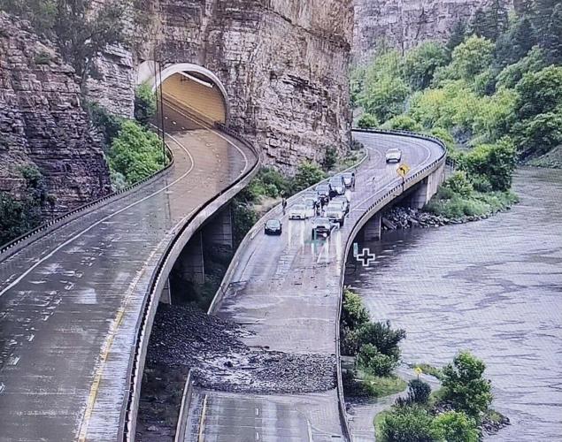
I-70 Mudslide July 3, 2021 Photo Courtesy CDOT via Twitter
Heavy rain is set to continue in Colorado through the end of the week, likely to cause more travel-related issues around the state. As these storms continue, Coloradans should expect an elevated risk of flash flooding and debris flow in some parts of the state through Saturday.
If rains continue as expected, it could mean that I-70 through Glenwood Canyon has been closed for five consecutive days this week, starting with a closure that happened this Tuesday, extending into Wednesday, with more closures possible on Thursday, Friday, and Saturday. Other impacts around the state are also expected.
Moisture values decreased overnight but slow moving storms will still pose a limited threat for flash flooding over the burn areas today excluding Calwood. Moisture increases substantially Friday and Saturday leading to an elevated threat for flash flooding. #COwx pic.twitter.com/As39VfSmIV
— NWS Boulder (@NWSBoulder) July 22, 2021
“Heavy rainfall and flash flooding will be possible this afternoon and evening, especially along the Continental Divide and across Lake and Chaffee counties,” the National Weather Service (NWS) warned in a recent outlook addressing Thursday weather. “Farther east, storms will be more scattered to isolated in nature over the Sangre de Cristo Range, the Wet Mountains and Teller County, though if storms move across existing burn scars, flash flooding may be possible.”
NEWSLETTER: Sign-up for the free OutThere Colorado newsletter here
Heavy rain and flash flooding possible again today, mainly along the Continental Divide. Watch for quick rises and high flows on creeks and streams, with mud and rock slides possible in steep terrain. #cowx pic.twitter.com/5wPbev1qGj
— NWS Pueblo (@NWSPueblo) July 22, 2021
Deep #monsoonal moisture will continue to fuel showers and thunderstorms through the end of the week. Heavy rain will continue to be a threat with the strongest storms resulting in increased concerns for flash flooding. #cowx #utwx pic.twitter.com/lG8j6IUZPg
— NWS Grand Junction (@NWSGJT) July 22, 2021
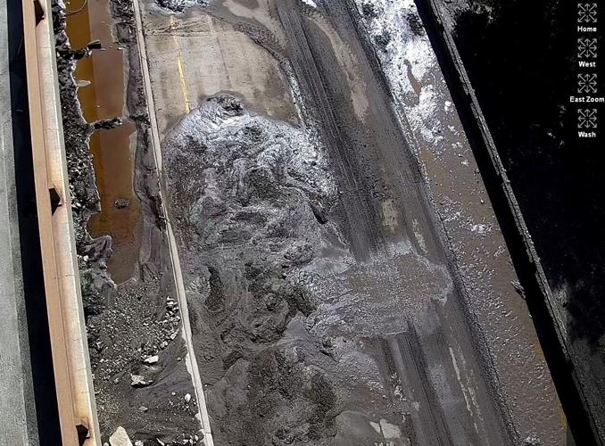
Interstate 70 in Glenwood Canyon was shut down due to the flash flooding and mudslides on Tuesday evening. Situated near the Grizzly Creek Fire burn scar, this particular area of the interstate is highly susceptible to post-wildfire flooding and mudslides due to lasting impacts of the blaze.
RELATED: Here’s why Colorado’s burn scars are so dangerous when rain starts falling
A report from 9News says the Tuesday night closure of Interstate 70 through the Glenwood Canyon area is the 8th time this stretch of road has been closed this summer.
Other roads have also recently faced closures, including Highway 125 – when mudslides trapped vehicles – and Highway 14, when a fatal flash flood occurred.
Scattered thunderstorms will continue to develop Friday and Saturday afternoon and into the early evening hours over the central mountains and the San Luis Valley, with impacts expected along the I-25 corridor and central plains, including the Palmer Divide in El Paso County and the Raton Mesa area.
In addition to the torrential rain, there is also a potential for hail up to the size of an inch, cloud to ground lightning, and erratic wind gusting up to 50 mph.
Additional burn scars at risk for post-fire flooding include Cameron Peak, East Troublesome, Calwood, and Williams Fork.
Editor’s Note: All weather statements are subject to change. For the latest forecast updates, please visit weather.gov. Check CDOT’s Facebook, Twitter (@coloradodot) or cotrip.org for closures and delays on highways and roads across Colorado.