







Dozens of Colorado mountain passes, communities at risk of flash flooding ahead of weekend
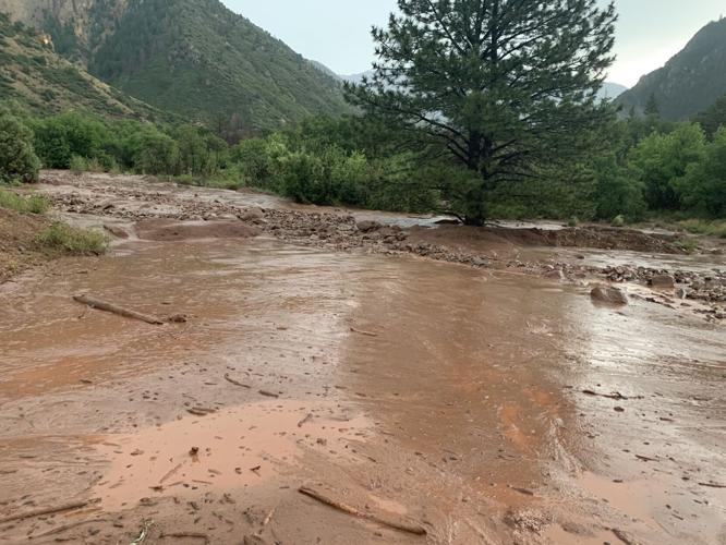
Mudslide on Avalanche Creek Road (Crystal Valley) off Highway 133. Photo Courtesy of the Pitkin County Sheriff's Office.
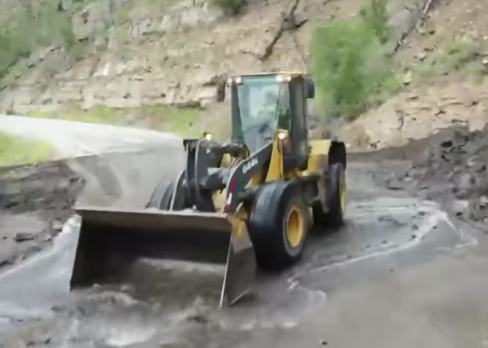
The threat of thunderstorms and post-wildfire flooding, debris flows, mudslides, and rockfall remain high in Colorado after a week filled with heavy monsoon rains.
Scattered to numerous showers and thunderstorms are expected again across much of central and western Colorado both Friday and Saturday, bringing the threat of flash flooding and mudslides to burn scar areas.
⚠Flash Flood Watch⚠ Substantial monsoonal moisture in Colorado will generate storms that could produce flash flooding over a large portion of central and western Colorado. The watch is in effect from 11am to 9pm today. #COwx pic.twitter.com/McLfyvzNHO
— NWS Boulder (@NWSBoulder) July 23, 2021
There is an elevated threat for flash flooding in every recent burn area today. Please have a way to receive warnings and have evacuation plans if you will be in or near a burn area today. Debris flows can travel well outside of the area of heaviest rainfall. #COwx pic.twitter.com/tVJFcph3zB
— NWS Boulder (@NWSBoulder) July 23, 2021
The National Weather Service (NWS) out of Boulder said “there is a significant threat of flash flooding for the Cameron Peak burn area.”
There is a significant threat of flash flooding for the Cameron Peak burn area, with an elevated threat for flash flooding in the rest of the burn areas today. Please have a way to receive warnings and have evacuation plans if you will be in or near a burn area today. #cowx pic.twitter.com/xrIOOVb0ge
— NWS Boulder (@NWSBoulder) July 23, 2021
The NWS issued a Flash Flood Watch for several areas of Colorado on Friday, including the Continental Divide, northern Sangre de Cristo Mountains and Southwest San Juan Mountains, until at least through the evening.
RELATED: Here’s why Colorado’s burn scars are so dangerous when rain starts falling
Flash Flood Watch is in effect from Noon MDT through this evening for the Continental Divide and northern Sangre de Cristo Mountains due to thunderstorms. You should monitor later forecasts and be prepared to take action should Flash Flood Warnings be issued. #cowx #colorado pic.twitter.com/ir7y0JPD62
— NWS Pueblo (@NWSPueblo) July 23, 2021
“Rock slides and quick rises in creeks and streams will be possible with heavy rainfall in steep terrain,” the watch states. “Mud and debris flows will be possible in and near burn scars.”
Precipitation on steep terrain that was severely burned can cause flash flooding within minutes. If you are in an area vulnerable to flooding & debris flows, plan in advance & move away from the area. There may be very little time to react once the storms and rain start. #cowx pic.twitter.com/dhQkZ6iWrs
— NWS Boulder (@NWSBoulder) July 23, 2021
Here are the areas under the Flash Flood Watch.
- Cumbres Pass
- St. Elmo
- South Fork
- Climax
- Wolf Creek Pass
- Creede
- La Veta Pass
- Poncha Pass
- Sargents
- Bonanza
- Granite
- Blanca Peak
- North Pass
- Alpine
- Telluride
- Ouray
- Lake City
- Eagle
- Edwards
- Glenwood Springs
- Carbondale
- Basalt
- Aspen
- Vail
- Snowmass
- Buford
- Trappers Lake
- Glendevey
- East Slopes Mosquito Range
- Estes Park
- Indian Peaks
- Nederland
- Eisenhower Tunnel
- Rocky Mountain National Park
- East Slopes Southern Gore Range
- Mount Evans
- Laramie and Medicine Bow Mountains
- Red Feather Lakes
- Cameron Pass
- Breckenridge
- Kenosha Mountains
- Winter Park
- Williams Fork Mountains
- Willow Creek Pass
- Rabbit Ears Range
- Berthoud Pass
“Drier weather is forecast Sunday and Monday over the area,” according to the NWS.
Severe thunderstorms sparked chaos across the state Thursday evening flooding portions of Interstate 70 through Glenwood Canyon and burying Avalanche Creek Road off Highway 133 in mud.
Mudslide on Avalanche Creek Road (Crystal Valley) approx 1/2 mile off Hwy 133. Resources will not be able to clear it due to the risk of further slides overnight. Campers will hunker down until the AM. @Carbondalefire @USFSWhiteRiver
(Photo credit: Catherine Christoff) pic.twitter.com/uVolUJxrHm— Pitkin Co. Sheriff (@PitkinSheriff) July 23, 2021
Drivers are advised to use extreme caution on the roads. If you encounter flooded roads, turn around to avoid potential drowning. Most flood fatalities occur in vehicles. Do not drive around barricades or other road closures.
Editor’s Note: All weather statements are subject to change. Before heading out, check the current weather conditions at weather.gov. Be sure to check the current road conditions before heading out at codot.gov.