


FLOOD WATCH: 1-2 inches of rain in less than an hour, NWS warns
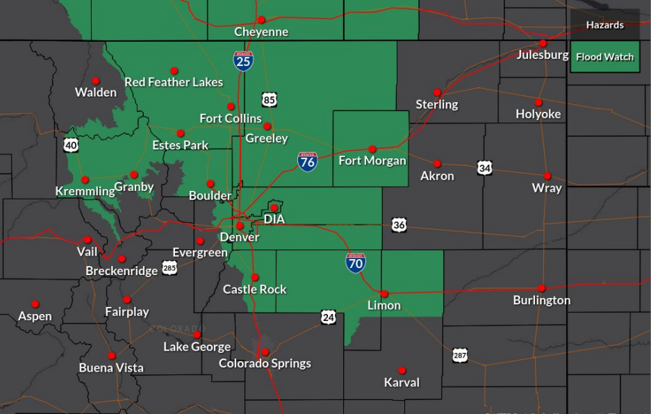
Widespread thunderstorms with the potential to produce 1 to 2 inches of rain in less than an hour are expected to impact a large portion of Colorado, including much of the Front Range on Monday.
As a result, the National Weather Service (NWS) has issued a Flood Watch for central, north central, and north western Colorado.
The areas highlighted in green on the map below are included in the Flood Watch:
According to the service, thunderstorms will develop across the high country at about noon and continue into the late evening.
The threat of flooding will be most significant near rivers, creeks, streams, and other low-lying and flood-prone locations, but could also occur in poor drainage spots and urban areas.
Burn scar areas should also be avoided with the service calling for an elevated flood risk at the Cameron Peak, East Troublesome, and Williams Fork burn scars on Monday, Tuesday, and Wednesday.
“Pay close attention and have multiple ways to receive warnings. Avoid traveling into burn areas during the afternoon and evening hours,” NWS warned.
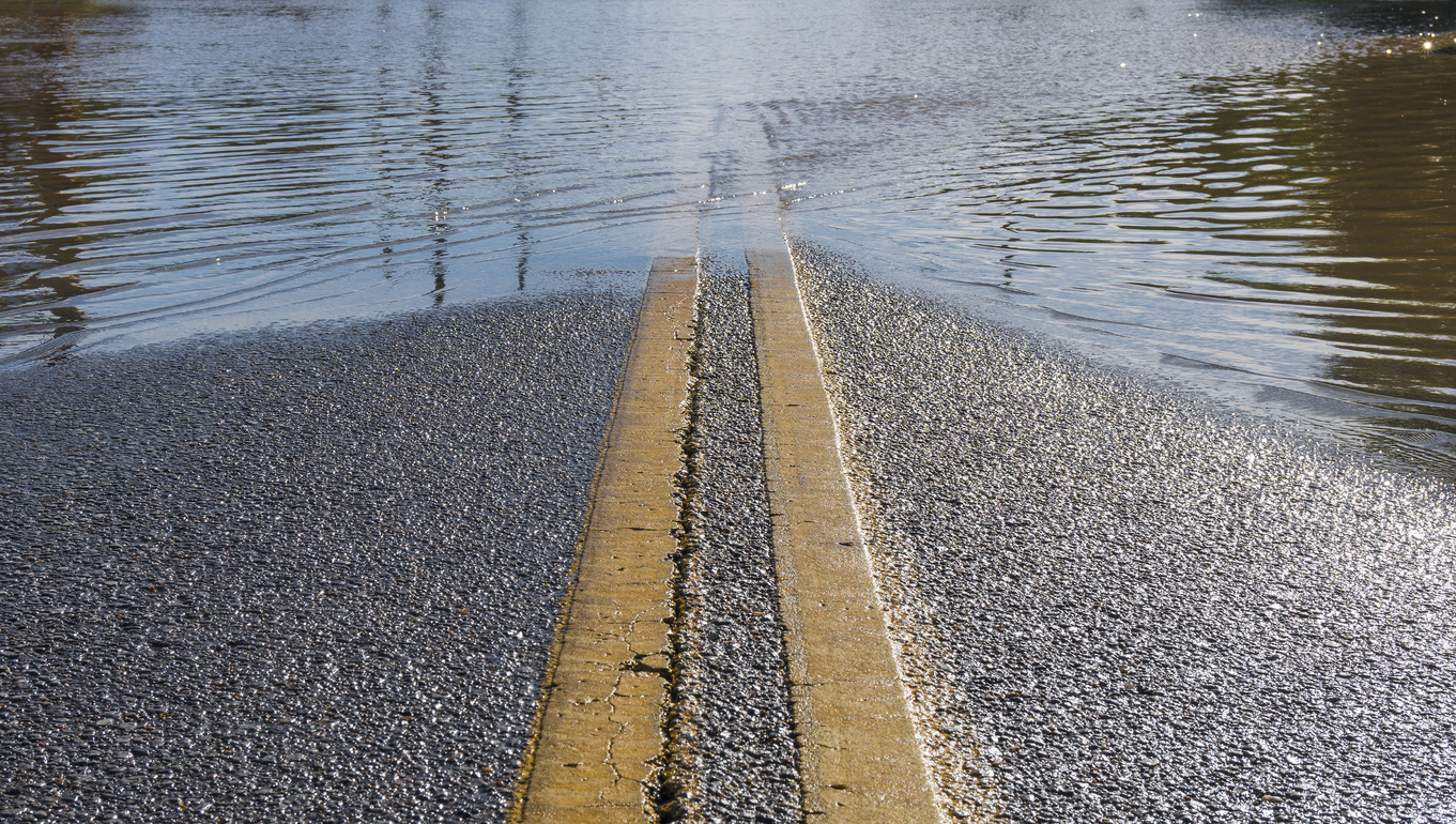
Remember to never drive through flooding roadways, because it may not be possible to know the depth of the water or whether or not the roadway has been damaged. Flood water that’s also moving can be especially dangerous. According to NWS, more than half of flood-related deaths happen in vehicles.
Check cotrip.org for closures and delays on highways and roads across the state.
This wet pattern is expected to continue through the week in many areas, as Colorado settles into a late monsoon season. Thunderstorm coverage will likely decrease, but scattered storms have been forecasted for most days.
STAY INFORMED: Get free Colorado news with our daily newsletter (Click here)
Get OutThere
Signup today for free and be the first to get notified on new updates.
PREV
PREVIOUS

17-year-old cyclist killed in Boulder crash Sunday. "We ride for Magnus"
Colorado cycling community mourns the loss of one of their own
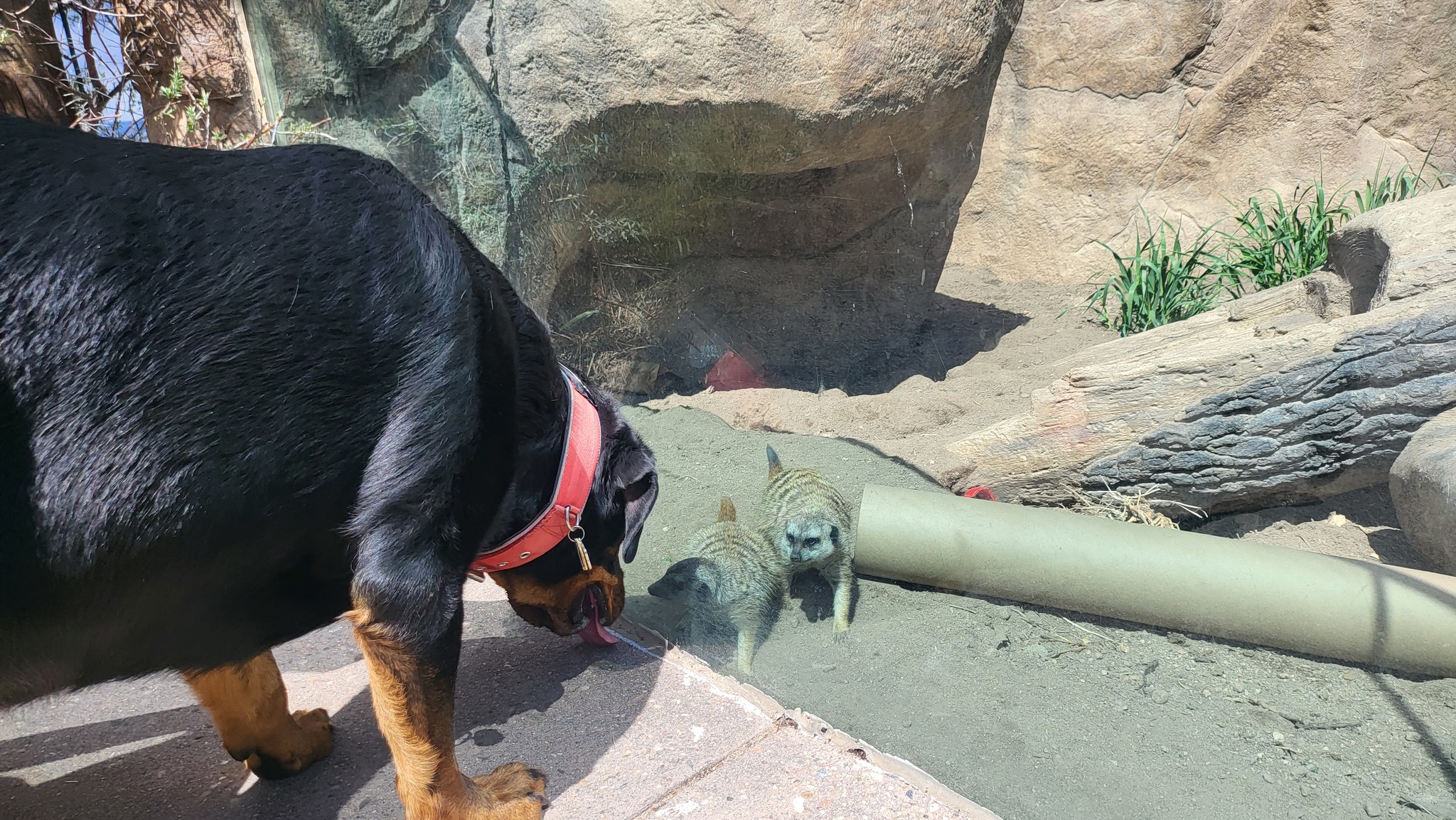
Colorado zoo invites 'well-behaved' dogs to visit grounds
The Cheyenne Mountain Zoo (CMZoo) is inviting guests to celebrate the ‘Dog Days’ of summer with them by bringing along their ‘well-behaved’ dogs to explore the grounds. The zoo recently announced that it will be hosting additional Dog Days next month after the success of the event earlier this summer. “We can support healthy animal behaviors […]