


Forecast intensifies to show 5 feet of snow possible in parts of Colorado
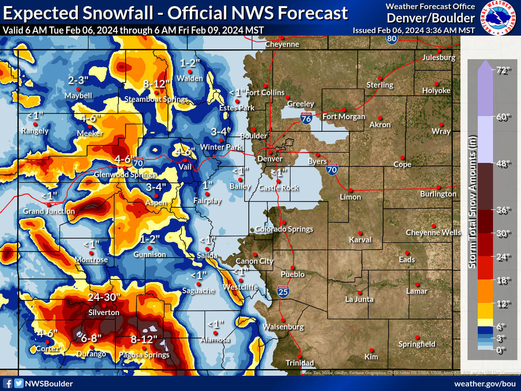
The storm forecast has intensified compared to snowfall accumulation mapping that was published on Monday, now calling for snow in the range of 48 to 60 inches in the southwest region of Colorado.
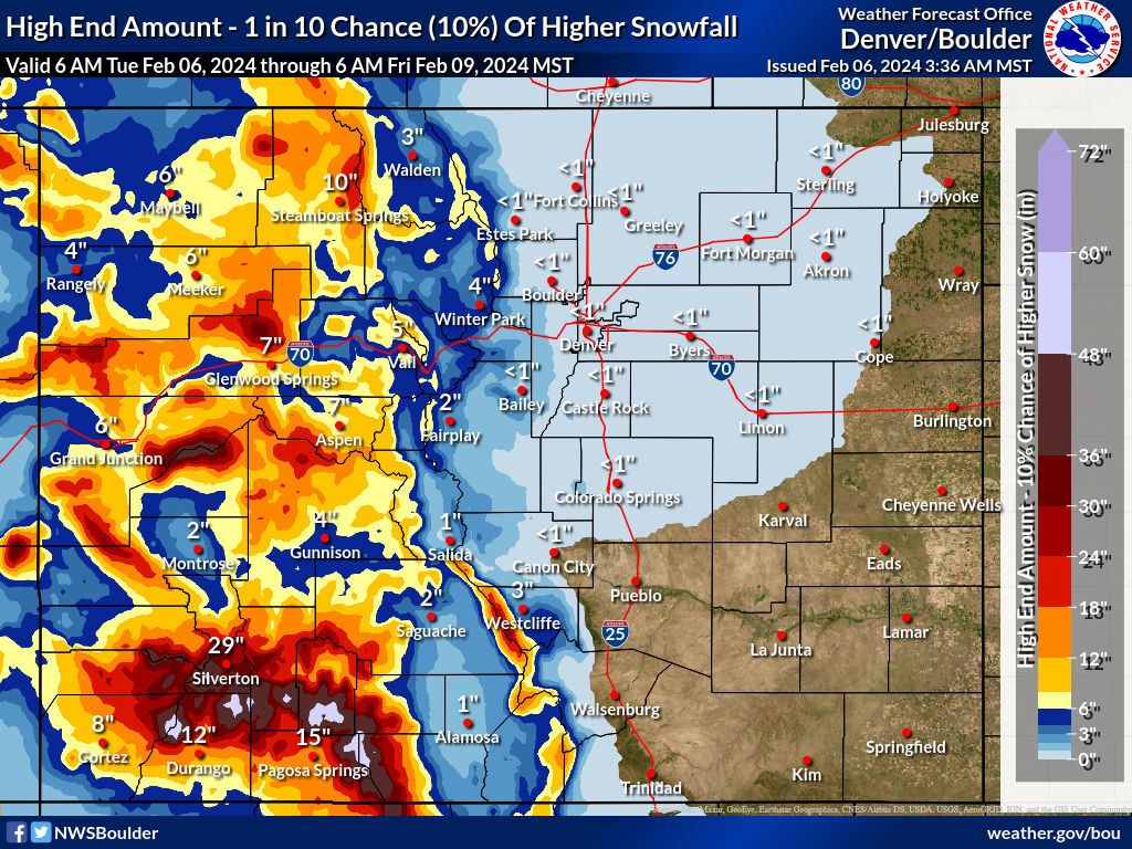
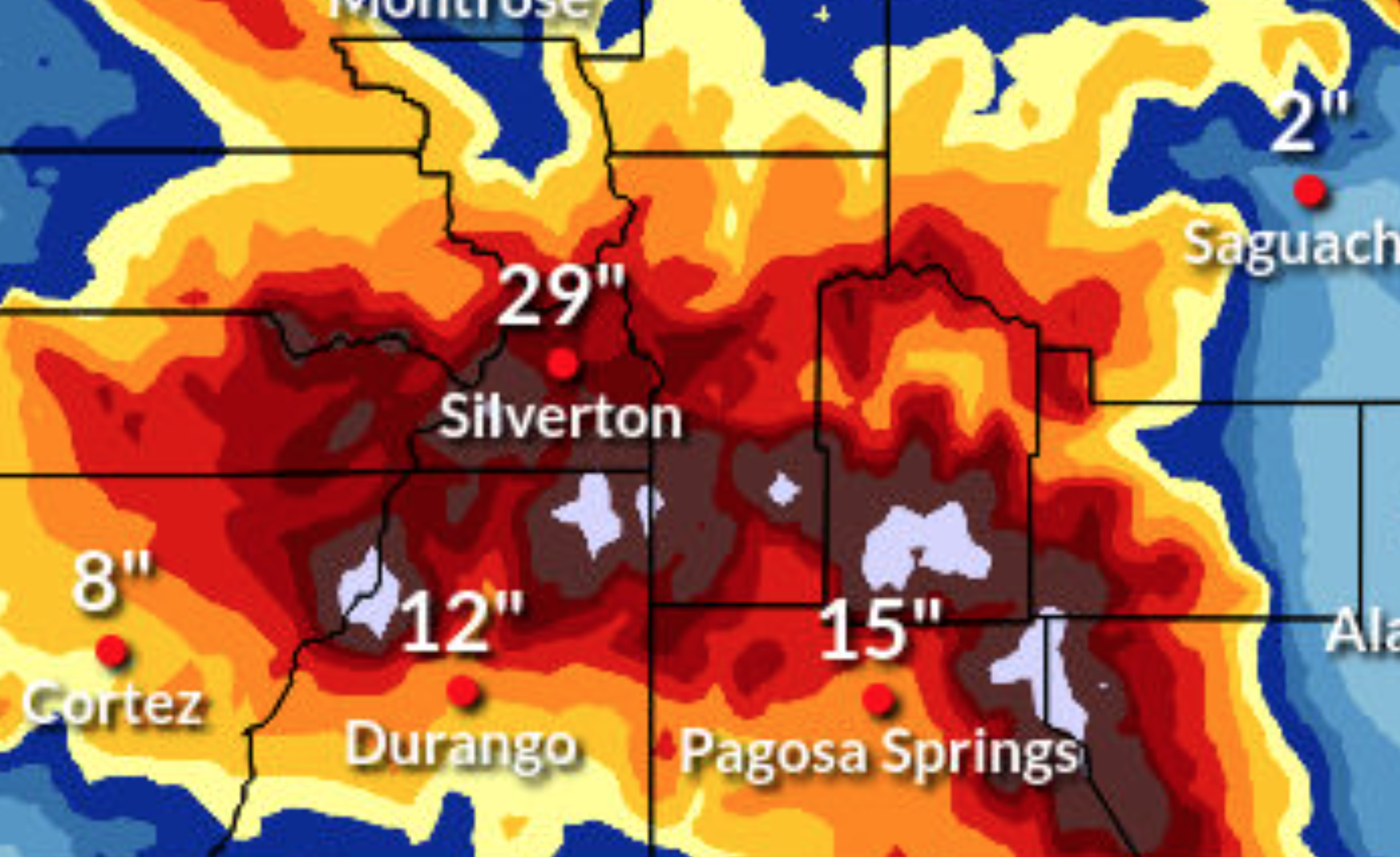
From Tuesday morning through Friday morning, some of the mountains around Durango and Pagosa Springs could get up to 60 inches – five feet – of snow in the ‘most likely’ snowfall scenario. The ‘high-end’ snowfall forecast, which has a one-in-10 chance of happening, shows that this deeper snow could be even more widespread, including mountains found directly south of Silverton.
Looking at the rest of the state, the eastern half of Colorado should mostly get skipped during this storm, including the I-25 metro area.
Meanwhile, it’s not just the southwest region that’s expected to get hit hard – it’s just expected to get hit the hardest. Mountains near Grand Junction, Steamboat Springs, Glenwood Springs, Aspen, and Westcliffe could see two feet of snow or more.
Thanks to strong winds that are expected to accompany this storm, visibility in areas where flakes are falling is expected to be limited. Expect drifting snow, potential whiteout conditions, and slick roads. Delays and closures are likely, especially when it comes to mountain passes, such as Wolf Creek Pass and Red Mountain Pass.
The two maps below show the ‘expected’ snowfall scenario and the ‘high-end’ one-in-10 chance snowfall scenario:
Find a full city-by-city breakdown of how much snow is expected here.
Find additional updates on the National Weather Service website.
Get OutThere
Signup today for free and be the first to get notified on new updates.
PREV
PREVIOUS
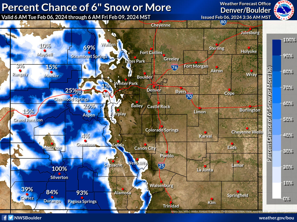
Colorado mountain town has 93% chance of at least 18 inches of snow
A major storm is about to hit Colorado, with potential to drop snow in the range of 48 to 60 inches in parts of the state between Tuesday and Friday morning. That being said, this storm will heavily favor the state’s western and southwestern peaks, nearly missing the Front Range and the I-25 metro area […]
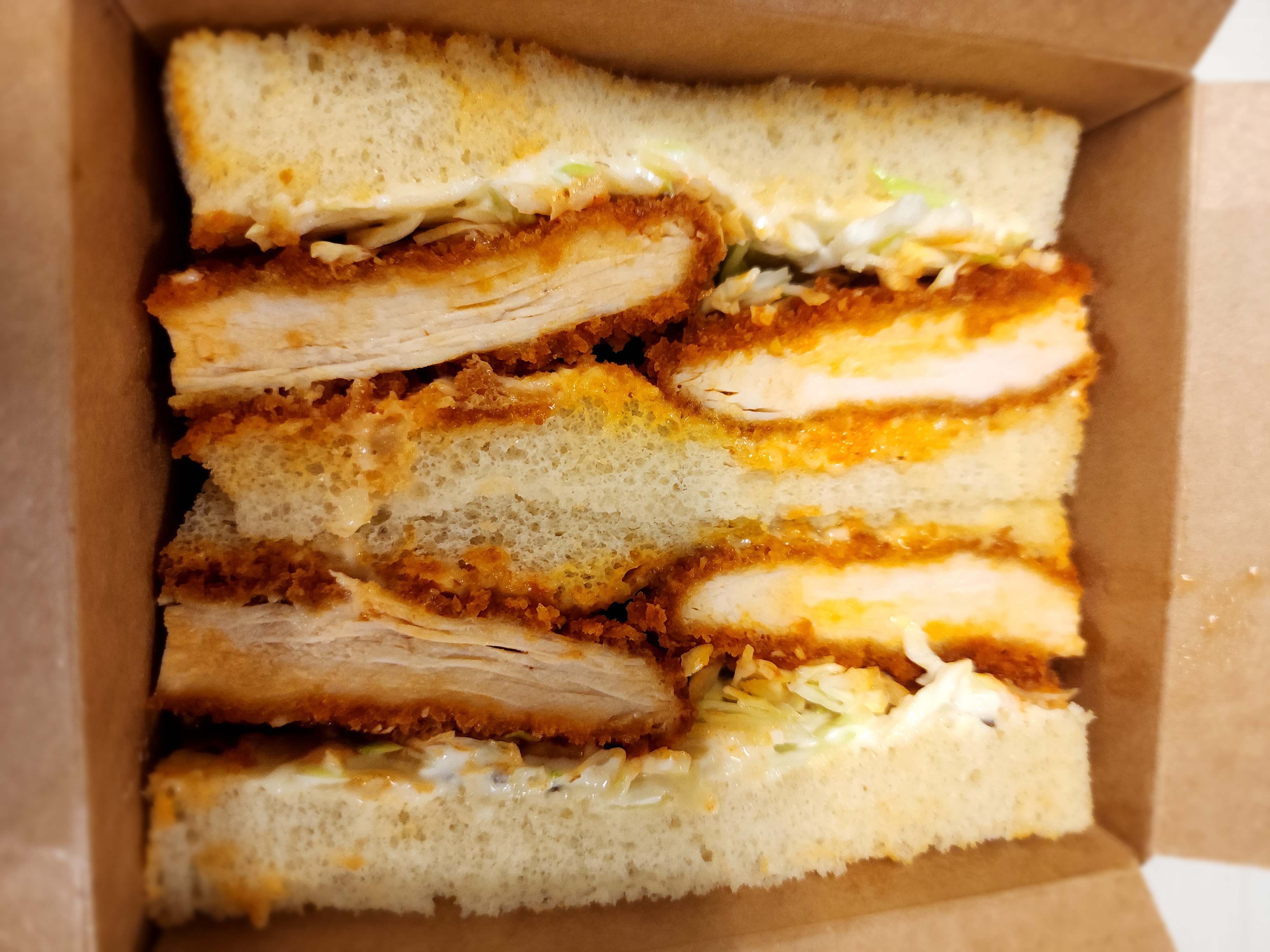
Denver's Sandoitchi pop-up combines Japanese sandwiches with Instagram aesthetics
At Denver’s latest restaurant pop-up, it’s hip to be square. RiNo’s Zeppelin station is once again hosting Japanese sandwich pop-up Sandoitchi, which will be open until Saturday. Sandoitchi makes Japanese-style sandwiches which mirror the kind found in Japanese “combini.” Japanese convenience stores, known as “combini,” have redefined the perception of convenience store food with their […]