


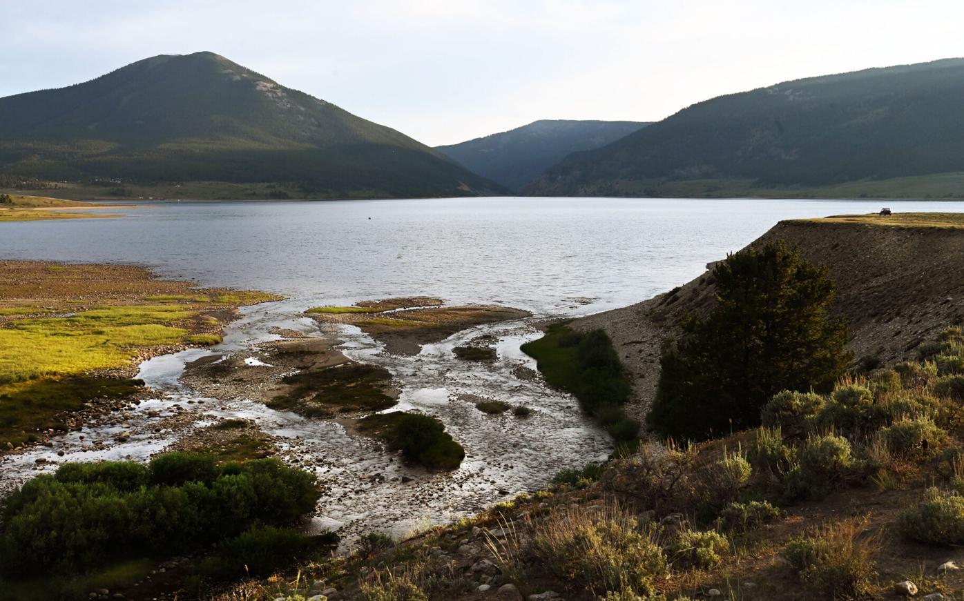
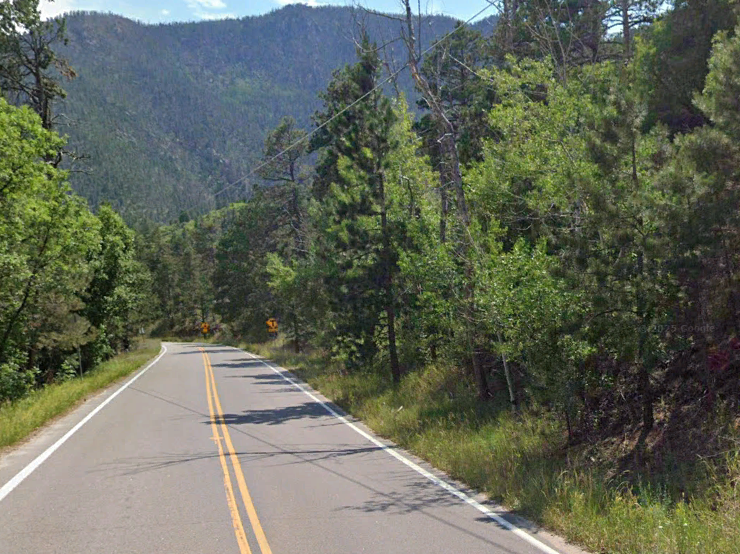
A look at 9 Colorado passes over the Continental Divide — and what to see on the drives
JERILEE BENNETT
Call it the great separator, or the thing that unifies us as Coloradans.
That’s the Continental Divide, or the Great Divide, so named for the mighty formation that separates our North American watersheds between the Pacific and Atlantic oceans.
In Colorado, we know it as the rugged wall between the Front Range and the Western Slope. We know the Continental Divide not so much as a barrier, but as an enticing invitation to scenic excursions.
The Continental Divide Trail lends perspective: This state houses some 650 miles of the route running more than 3,000 miles from Mexico to Canada. This state also houses some of the best views along the entire divide — its highest point meets Grays Peak — and some of its great history lessons and engineering feats.
‘A sacred place:’ Exploring the Grottos off Colorado’s Independence Pass
Technology followed in the footsteps of hunter-gatherers to carve tunnels, tracks and roads over the mountains. Miners carved their own paths, along terrain now dominated by ski areas.
Yes, to travel the Continental Divide is to travel through time — and to make memories.
While the routes are many, here’s a look at some of the most prominent in Colorado:
Berthoud Pass
U.S. 40 between Clear Creek and Grand counties; topping near 11,300 feet
FYI: The pass gets its name from Edward Berthoud, who surveyed a railroad route in 1861. And while his road is best known by Denverites traveling to the likes of Winter Park, it was another route in the vicinity that gained equally historic acclaim: Moffat Tunnel was marked the Western Hemisphere’s longest railroad tunnel when it finished through the mountains in 1928.
Stretch the legs: Berthoud Pass is synonymous with backcountry skiing and snowboarding. In summer, one might park at the old ski area parking lot and hike above treeline to Mount Flora.
Boreas Pass


Between Breckenridge and Como; topping near 11,500 feet
FYI: South of Breckenridge, the pavement ascends to the dirt that was the bed of a railroad unlike any America has ever seen. Boreas Pass became known as the nation’s highest narrow gauge starting in 1882. The name hints at the extremes those railroaders endured: Boreas is the Greek god of the north wind.
Stretch the legs: The road maintains several relics from the old days, including the company settlement at the summit. Around the cabins, note the stumps of trees that were cut to build the railroad.
Cottonwood Pass


Between Buena Vista and Almont; topping near 12,130 feet
FYI: A newly, fully paved road combined with the 2020 pandemic and led to an observation of the man we met running Taylor Park Marina: “I’d guess this place hasn’t seen this many people since the turn of the century in the mining days.” Where there is now bustle at Taylor Reservoir, there was once a bustle of prospectors across the Sawatch Range. They left ghost towns called Tincup — popular for off-roaders — and St. Elmo beyond.
Stretch the legs: Taylor Reservoir and the adjoined river are go-to fisheries. Also along the pass is Denny Creek Trail rising to fourteener Mount Yale.
Colorado couple claims record across Colorado 14ers
Independence Pass


Colorado 82 between Twin Lakes and Aspen; topping near 12,100 feet
FYI: It was first known as Hunter Pass, a nod perhaps to the land’s deep history as hunting grounds. The pass now shares the name of a town supposedly built from a silver discovery on July 4, 1879. Following booms in Leadville, mining spread to this side of the Continental Divide, paving the way to the Roaring Fork Valley’s development.
Stretch the legs: The old townsite of Independence is a few miles from the summit, with well-preserved cabins beside the river. Drivers pull off for more sightseeing around Lincoln Creek, the Grottos, and the Braille and Discovery trails.
Loveland Pass


U.S. 6 between Clear Creek and Summit counties; topping near 11,990 feet
FYI: Loveland is Colorado’s highest mountain pass that does not close for winter. Of course it does not, for the ski industry it serves. Initially, the idea was to serve the mines of Leadville with a wagon road from Denver. William A.H. Loveland, president of the Colorado Central Railroad, saw that route opened in 1869 — about a century ahead of the Eisenhower Tunnel that forever changed travel in the Rockies.
Stretch the legs: Driving up from Loveland Ski Area, one reaches Grizzly Peak Trail — a challenging hike — followed by the short trek to Pass Lake. Plenty more attractions ahead at Arapahoe Basin Ski Area and Keystone Resort.
Monarch Pass


U.S. 50 between Salida and Gunnison; topping near 11,310 feet
FYI: Starting in the late 1800s, this part of the Continental Divide saw a couple of wagon routes high out of the Arkansas River Valley. The alignment we know today was established in 1939 — almost under the name Vail Pass, for the state’s chief highway engineer, Charles Vail. Locals protested for the long-honored butterfly.
Stretch the legs: While continuing scenic tram rides, new owners in recent years have revamped the visitor center and restaurant to be Monarch at the Crest. This is also the base for Monarch Crest Trail, one of Colorado’s most epic mountain bike rides.
Rabbit Ears Pass


U.S. 40 between Steamboat Springs and Grand County; topping near 9,425 feet
FYI: In northwest Colorado, a peak with rabbit-like ears has watched development below over untold time. Beginning in 1911, it watched men build a road that would be one of America’s next significant transcontinental connections. In more recent decades, Rabbit Ears Peak has watched a recreation boom.
Stretch the legs: In winter, snowmobilers stage at the East Summit parking area and cross-country skiers and snowshoers at the West Summit. The trail possibilities expand in summer. But it’s in autumn that the aspen-loaded pass shines most.
Happy Trails: A trailhead-to-trailhead tour of Ute Valley Park in Colorado Springs
Trail Ridge Road


U.S. 34 between Estes Park and Grand Lake; topping near 12,180 feet
FYI: Rocky Mountain National Park opened Trail Ridge Road to much fanfare in 1932. The celebration continues among tourists today, many of them witnessing the alpine world for the first time. Of the 48 miles between the park’s gateways, the “Highway to the Sky” roams above timberline for 11 miles.
Stretch the legs: Take your pick of trailheads and overlooks on either side of the road below the Alpine Visitor Center. A couple of our favorites on the road’s east side: Hidden Valley and Alluvial Fan. And on the west side toward Grand Lake: Lake Irene and Coyote Valley trailhead.
Wolf Creek Pass


U.S. 160 between South Fork and Pagosa Springs; topping near 10,860 feet
FYI: Wolf Creek Pass construction finished in 1916. It’s a wonder how motorists of the day managed the road’s tight, steep curves. Even for today’s motorists, the road is notorious, especially in winter. Truckers are careful to join drivers heading to Wolf Creek Ski Area, which claims more natural snowfall on average than any other ski area in Colorado.
Stretch the legs: At the top of the pass, a forest road stretches about 1 1/2 miles to the Lobo overlook — well worth the detour. Also recommended: Treasure Falls. From the small parking lot off the road, it’s a short hike to the 100-foot cascade.

Lindsey Vonn gets encouragement from soccer legend Cristiano Ronaldo as she recovers from injury
Daniel Boniface
dan.boniface@denvergazette.com
Updated 8 hours ago
One of soccer’s all-time legends this week sent words of encouragement to Colorado skier Lindsey Vonn as she recovers from a gruesome injury sustained at the Winter Olympics in Cortina. Cristiano Ronaldo shared the positive words in a comment on...
Daniel Boniface
Reporter
Red Flag Warning issued for Denver, I-25 corridor, plains on Wednesday
Daniel Boniface
dan.boniface@denvergazette.com
Updated 22 hours ago
Another day of critical fire danger is on tap in Denver, the Interstate 25 corridor and the Eastern Plains on Wednesday, meteorologists said. The National Weather Service in Boulder issued a Red Flag Warning from 10 a.m. to 6 p.m....
Daniel Boniface
Reporter
With new book, Colorado climber turns the page on horrific chapter
Seth Boster
seth-boster@denvergazette.com
Updated 3 days ago
In her hospital bed on the morning of May 8, 2017, Melissa Strong asked her husband, Adam, for a pen. She could barely grip it; her fingers hardly resembled fingers, more like dark and swollen nubs after tense, reconstructive surgeries...
Seth Boster
Reporter
Rocky Mountain National Park to continue reservation system while other parks won’t
Seth Boster
seth-boster@denvergazette.com
Updated 1 week ago
While some of America’s most popular national parks are dropping reservations this summer, they will still be required at the most popular one in Colorado. Rocky Mountain National Park has announced its timed-entry reservation system for the peak season from...
Seth Boster
Reporter
Long-dreamed Ute Pass Trail to expand in hills west of Colorado Springs
Seth Boster
seth-boster@denvergazette.com
Updated 1 week ago
For more than 20 years, El Paso County has worked to build a trail roughly following a historic route of tribal people ー a seasonal hunting route now defined by U.S. 24 through the foothills between Manitou Springs and Teller...
Seth Boster
Reporter
Lower bird count, growing noxious weeds, new species reported in Colorado Springs open spaces
Seth Boster
seth-boster@denvergazette.com
Updated 1 week ago
How are the plants and animals that call Colorado Springs home doing? The city’s Parks Board recently gained insights during an annual report from Cody Bear Sutton, the Parks Department’s natural resources specialist. Sutton presented a brief summary of findings...
Seth Boster
Reporter

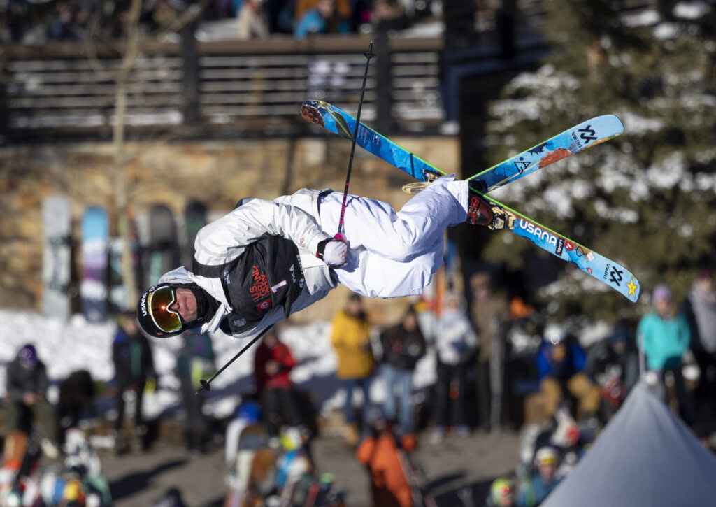
Colorado’s Mikaela Shiffrin wins slalom to break 8-year Olympic drought
Associated Press
associated-press@denvergazette.com
Updated 1 week ago
CORTINA D’AMPEZZO, Italy (AP) — Mikaela Shiffrin’s eight-year Olympic medal drought is over. The American skiing standout put in two dominant runs to win the women’s slalom at the Winter Games on Wednesday by 1.50 seconds. The race isn’t officially over yet,...
Associated Press
Reporter
Mark Kiszla: Could Olympic excess kill what makes Cortina special?
Mark Kiszla mark.kiszla@denvergazette.com
mark.kiszla@denvergazette.com
Updated 1 week ago
CORTINA D’AMPEZZO, Italy – As the lights of the old ski jump hill from the 1956 Olympics shine through his kitchen window, Italian mountain climber Mario Dibona pours a beer and gently places his prized possession on the table. “Gruppo...
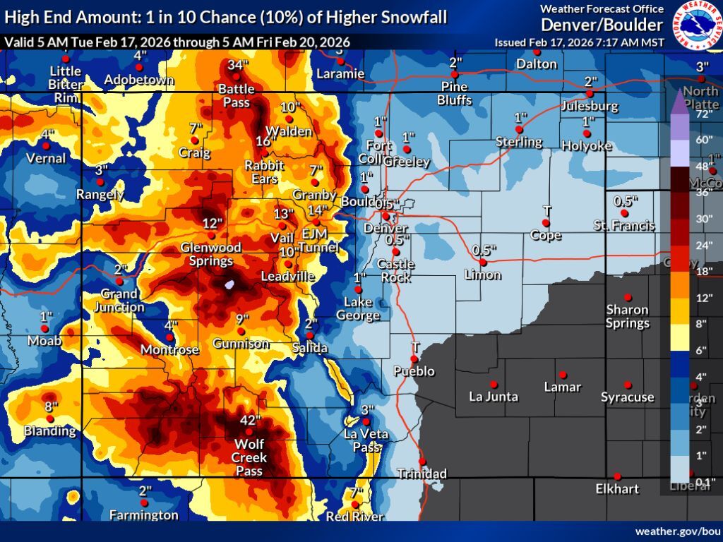
Widespread snow totals of 18-plus inches expected across Colorado’s mountains this week
Spencer McKee
spencer@outtherecolorado.com
Updated 1 week ago
Winter weather is roaring into Colorado this week, with big snow and a drop in temperature expected. According to mapping from the National Weather Service, the most likely snowfall scenario will mean at least 8 inches of snow across the...
Spencer McKee
Reporter
Mark Kiszla: What Hotdog Hans could teach Olympians feeling strain of the Winter Games
Mark Kiszla mark.kiszla@denvergazette.com
mark.kiszla@denvergazette.com
Updated 1 week ago
CORTINA D’AMPEZZO, ITALY • No offense to Olympic megastars Sidney Crosby or Snoop Dogg, but the celebrity I’d most like to crack open a frosty Peroni with at the Winter Games is Hotdog Hans. “We’re gonna have to get you...
PREV
PREVIOUS
'Devastating' — Zebra mussels found in Colorado River, officials scramble to develop rapid response
After years of taking steps to keep zebra mussels out of Colorado’s rivers and lakes, state officials said on Tuesday they are “devastated” to learn the invasive species has now made its way into the Colorado River, potentially affecting four states, and they are working on a rapid response to stop it from spreading. “This […]
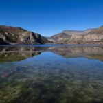
Mixed reactions to plan for Colorado's Sweetwater Lake
As a public comment period draws to a close regarding a plan for a scenic lake in western Colorado, land managers continue to face strong opposition. That opposition — largely from people living nearby — quickly followed Gov. Jared Polis announcing Sweetwater Lake as Colorado’s next state park in 2021. The announcement came after the lake and […]