


Light snow accumulations Tuesday as mid-November ‘dry spell’ continues | Whiteout snow report
Be thankful as Thanksgiving week powder potentially on the horizon
Skiers and riders, Colorado has been sandwiched between fall’s snow storms since mid-October, reaping the benefits from both north and south flowing systems.
If Colorado is the meat, the two pieces of bread are the zonal west-to-east flow in the north and cut-off lows in the south, squishing snow storms together across Colorado for the better part of a month.
This has led to above average snow pack leading up to Thanksgiving, a vast difference to where the state was at in 2023.
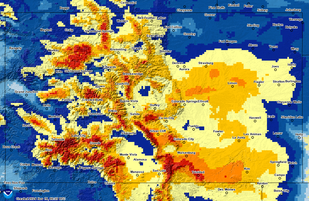
According to mapping from NOAA’s National Operational Hydrologic Remote Sensing Center, seasonal accumulation of at least 0.10 inch or more of snow has accumulated approximately everywhere in the state as of Sunday.
Compared to the same date in 2023, a drastic difference appears in seasonal accumulation across the state, with only small pockets above 48 inches north of Crested Butte and no snow in the Grand Valley, southwestern corner and large areas on the eastern Plains.
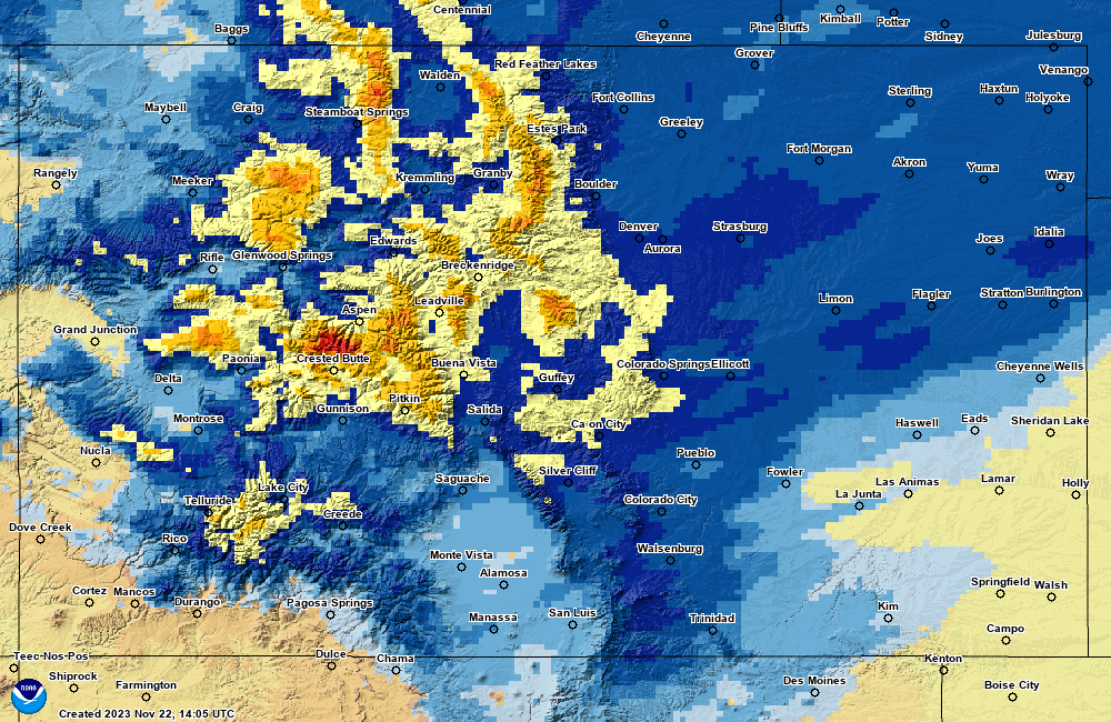
Furthermore, the statewide snow water equivalent on Sunday, Nov. 17, 2023 was at 1 inch vs. at 2.7 inches yesterday, or 1.7 inches less in 2023 compared to 2024.
But that’s about to change.
Recap:
More drying out continued over the weekend, with both Saturday and Sunday offering sunny skies and warmer temperatures around Colorado’s high country.
The National Weather Service in Grand Junction recorded highs of 40 and 42 in Aspen over the weekend days and the NWS in Boulder recorded highs of 28 and 34 in Copper Mountain, with no precipitation falling; although 2 inches fell in Steamboat on Saturday night.
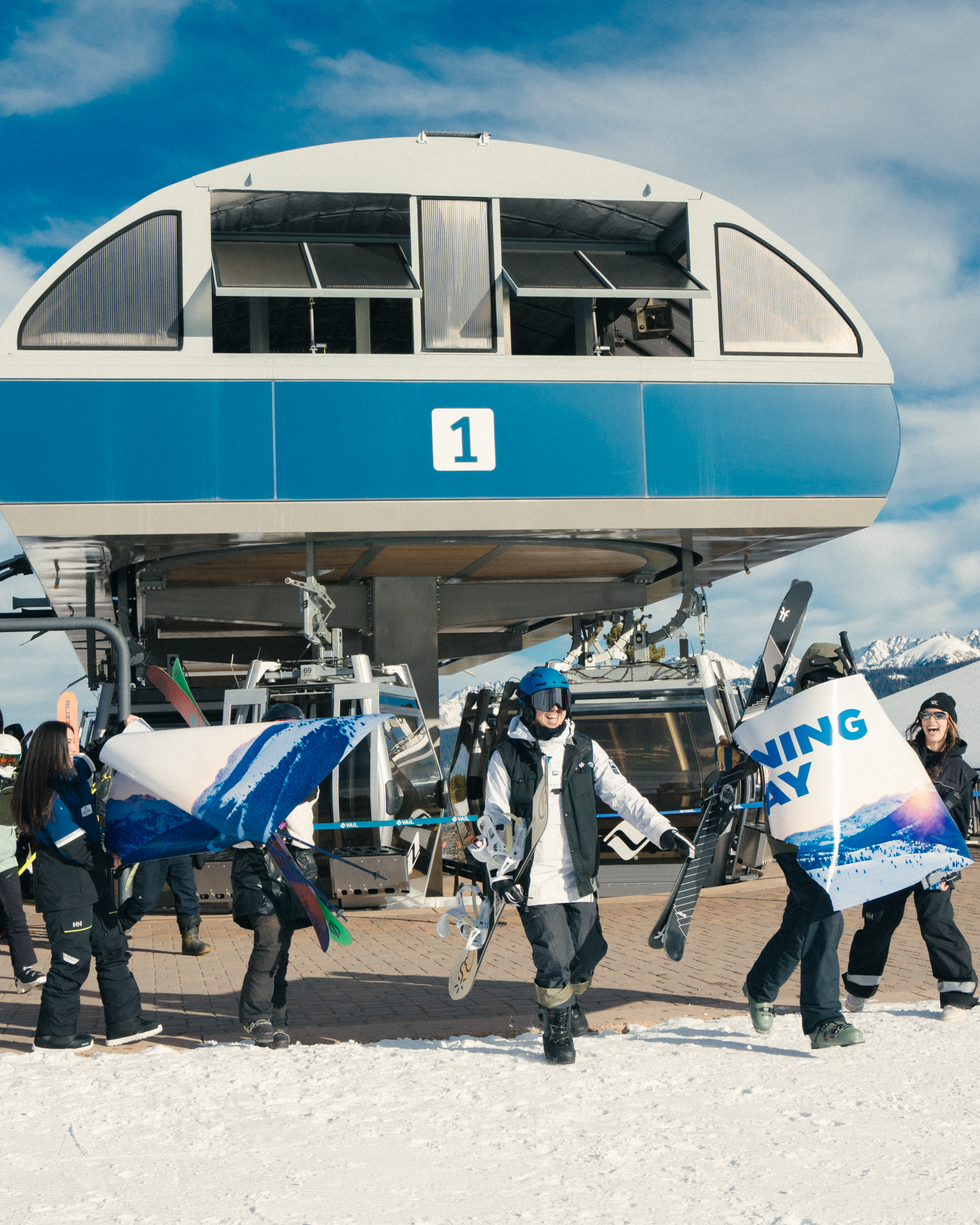
Good news, however, Vail and Purgatory are now open, each spinning lifts seven days a week and bringing Colorado to 10 open ski areas or resorts.
Forecast:
On Monday, a low pressure system slowly drifting its way north northeastward through the panhandles of Texas and Oklahoma will bring some moisture into the state on counter clockwise rotation. The northern mountains (Park, Medicine Bow and Flattops) should see some snow start to fall in the afternoon.
The ECMWF forecast model has snow starting around 1 p.m., in extreme northwestern Colorado and snow mainly falling north of Interstate 70 by late afternoon.
Overnight Tuesday into Tuesday morning, more snow works its way across Colorado from the north and northwest.
Snow ends mid-evening for the state, but not after the northern mountains receive between 1-4 inches, the central mountains between 1-4 inches (highest accumulations in the West Elks) and between 1-3 inches in the southern mountains.
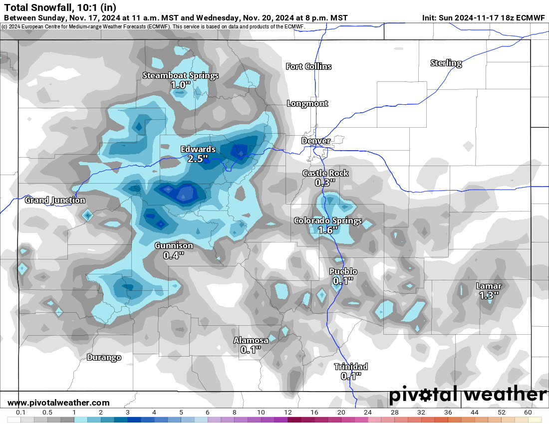
Best chances for snow are in Pitkin, eastern Eagle, Summit and southern Grand counties.
Although this storm more or less ‘hits’ Colorado, moisture levels and orographic lifting work against creating larger totals. The bulk of moisture associated with this low will stay far east of Colorado, but ski slopes will get something.
Temperatures are forecast to be on the chilly side, according to the National Weather Service. Expect teens on Tuesday with light powder skiing and riding, mostly in the central mountains and northern mountains.
From Wednesday to Saturday, temperatures rebound again and drier weather moves back into the state. Temperatures are forecast to be in the mid 40s Thursday through Saturday ahead of a week disturbance for Sunday.
Long range:
On Sunday morning, snow showers are potentially entering the state from the west as a low pressure system passes to Colorado’s north.
The GFS forecast currently has snow accumulating in western and northern Colorado but spreading into the southern mountains by Sunday evening.
This storm looks promising compared to the last two duds as well, but the forecast information needs to be taken with a grain of salt due to its date range being pretty far out still.
Snow is forecast to fall from Sunday to Tuesday, Nov. 26 afternoon, then pick up again on Wednesday, Nov. 27 morning and last through Thanksgiving Thursday and end some time Friday, Nov. 29 morning.
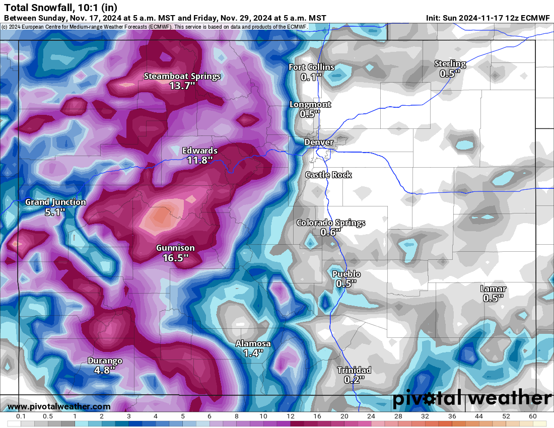
This two-part storm is still pretty far off, but preliminary snow accumulations range between 12-20 inches across all three mountain zones, with the central mountains getting the most.
As more forecast models run and the date nears, better information regarding the Thanksgiving week storms will be known and updated.
Today’s 24-hour snow totals from Colorado resorts:
Arapahoe Basin – 0″
Aspen Highlands – Closed for the season
Aspen Mountain – Closed for the season
Beaver Creek – Closed for the season
Breckenridge – 0″
Buttermilk – Closed for the season
Cooper – Closed for the season
Copper Mountain – 0″
Crested Butte – Closed for the season
Echo Mountain – Closed for the season
Eldora Mountain – 0″
Granby Ranch – Closed for the season
Hesperus – Closed for the season
Howelsen Hill – Closed for the season
Kendall Mountain – Closed for the season
Keystone – 0″
Loveland – 0″
Monarch – Closed for the season
Powderhorn – Closed for the season
Purgatory – 0″
Silverton – Closed for the season
Snowmass – Closed for the season
Steamboat – Closed for the season
Sunlight – Closed for the season
Telluride – Closed for the season
Vail – 0″
Winter Park – 0″
Wolf Creek – 0″