


48-plus inches of snow could fall on some Colorado peaks this week
Following a blanket of snow that fell on much of the state overnight on Sunday, more snow is on the way to Colorado.
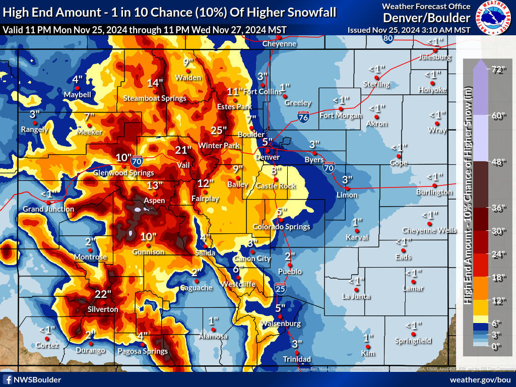
National Weather Service data shows that up to 48 inches of snow could land on mountains located southwest of Aspen in the most likely scenario from Monday evening through Wednesday night. Meanwhile, big totals are expected across most of Colorado’s high-elevation terrain to the tune of at least a foot.
The high-end snowfall scenario depicts a situation where even more snow lands in the mountains, with totals in the 18 to 24 inch range being more widespread. A few select peaks could get between 48 and 60 inches if this forecast comes to fruition.
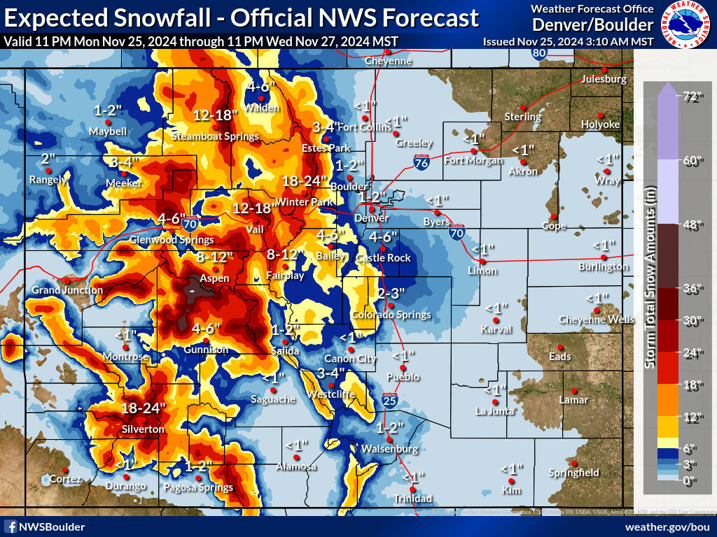
As far as the Front Range goes, the stretch of I-25 between Castle Rock and Colorado Springs should be the area where the most snowfall occurs. In the most likely scenario, about four to six inches falls on this stretch of road during the multi-day storm. While that could be enough to cause some travel concerns in itself, the ‘high-end’ snowfall scenario calls for about a foot of snow along this route, which would be more problematic. In the high-end scenario, Colorado Springs and Denver each get about five inches of snow, with Boulder getting seven and Fort Collins getting three.
Given that Thanksgiving week is likely to bring record-setting travel this year, travel complications can be expected in the Centennial State. Even in the ‘most likely’ snowfall scenario, parts of I-70 get two feet of snow. Those driving across the state should expect to encounter delays, road closures, and slow moving traffic.
Don’t forget to pack these 22 ‘winter driving survival items’ before your next trip.
Follow along with the National Weather Service website for weather related alerts and updated forecasts.
Get OutThere
Signup today for free and be the first to get notified on new updates.
PREV
PREVIOUS
3+ feet of snow forecast in Colorado ahead of Thanksgiving, Black Friday | Whiteout snow report
Major winter storm to impact state's mountains
"Very difficult to impossible travel": 20" of snow or more likely on major Colorado highways
A busy week of Thanksgiving travel lies ahead in Colorado, and according to the National Weather Service, dangerous driving conditions are likely on many of the state’s busiest roads. While Front Range travel is likely to have fewer impacts compared to those of a major storm that rolled through near the start of November, I-70 […]