


Half of Colorado included on NWS ‘Hazards Outlook’ map due to incoming weather
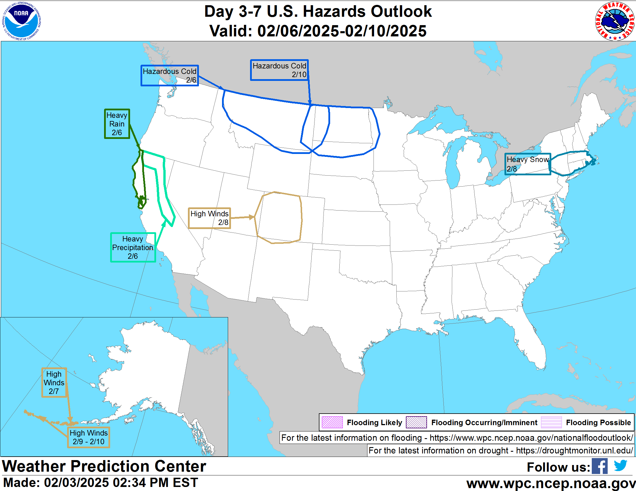
Once again, a large portion of Colorado has been featured on the National Weather Service ‘Hazards Outlook’ map – but this time, it’s not for snow.
While portions of the state have been included on this map in recent weeks, most of the time, it’s been for heavy snow that’s expected to hit the state. The most recent inclusion, however, indicates that high wind speeds could be present in western Colorado on February 8.
Hazards associated with high winds in Colorado’s mountainous terrain can include flying debris, limited visibility due to blowing dust and snow, and a tipping risk for high-profile vehicles.
A report from Denver Gazette’s Jonathan Ingraham also indicates that some relatively light snow could drop a few fresh inches of powder in Colorado on days surrounding high winds. This could further amplify the wind’s impact on visibility and could make it more difficult for outdoor recreators to retrace footprints in the snow.
This weather is still days away, so a lot can change, but those in the impacted area can prepare by ensuring that items left outside are secured to the ground. Additionally, this high wind probably means it’s not the best time to enter the backcountry for most. Those who are prepared for the high winds may still opt to do so, but for those who are not, wind chills could be very brutal, resulting in the potential for frostbite.
Find additional forecasting information on the National Weather Service website.
STAY INFORMED: Get free Colorado news with our daily newsletter (Click here)
Get OutThere
Signup today for free and be the first to get notified on new updates.
PREV
PREVIOUS

2025 GoPro Mountain Games registration opens Wednesday
Speed climbing, ultra running and more to be added following landmark year in 2024.
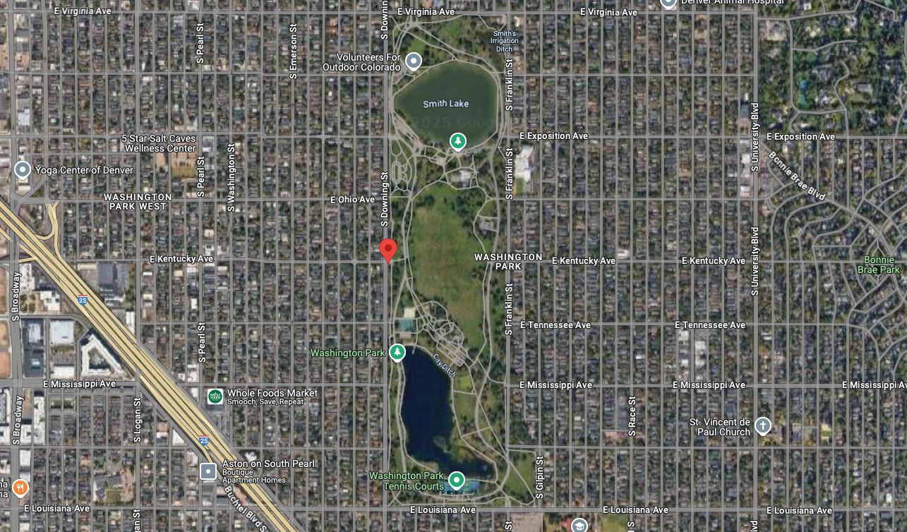
28-year-old suspect in Denver park shooting arrested after "short vehicle pursuit"
An arrest has been made related to a February 2 shooting at Denver’s popular Washington Park. According to the Denver Police Department, the Sunday shooting occurred at about 2:14 p.m. in the 900 block of South Downing Street, with officers arriving at the scene to find a male victim with an apparent gunshot wound. The […]