


Another 12-20″ of snow forecast from ‘Round 2’ set to blanket Colorado
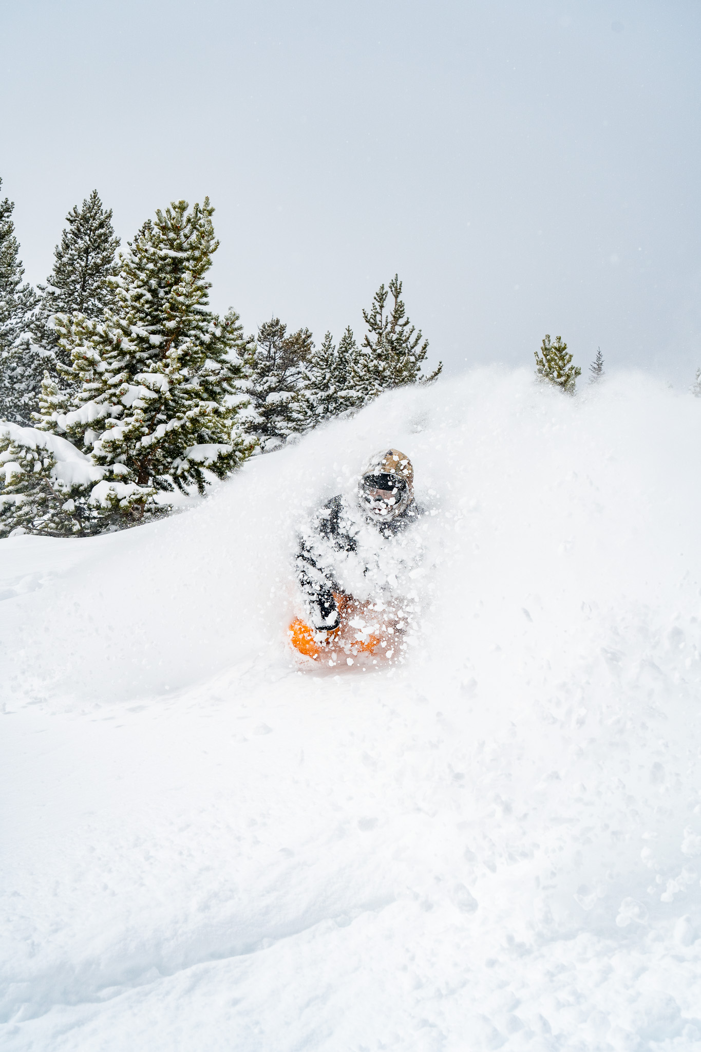
Whiteout snow report
The second round of four snow storms enter Colorado Wednesday night, with snow lasting into Friday night and heavy snowfall totals are possible with multiple powder days to conclude the week.
After a calm and sunny weekend, round three enters the state Tuesday for a quick shot on the northern and central mountains.
Storm four, potentially another large snow maker, is trending toward arrival around Thursday, March 13 and lasting through Sunday, March 16.
Recap:
Storm 1’s snow showers ended late Tuesday night, but not after between 1-9 inches of snow fell across the state, adding onto the 2-9 inches for Tuesday’s first chairs.
Forecast:
Storm 2 – From Wednesday night through Friday night, the second low pressure system is forecast to push across Utah into Colorado. The storm will produced amplified snow via amplified moisture even though it is still pseudo disorganized.
The storm is also still forecast to be coming in in two waves; Wednesday night through Thursday afternoon, and Thursday evening through Friday night, with the second wave producing the higher totals.
Forecasted snowfall totals in the northern mountains are between 6-14 inches, in the central mountains between 12-20 inches and in the southern mountains between 8-14 inches.
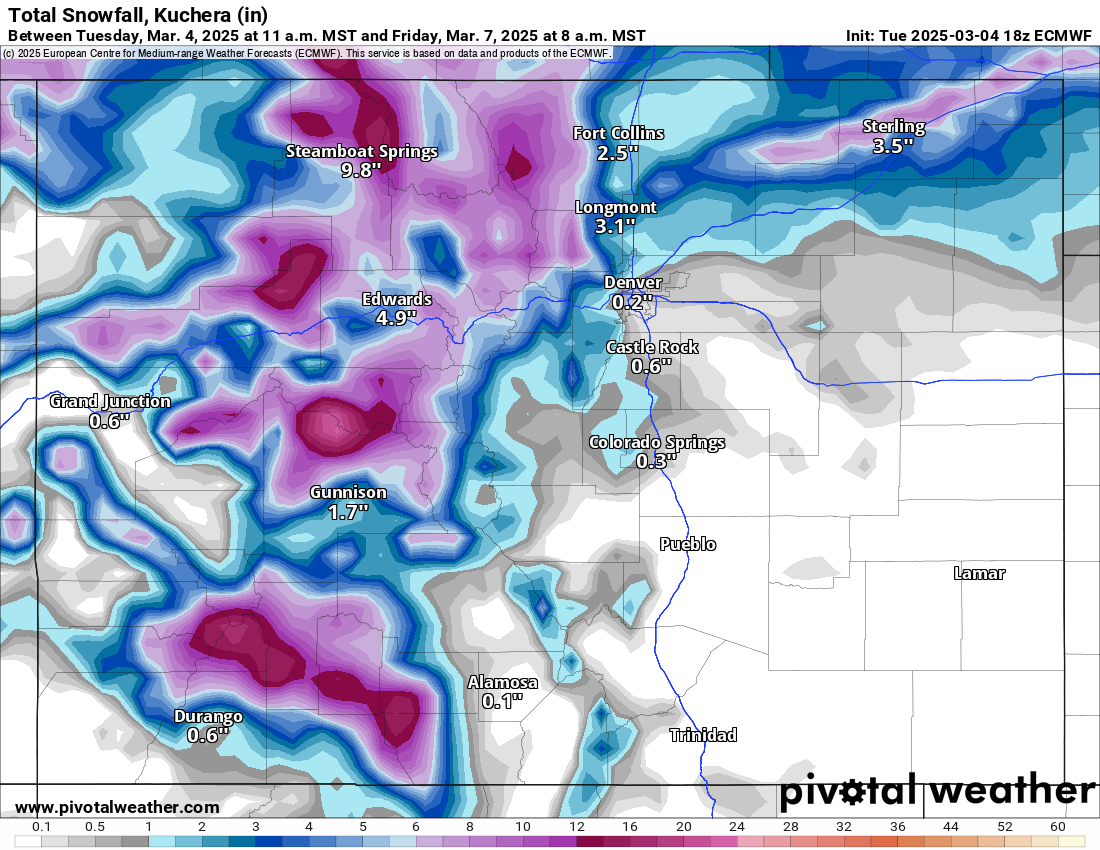
Powder days on Thursday and Friday, and a light powder day on Saturday are more than likely.
Saturday through Monday are going to be mostly dry and calm, however, temperatures will remain in the 20s on Saturday and Sunday and low 30s on Monday, ensuring most of the newly fallen snow won’t melt too much except perhaps on south facing slopes in the afternoon.
Storm 3 – From next Tuesday late morning through next Wednesday afternoon, snow develops via a weather disturbance crossing Montana into South Dakota, creating a line of showers coming into the state from the northwest.
This storm is a fast moving one, is forecast to deliver snow overall to the northern half of the state and be in and out in approximately 24 hours.
Current forecasts indicate additional snowfall totals in the northern mountains are between 3-7 inches, in the central mountains between 4-8 inches and in the southern mountains between 2-4 inches.
Long-term forecast:
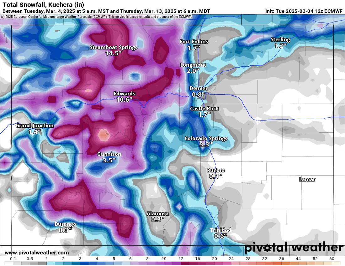
Storm 4 – From Thursday, March 13 night through Sunday, March 16 night, the last storm of the four brings two waves of snow to the state.
The first wave is from Thursday afternoon to Friday afternoon and the second wave is from Saturday morning to Sunday evening.

The highest snowfall totals favor the southern and central mountains with this last storm, with the southern mountains potentially receiving up to 2 feet, the central mountains between 10-18 inches, and the northern mountains between 8-11 inches.
More accurate details will become more clear as the dates draw closer, but this storm’s possibility continues to trend toward happening.
Today’s 24-hour snow totals for Colorado ski resorts:
Arapahoe Basin – 5″
Aspen Highlands – 5″
Aspen Mountain – 2″
Beaver Creek – 3″
Breckenridge – 7″
Buttermilk – 1″
Cooper – 8″
Copper Mountain – 7″
Crested Butte – 3″
Echo Mountain – 2″
Eldora Mountain – 3″
Granby Ranch – 3″
Hesperus – Closed for the season
Howelsen Hill – 1″
Kendall Mountain – 5″
Keystone – 4″
Loveland – 9″
Monarch – 3″
Powderhorn – 1″
Purgatory – 0″
Silverton – 7″
Snowmass – 1″
Steamboat – 3″
Sunlight – 0″
Telluride – 4″
Vail – 3″
Winter Park – 7″
Wolf Creek – 9″
Get OutThere
Signup today for free and be the first to get notified on new updates.
PREV
PREVIOUS

Lauren Boebert, GOP colleagues primed to grill Denver Mayor Mike Johnston on 'sanctuary' policies
When Denver Mayor Mike Johnston joins three other big city mayors Wednesday to testify before a House committee’s looking into “sanctuary” cities, U.S. Rep. Lauren Boebert and her three Republican colleagues from Colorado plan to put the Democrat on the hot seat. Boebert, a third-term lawmaker from Windsor and a member of the House Committee […]

Denver weather: Sunny skies return Wednesday ahead of end-of-week snow
Denverites will see a break in the action Wednesday as the sun returns and warms the city back into the 50s. Denver residents can expect sunny skies today, with a high near 54, according to the National Weather Service in Boulder. East southeast winds to blow between 3 to 8 mph. “Light snow in the […]