


Alt-rock: Why some jam to the less-traveled, extreme sides of Colorado 14ers

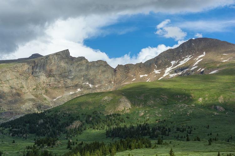
Colorado Fourteeners Initiative in recent years has rerouted a section of Black Cloud Trail on Mount Elbert — part of an alternate route the nonprofit’s executive director, Lloyd Athearn, recommends for those looking to get off standard trails in the fourteeners.
Courtesy of Colorado Fourteeners Initiative

In the 1990s, Andrew Hamilton was guiding river trips and in his spare time scaling Colorado’s highest peaks when he came by a book.
It was the first edition of “Colorado’s Fourteeners: From Hikes to Climbs,” by legendary mountaineer Gerry Roach. Like many others who had grown up in the state, Hamilton was familiar with trails to the summits — the hikes detailed in the book. He was far less familiar with the climbs.
The book “showed all these other routes you could do,” Hamilton recalls (250-plus across the 54 peaks). “For me, that just changed everything.”
Funding approved for controversial Mad Rabbit trails in Colorado
In later online forums — the likes of 14ers.com that digitally chronicles many of those routes Roach put on the page — Hamilton would become known as “the King of the Fourteeners.” The name would be for his record-setting dashes across the peaks.
And the feats were only possible with information he gathered from Roach’s book, those descriptions and maps inspiring summit linkups via different slopes and ridges that were more efficient — and also much more dangerous in the absence of a trail.


Andrew Hamilton dashes down a scree field high in Colorado’s mountains. He’s known as the “King of Fourteeners” for his records.
“Alternate” or “nonstandard” routes, as they are called. And “better,” Hamilton calls them.
As Roach explains in his book: “Most of the routes on Colorado’s fourteeners are walk-ups (Class 1, Class 2, easy snow) or scampers (Class 2+), but there are many wonderful scrambles (Class 3, moderate snow) and technical climbs (Class 4, Class 5, steep snow).”
The standard routes were “becoming crowded,” reads the third edition of “Colorado’s Fourteeners,” released in 2011. But “Colorado is still full of wilderness!”
Hence the draw to alternate routes — for a certain, niche crew.
“For more experienced people who are looking for a bigger challenge, and to use their brain a little more,” says Hamilton’s wife and climbing partner, Andrea Sansone.
Colorado Springs Utilities forwards plans for new reservoir
Yes, for the serious and experienced, it’s “a natural progression” in the history of alpinism, says Lloyd Athearn, executive director of Colorado Fourteeners Initiative (CFI).
“There’s always been a spirit to try new things, to test oneself and find more aesthetically pleasing and challenging lines,” he says.
However “a natural progression” for some, routes off trail and beyond fairly gentle talus fields are not for all, he stresses. CFI estimates 260,000 people ascend fourteeners every year. And “the vast majority should be on standard routes,” Athearn says.
That’s because the vast majority are not like Hamilton or the young man who broke his wintertime fourteener speed record back in 2023.


Chris Fisher negotiated harsh terrain and elements during his record push across Colorado fourteeners in winter.
More recently, Chris Fisher has been mixing it up in the Himalayas. When he’s back among Colorado’s fourteeners, he’s not drawn to the trails nearly as much as he’s drawn to sheer, rocky faces often requiring rope and steep, narrow spines always requiring skill and intense focus.
He’s well familiar with the Four Great Traverses, as they’re known by thrill seekers: perilous, exposed links between Little Bear and Blanca peaks; between South and North Maroon peaks; between Crestone Peak and Crestone Needle; and between El Diente Peak and Mount Wilson.
Those are not to be dared by the uninitiated, Fisher says. “I think the best way to work your way up is starting with something like Kelso Ridge and Sawtooth.”
Kelso resembles a dragonback between Grays and Torreys peaks, while Sawtooth is the jagged traverse between mounts Bierstadt and Blue Sky. Fisher points to another route commonly sought by Front Range explorers broadening their horizons: the West Ridge route of Quandary Peak, involving careful rock climbs along unforgiving drop-offs.
“A beautiful route,” Athearn agrees, “but I can’t tell you how many folks Summit County Search and Rescue has pulled off that route.”
Accidents and tragedies appear increasingly common on Kelso and Sawtooth as well from Alex Derr’s view. He tracks such episodes and aims to increase outdoor education through his blog, The Next Summit.
‘Best office in the world’: Busy summer of trail work on Colorado 14ers
Derr sees an alarming trend — “people getting ahead of themselves and chasing some cool shot for Instagram” — and also a somewhat understandable trend.
“After you’ve done like 15 or 20 (standard routes), I feel like, especially among my friends, they start saying, ‘Hey, what if we did the Angel of Shavano up Shavano instead of the standard, slog hike? Or what about Little Browns Creek?’”
That’s one he recommends: the Little Browns Creek route up Mount Antero, away from the Jeep road. “It’s simply the best way to hike Mount Antero, either as a single-day trip or an overnight venture,” he once wrote on his blog, detailing the 14-mile round trip with some Class 2 scrambling.


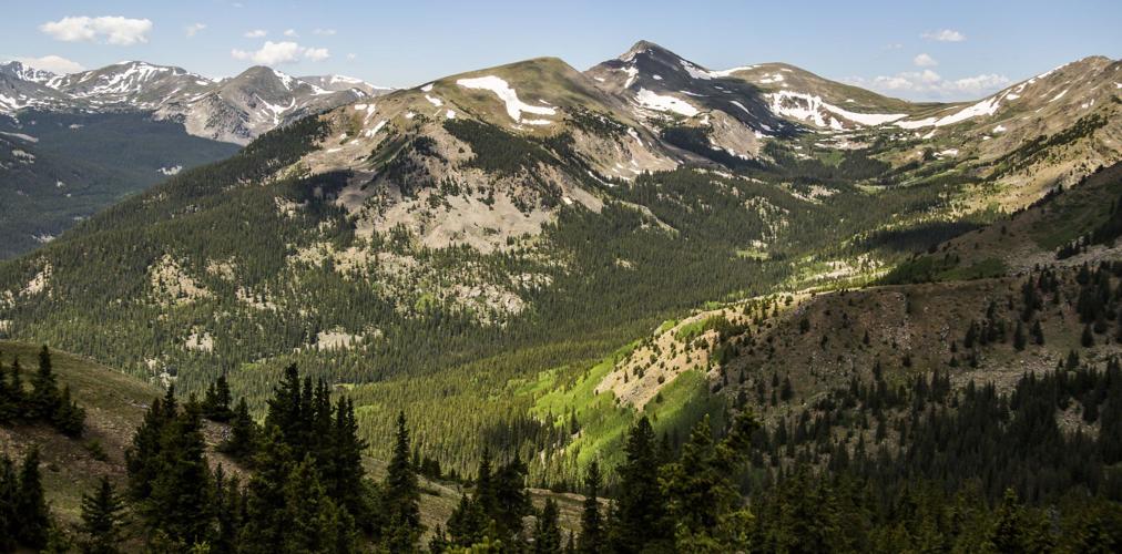
At 14,433 feet, Mount Elbert outside Leadville is the highest peak in Colorado. It’s also one of the easier fourteeners for those who aren’t experienced.
It’s one nonstandard fourteener route that does not fall into the overly technical category. Athearn points to a Class 1 alternative on the state’s highest mountain: the East Ridge route of Mount Elbert, with slightly more mileage, different views and far fewer people than the standard Northeast Ridge route.
“A little longer, but the additional effort is a small price to pay for solitude,” Roach writes similarly of Mount Yale’s East Ridge, an alternate to the standard, also Class 2 Southwest Slopes route. Roach’s book classifies the East Ridge as a “classic,” along with another often-preferred nonstandard route in the San Juan Mountains: the Southwest Ridge of Mount Sneffels.
On 14ers.com, the warnings are clear for those routes on Yale and Sneffels: exposure, rockfall potential, route finding and commitment are all listed as “considerable.”
That could describe the risks of any fourteener route, but especially most alternate routes, Derr says. If a personal locator beacon isn’t carried on a standard route, it should be for these routes off trail, he says, no matter how prepared and well-studied one is.
There’s a simple explanation for these more complicated ventures, he says: “High risks, high rewards.”
Risk and reward is a personal calculus, Hamilton recognizes. He only knows his own parameters, which were explained by a book he read not long ago.
“It was called ‘The Comfort Crisis,’” he says. “About how we’ve become way too comfortable as people, and our bodies thrive when we’re challenged. … But you can’t die. That’s the one rule.”
Fast-rising Colorado mountain runner sets records across Himalayas
Colorado hot springs celebrates ‘first-of-its-kind’ expansion
Seth Boster
seth-boster@denvergazette.com
Updated 6 hours ago
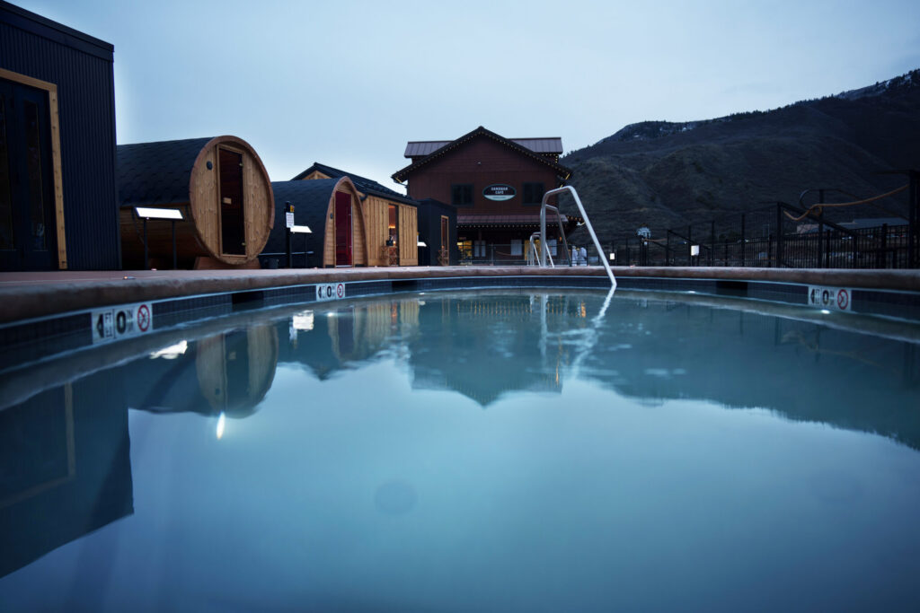
A hot springs destination in Colorado has marked a “major” expansion. And it’s not exactly the expansion you’d expect at a soaking retreat. In Glenwood Springs, Iron Mountain Hot Springs is calling its newly opened Sauna Summit “the country’s most...
Seth Boster
Reporter
Double-digit snowfall totals likely on some Colorado peaks before weekend hits
Spencer McKee
spencer@outtherecolorado.com
Updated 10 hours ago
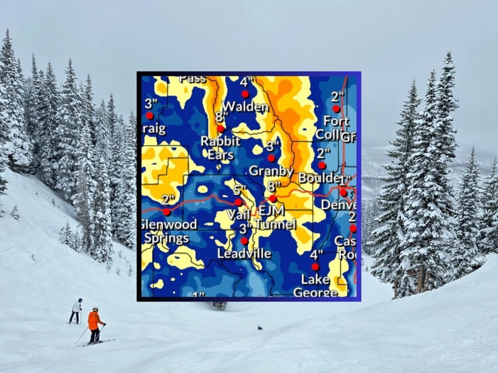
Weekend warriors, rejoice! It’s looking like many Colorado ski areas could get a nice refresh by the time the weekend hits. Mapping from the National Weather Service shows that in the most likely scenario, a winter storm will bring about...
Spencer McKee
Reporter
It’s time to apply for big game hunting licenses in Colorado
Seth Boster
seth.boster@gazette.com
Updated 1 day ago
Colorado Parks and Wildlife’s new big game brochure has been hitting hunters’ mailboxes ー the annual reminder to start planning for the seasons ahead. CPW also reminded in a recent social media post: “Whether you’re after a long-awaited lifetime tag...
Seth Boster
Reporter
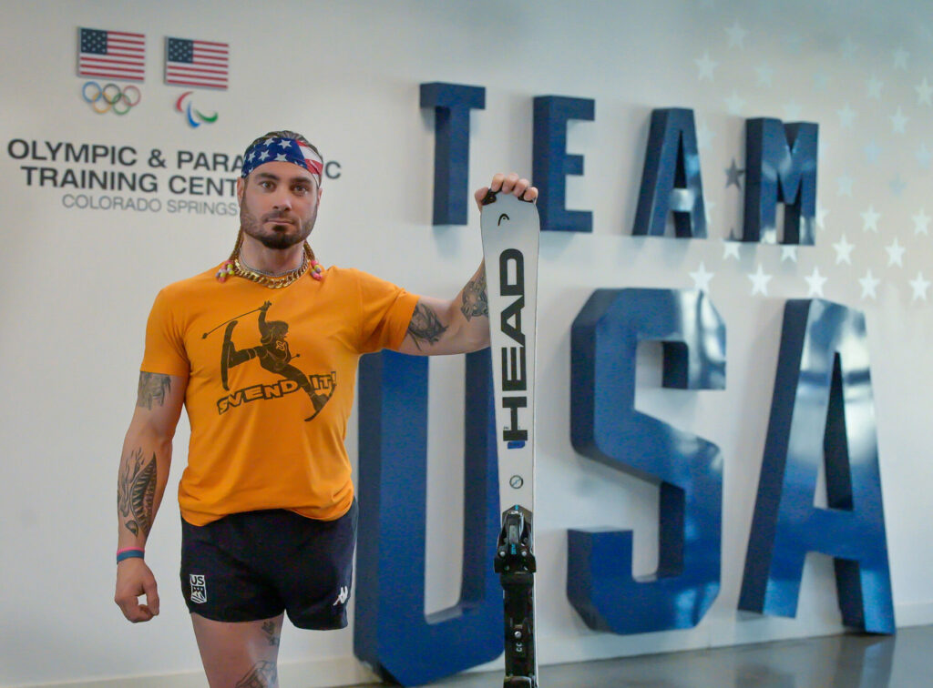
U.S. Paralympic skier Patrick Halgren exemplifies happiness, gratitude into second Paralympic Games
Marissa Kraus
marissa.kraus@gazette.com
Updated 2 days ago
Patrick Halgren can’t get enough of the cheeseburgers at the U.S. Olympic & Paralympic Center. Free housing, a world-class training facility, and all the food at his disposal, Halgren’s life is “eerily good.” It’s a life the Paralympian never imagined...
Marissa Kraus
Reporter
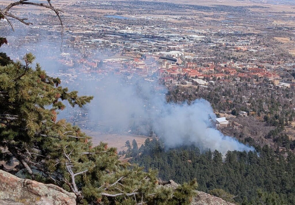
Wildfire near Chautauqua Park is 100% contained, Boulder Fire says
Bernadette Berdychowski
bernadette.berdychowski@denvergazette.com
Updated 3 days ago
The Bluebell fire near Chautauqua Park in southwest Boulder is 100% contained, Boulder Fire announced on X in a post late Saturday afternoon. “There are no active flames and crews are in mop up,” Boulder Fire said. The response team...
Bernadette Berdychowski
Reporter
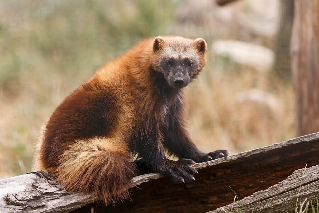
‘Larger than life’ and ‘logistically challenging:’ Getting to know wolverines and Colorado’s restoration plan
Seth Boster
seth-boster@denvergazette.com
Updated 3 days ago
Last month inside a Denver conference room, as the Colorado Parks and Wildlife Commission moved to the next agenda item, a whisper could be heard. “I’m excited for this one.” Bob Inman stepped to a microphone. “Colorado has many remarkable...
Seth Boster
Reporter

Lindsey Vonn gets encouragement from soccer legend Cristiano Ronaldo as she recovers from injury
Daniel Boniface
dan.boniface@denvergazette.com
Updated 5 days ago
One of soccer’s all-time legends this week sent words of encouragement to Colorado skier Lindsey Vonn as she recovers from a gruesome injury sustained at the Winter Olympics in Cortina. Cristiano Ronaldo shared the positive words in a comment on...
Daniel Boniface
Reporter
Red Flag Warning issued for Denver, I-25 corridor, plains on Wednesday
Daniel Boniface
dan.boniface@denvergazette.com
Updated 6 days ago
Another day of critical fire danger is on tap in Denver, the Interstate 25 corridor and the Eastern Plains on Wednesday, meteorologists said. The National Weather Service in Boulder issued a Red Flag Warning from 10 a.m. to 6 p.m....
Daniel Boniface
Reporter
With new book, Colorado climber turns the page on horrific chapter
Seth Boster
seth-boster@denvergazette.com
Updated 1 week ago
In her hospital bed on the morning of May 8, 2017, Melissa Strong asked her husband, Adam, for a pen. She could barely grip it; her fingers hardly resembled fingers, more like dark and swollen nubs after tense, reconstructive surgeries...
Seth Boster
Reporter
Rocky Mountain National Park to continue reservation system while other parks won’t
Seth Boster
seth-boster@denvergazette.com
Updated 2 weeks ago
While some of America’s most popular national parks are dropping reservations this summer, they will still be required at the most popular one in Colorado. Rocky Mountain National Park has announced its timed-entry reservation system for the peak season from...
Seth Boster
Reporter
PREV
PREVIOUS

Funding approved for controversial Mad Rabbit trails in Colorado
Funding has been approved for a major, controversial project expanding trails in northwest Colorado. Off Rabbit Ears Pass near Steamboat Springs, the Mad Rabbit project has been called “the most contentious trails project in the state, maybe in history” by one city councilor. After more than a decade of debate that underscored the broader tug-and-pull […]
Douglas County cans idea to allow 'minimalist camping' at Sandstone Ranch
Following stakeholder backlash over wildfire concerns, Douglas County commissioners dropped an idea to allow “minimalist camping” at Sandstone Ranch in Larkspur. Commissioners, however, have expressed interest in allowing camping elsewhere in a county that is 51% open space. “Following community feedback and further fire risk analysis, (commissioners) decided not to pursue camping at Sandstone Ranch […]