


8-14″ of snow for Colorado possible as latest forecast shows promise to end dry November
Light snow in the northern Colorado mountains is forecast heading into the second weekend of November, starting a shift to more stormy weather for the second half of the month.
But first a dry spell will take hold for about five days from this weekend into next late week before a larger storm system is forecast from Thursday to Sunday, Nov. 16.
Plus additional snow is possible Monday, Nov. 17 through Tuesday, Nov. 18 in the high country, and the Front Range urban corridor should finally see its first snow, including metro Denver, around late Wednesday, Nov. 19.
Recap:
On Tuesday and Wednesday, Colorado’s high country recorded above-average temperatures again, continuing a warm spell that has lasted over a week.
Aspen Mountain recorded a high of 51 degrees on Tuesday and 50 degrees on Wednesday. Copper Mountain recorded a high of 50 degrees on Tuesday and 54 degrees on Wednesday.
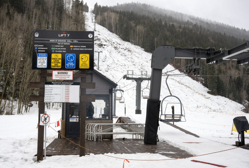
Snowmaking efforts at night have continued at ski areas and resorts that have the ability, however coverage on non-snowmaking slopes still looks rather bare.
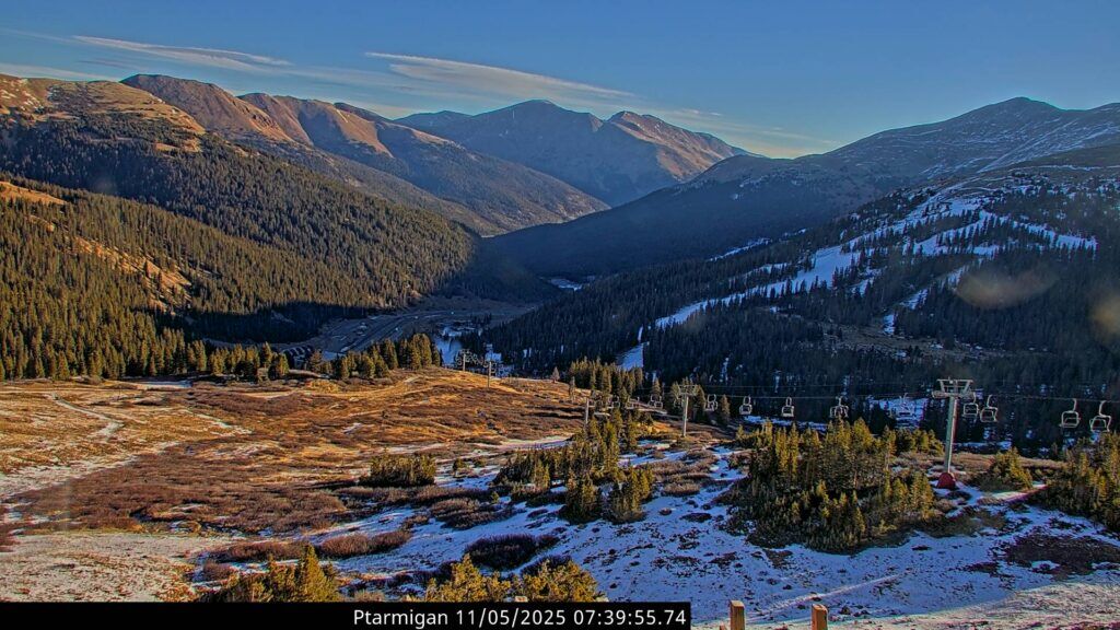
South facing slopes have little to no snow and north facing slopes have snow more or less only in shaded areas, as evident from Loveland Ski Area’s Ptarmigan web camera.
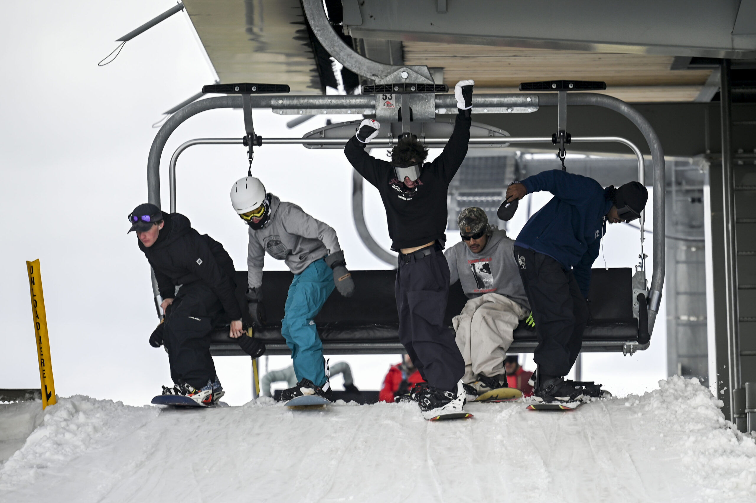
Loveland opens for the season on Saturday at 8:30 a.m., offering top-to-bottom turns on Catwalk, Mambo and Home Run, giving 1,000 vertical feet and 1.5 miles of terrain, plus a small terrain park will also be open, the resort announced on social media Wednesday afternoon.
Forecast:
Light snow will begin falling early Thursday morning in the northern mountains and will continue through Thursday evening.
Snowfall totals range between a trace-2 inches, mostly in the northern Front Range around Estes Park and Grand Lake, with Steamboat and Winter Park seeing light accumulations as well.
A break in the action on Friday is forecast ahead of a second round of snow coming in Friday night through Saturday morning.
Additional snow accumulations of 1-2 inches is possible for the northern mountains, including down to Interstate 70.
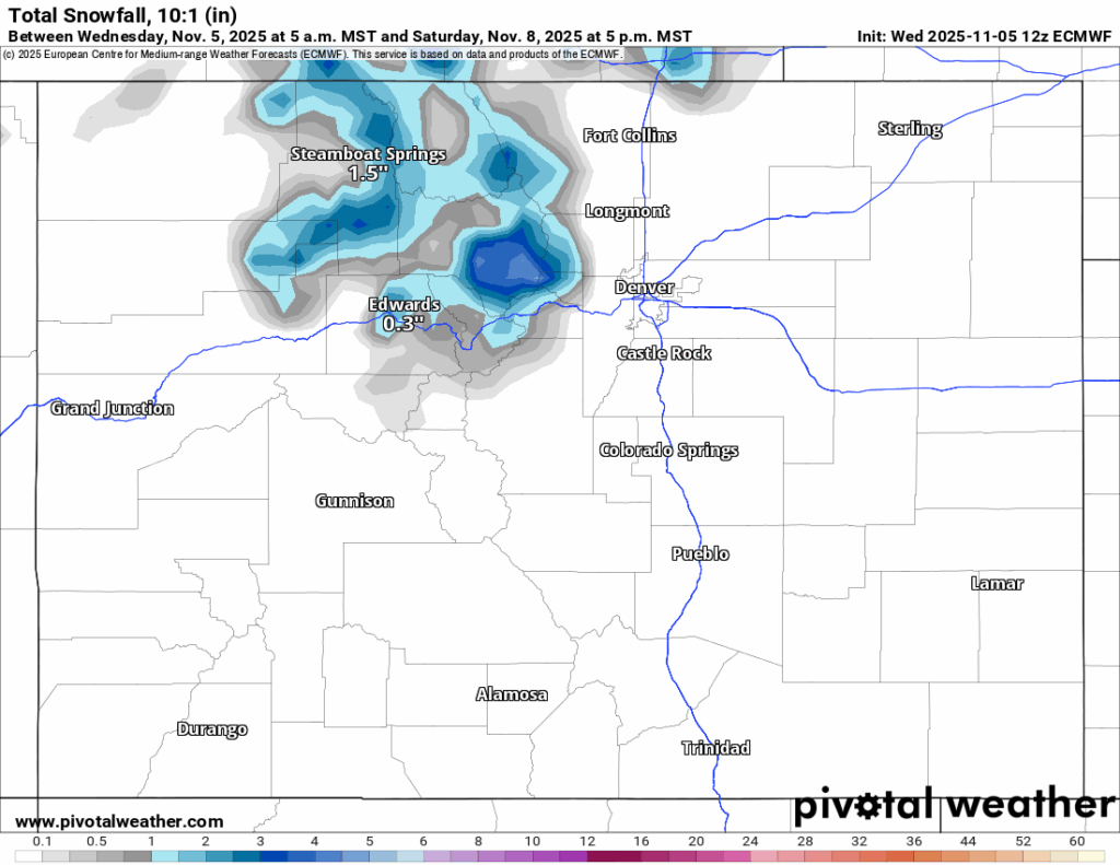
The central and southern mountains look to receive no snow from both of these waves of energy as the storm system passes too far north of Colorado to bring anything that far south.
Saturday and Sunday see a return to dry and warmer conditions across the high country.
Long-term forecast:
From Monday to early Thursday morning, Nov. 13 continued dry and sunny conditions will persist although daily temperatures will be lower, giving some help for the ski areas to make snow for longer durations on any given day.
Early Thursday, Nov. 13 morning, a larger system enters the state from the southwest and will finally deliver much needed snow to all three mountain zones through Sunday, Nov. 16 morning.
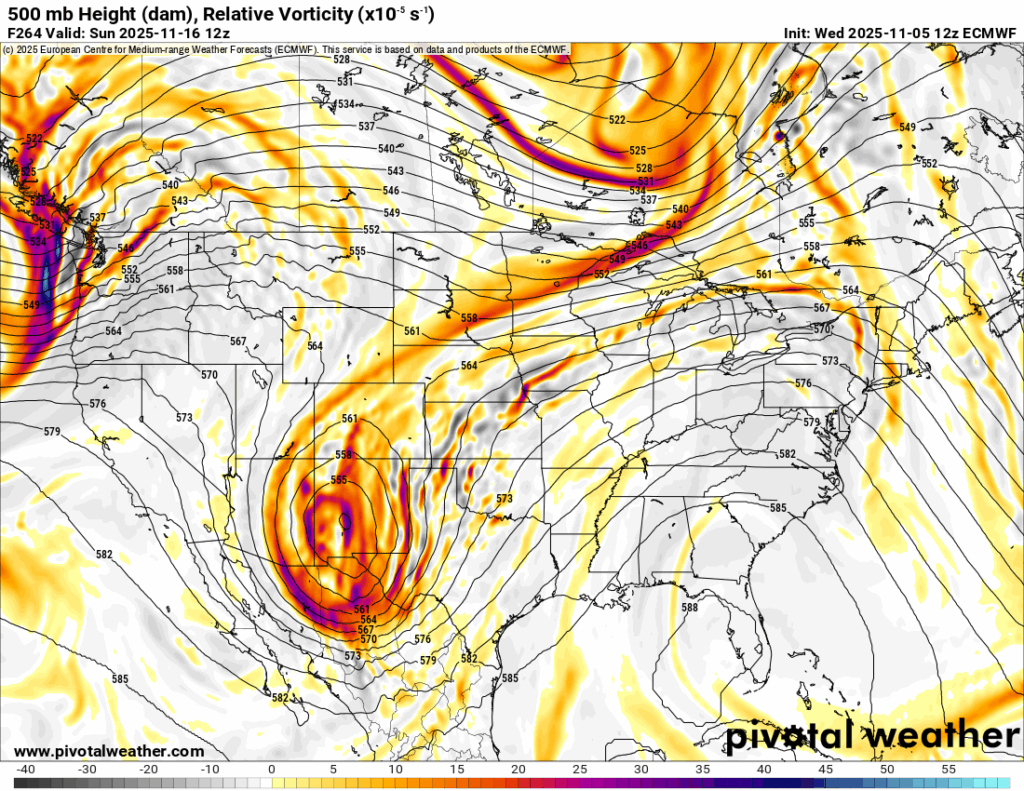
The storm has a west-to-east trajectory across Arizona and New Mexico but will pump moisture into Colorado from the west southwest, southwest and then southeast.
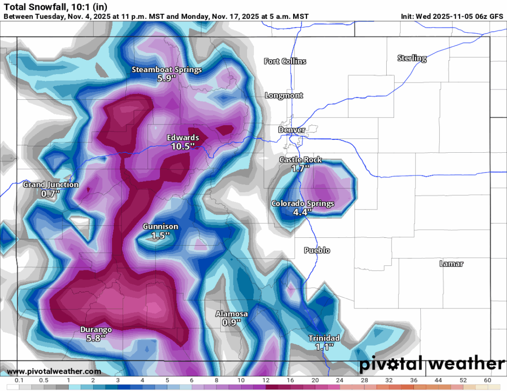
Multiple models are aligning well with where the snow will fall, how much potentially and the duration from this storm.
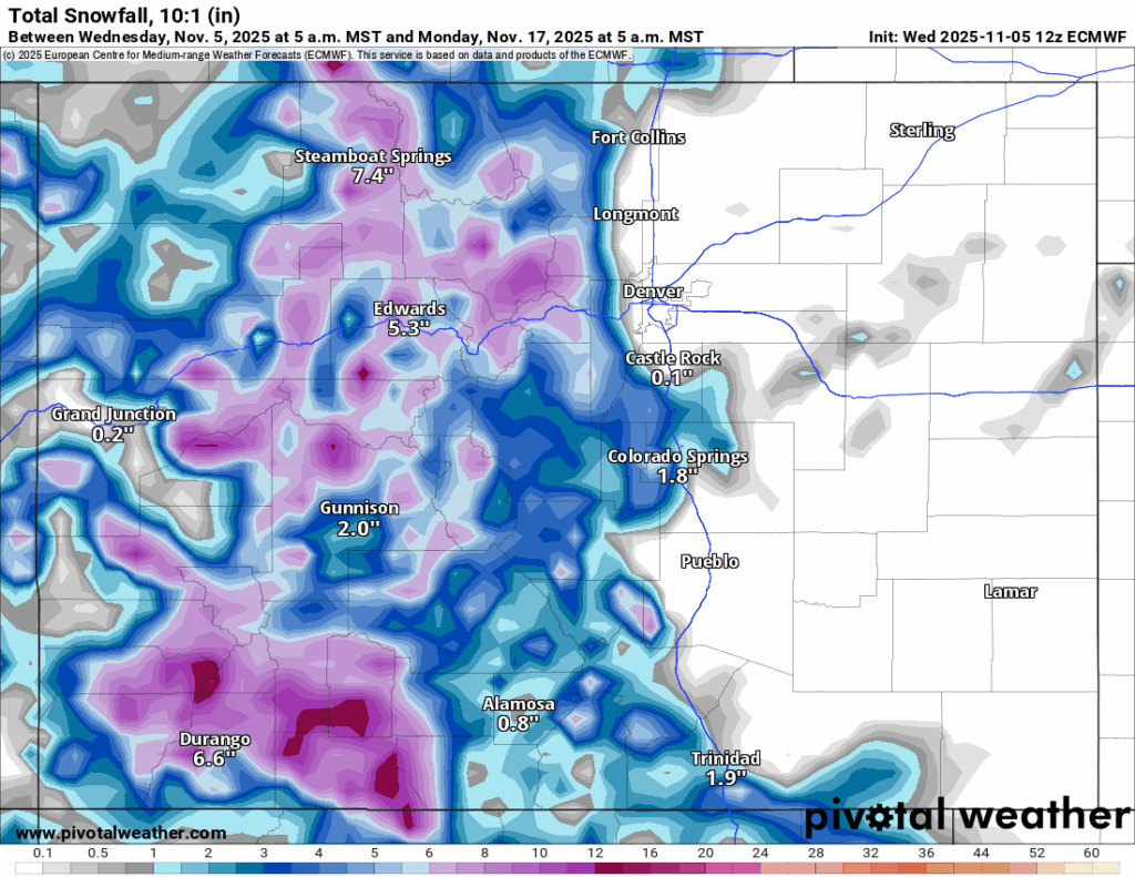
Forecasted totals in the northern mountains range between 4-8 inches, in the central mountains between 6-12 inches and in the southern mountains between 8-14 inches.
ECMWF:
GFS:
Snow is forecast to ramp up again overnight Monday, Nov. 17 through Tuesday, Nov. 18, this time from northwest to southeast (benefitting the northern mountains most).
From Tuesday, Nov. 18 through Wednesday, Nov. 19, more snow is possible, including the potential first snow for metro Denver late Wednesday, Nov. 19.
Colorado ski resorts’ planned opening dates and 24-hour totals:
Arapahoe Basin – 0″
Aspen Highlands – Dec. 13
Aspen Mountain – Nov. 27
Beaver Creek – Nov. 26
Breckenridge – Nov. 7
Buttermilk – Dec. 13
Cooper – Dec. 10
Copper Mountain – Nov. 7
Crested Butte – Nov. 26
Echo Mountain – TBD
Eldora Mountain – Nov. 14
Granby Ranch – Nov. 26
Hesperus – Closed for the season
Howelsen Hill – Nov. 29
Kendall Mountain – December
Keystone – 0″
Loveland – Open as soon as conditions allow
Monarch – Nov. 21
Powderhorn – Nov. 22
Purgatory – Nov. 22
Silverton – Private mountain after Dec. 1, Guided and Heli season Dec. 27
Snowmass – Nov. 27
Steamboat – Nov. 22
Sunlight – Dec. 12
Telluride – Nov. 27
Vail – Nov. 14
Winter Park – 0″
Wolf Creek – Open as soon as conditions allow
Broncos fans don’t blame Stidham, optimistic for future
Sage Kelley
sage.kelley@denvergazette.com
Updated 11 minutes ago
Falling snow acted as an excuse for the tears of Broncos fans. Fans sporting snow-covered jerseys trudged away from Empower Field at Mile High or local haunts Sunday afternoon after the Broncos fell short (or left) to the New England...
Sage Kelley
Reporter

Colorado Democrats react to Alex Pretti’s death in Minnesota
Wire Services
wire-services@denvergazette.com
Updated 2 hours ago
Colorado’s Democrats called for an “impartial” investigation into the death of a man shot by a federal agent during an immigration operation on Saturday. Meanwhile, the chief of the Border Patrol defended the shooting, saying Alex Pretti inserted himself in...
Wire Services
Reporter

Edgewater police shoot suspect in Wheat Ridge
Sage Kelley
sage.kelley@denvergazette.com
Updated 4 hours ago
A man is in critical condition following an officer-involved shooting in Wheat Ridge on Saturday morning. An Edgewater Police Department officer was patrolling in the area of West 24th Avenue and Pierce Street around 10:30 a.m. when they saw a...
Sage Kelley
Reporter
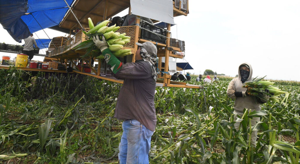
How healthy is the Western Slope’s agricultural industry? New report lays it out
RACHAEL WRIGHT Special to The Gazette
rachael-wright-special-to-the-gazette@denvergazette.com
Updated 1 day ago
On Jan. 19, Colorado Mesa University and the Business Incubator Center unveiled the results of their groundbreaking study — Western Slope Agriculture Report — to a packed conference room of ranchers, farmers and community leaders. “This study places us on...
Telluride Mountain Village mayor and mayor pro-tem resign after launch of private investigation
Rachael Wright
rachael.wright@coloradopolitics.com
Updated 1 day ago
By Rachael Wright Special to the Gazette Telluride Mountain Village Mayor Marti Prohaska resigned her position recently after the Mountain Village Town Council announced it would conduct an independent investigation into unofficial conversations she had with Telluride Ski Resort (Telski) owner...
Rachael Wright
Reporter
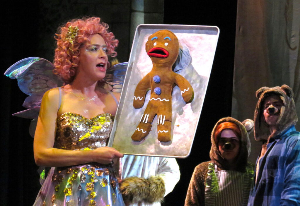
‘Shrek’ Freak flags will continue to fly in Parker despite audience complaints
John Moore
john.moore@denvergazette.com
Updated 6 hours ago
High school drops sponsorship but Pride flags remain in homegrown staging of popular musical Let your freak flag fly … just not your Pride flags. That was the message for the cast of a local stage production of “Shrek the...
John Moore
Reporter
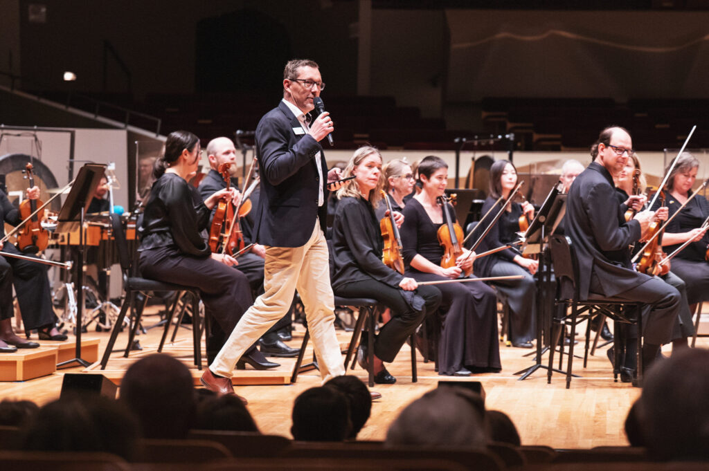
Super! Colorado Symphony is about to turn New York City into classic country
John Moore
john.moore@denvergazette.com
Updated 1 day ago
Historic tour will feature Gregory Alan Isakov at Radio City Music Hall and virtuoso violinist Itzhak Perlman at Carnegie Hall Daniel Wachter was born in Germany, but he knows exactly how to talk to his fellow Coloradans. “For the Colorado...
John Moore
Reporter
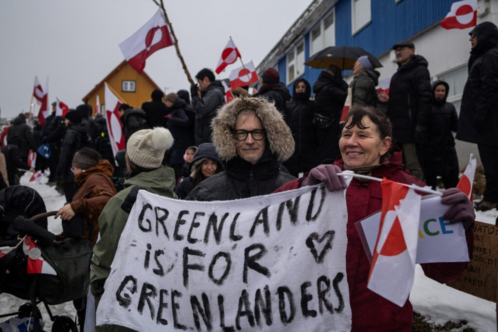
Greenland is now Colorado’s problem. And that’s a good thing. | Vince Bzdek
Vince Bzdek
vince-bzdek@denvergazette.com
Updated 1 day ago
The conclusion to the dizzying odyssey over Greenland this week reminded me a little of the ending of the “Wizard of Oz.” If you recall, Dorothy, the Scarecrow, the Lion and the Tin Man finish a great and frightful quest...
Vince Bzdek
Reporter
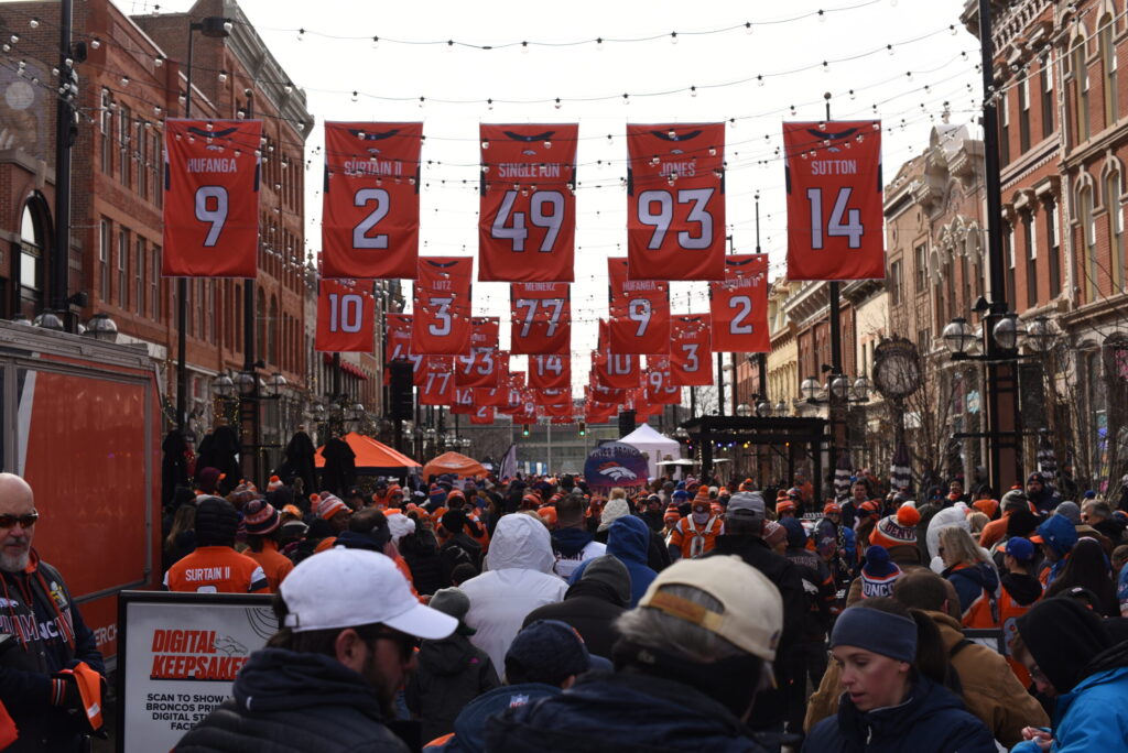
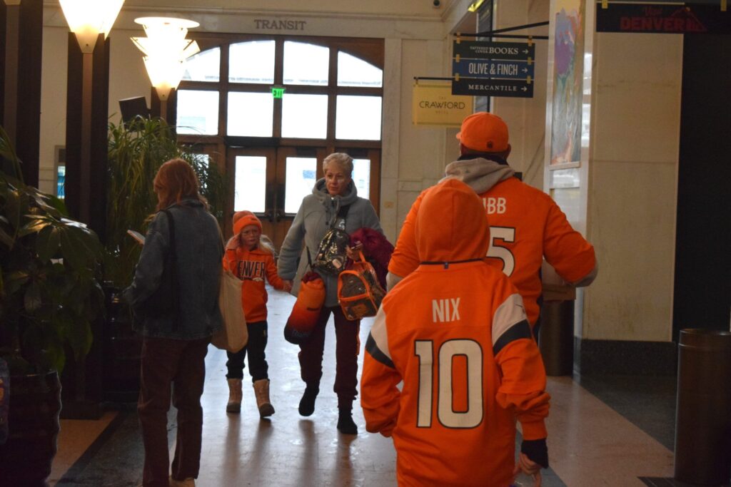
Broncos fans excited for Patriots matchup at chilly Larimer Square rally
Michael Braithwaite
michael.braithwaite@gazette.com
Updated 7 hours ago
As the Denver Broncos prepare for Sunday’s AFC Championship game, hundreds of orange-clad fans filled Larimer Square to support the hometown team. Featuring a DJ, a simulated tunnel and Denver’s three Lombardi trophies on display, Saturday’s fan rally drew an...
Michael Braithwaite
Reporter
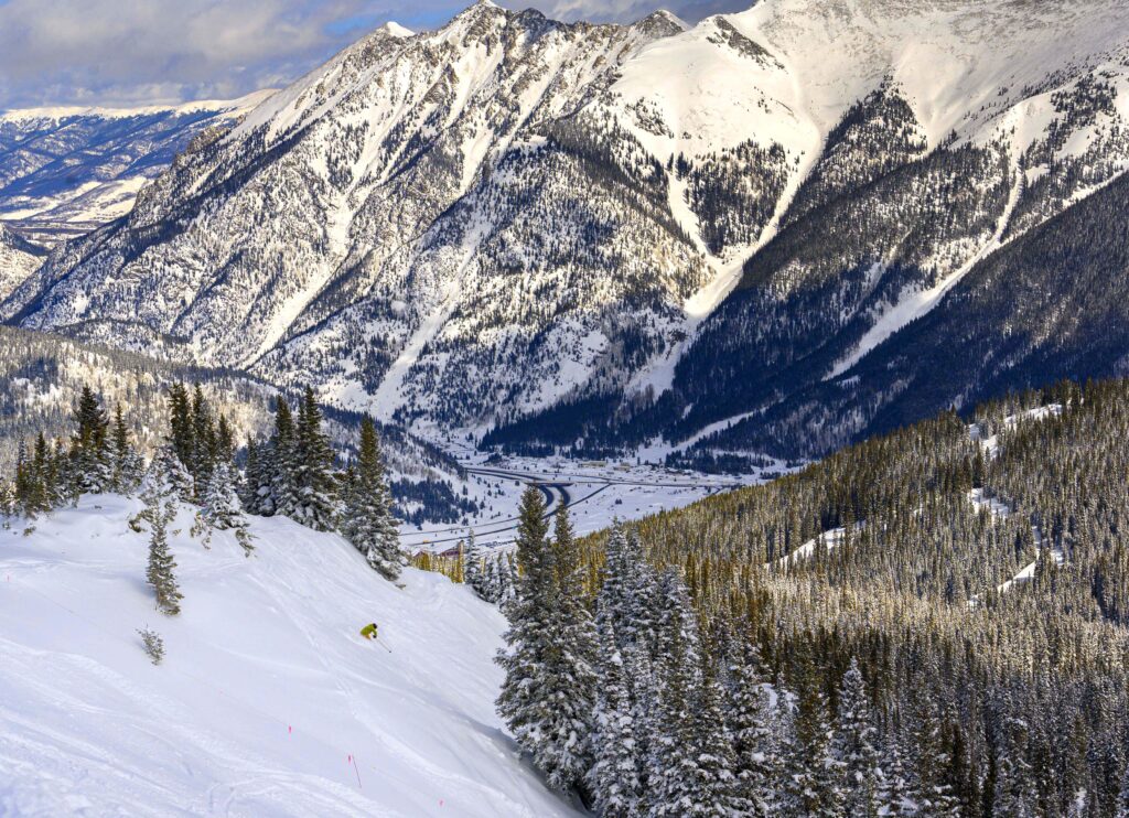
Copper Mountain out-of-state skier dies after crash into tree Saturday
Michael Braithwaite
michael.braithwaite@gazette.com
Updated 7 hours ago
An out-of-state skier at Copper Mountain died Saturday after he lost control and crashed into a tree, the Summit County Sheriff’s Office said. The man, who was wearing a helmet, lost control while on American Flyer, an intermediate-level trail, and...
Michael Braithwaite
Reporter
PREV
PREVIOUS

10th Circuit upholds financial incentive for lawyers to take on challenges to immigration detention
The Denver-based federal appeals court ruled on Monday that the law allowing attorneys to recover their costs for prevailing against the government does apply to successful legal challenges to immigration detention. A three-judge panel of the U.S. Court of Appeals for the 10th Circuit acknowledged a decision to the contrary would deter legal representation for […]

Douglas County school board members ran on progressive values
The winners of Tuesday’s election of Douglas County School District board members campaigned on progressive values. Douglas County voters chose Clark Callahan, Kelly Denzler, Kyrzia Parker and Tony Ryan to make up four of the seven-member board. All four candidates were endorsed by the county’s Democratic Party. Their Republican opponents mostly ran on partisan issues. […]