


Heavy snow could occur in Colorado over upcoming days as snowpack sits at 21% of norm
After a dry stretch in Colorado to start the snow season, it’s looking like a turnaround is on its way.
According to forecasting from the National Weather Service and NOAA, a chance of snow in Colorado ramps up once Friday, November 14 hits, with a multi-day stretch of potential snow continuing through at least November 19. At this time, it’s looking like most of that snowfall, if it does occur, will be limited to the western half of the state, favoring areas of high elevation.
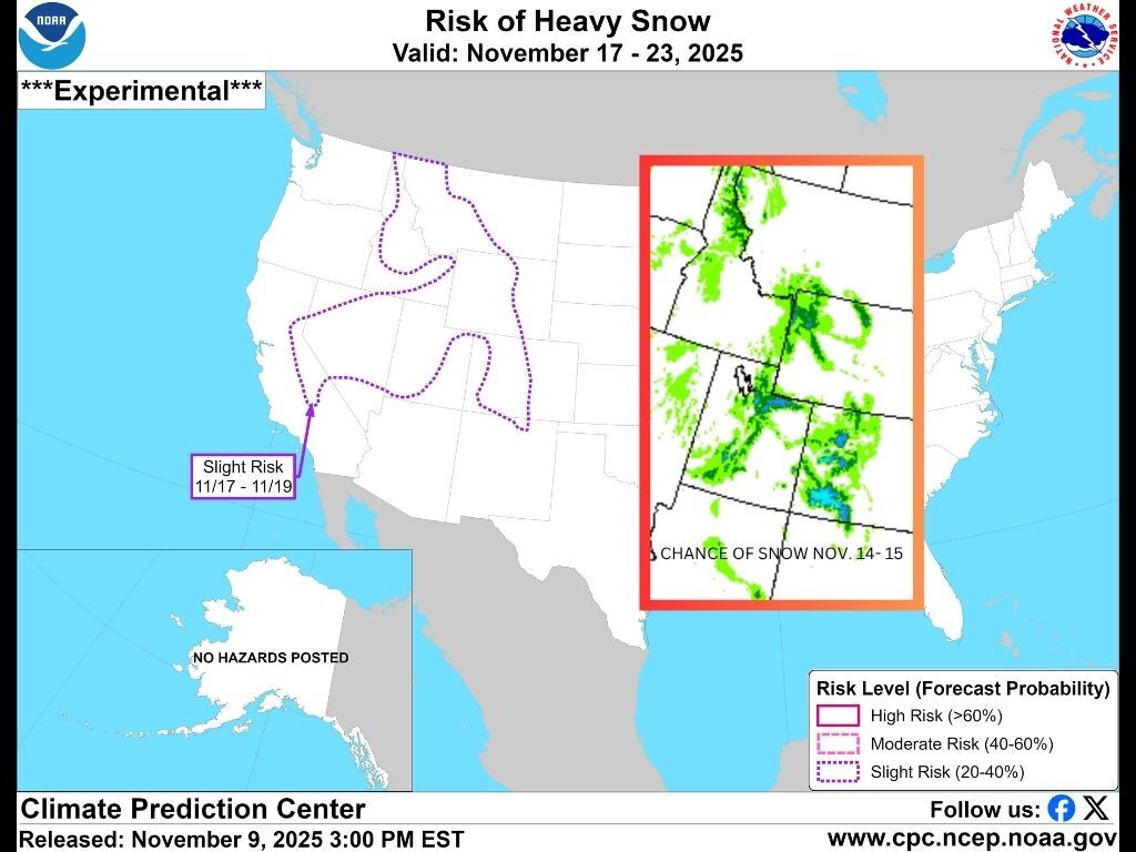
This first round of snow is depicted in a forecast map produced by the NOAA, showing that there’s a high chance of at least 0.25 liquid equivalent inches of snow or sleet from November 14 through November 15. Right now, mapping shows that the chance of this moisture is the highest in southwest Colorado (in the 50 to 90% chance range, as seen in the shades of blue on the map above).
Meanwhile, a large swath of Colorado is also included in the impacted range on the experimental ‘risk of heavy snow’ map produced by the Climate Prediction Center. This risk includes much of the Rocky Mountain region of the American West and is said to stretch from November 17 through November 19.
It’s worth noting that this snow would still be several days out, so it’s not quite certain at this time. As the end of the week nears, more detail related to expected totals should be available. At this time, Denver Gazette’s Jonathan Ingraham puts totals in the range of six to 12 inches through the end of the weekend.
The state’s winter slopesport enthusiasts are sure to welcome the snow, with snowpack currently at about 21 percent of what’s normal for the date.
Find additional information about this forecast on the National Weather Service website.
Get OutThere
Signup today for free and be the first to get notified on new updates.
PREV
PREVIOUS

Trump administration renews Supreme Court appeal to keep full SNAP payments frozen
President Donald Trump’s administration returned to the Supreme Court on Monday in a push to keep full payments in the SNAP federal food aid program frozen. The request is the latest in a flurry of legal activity over how a program that helps buy groceries for 42 million Americans should proceed during the U.S. government […]

Police search for suspect in string of DIA suitcase thefts spanning several months
The Denver Police Department is asking for public assistance in identifying a suspect in an ongoing case related to suitcase theft at Denver International Airport. According to a report from law enforcement on the matter, the pictured individual is suspected of stealing several suitcases from travelers between June 2025 and October 2025. The alleged crime […]