


Denver weather: Second breezy day Thursday, fire watch warning, record heat possible Friday

After dangerous winds whipped to 109 mph south of Boulder on Wednesday, Thursday’s weather around metro Denver and within the city will be similar, minus the intense wind gusts but also much cooler.
Denverites can expect sunny skies today, with a high near 47, according to the National Weather Service in Boulder. Breezy conditions again, with a northwest wind between 7 to 16 mph, becoming southeast in the afternoon. Winds could gust as high as 29 mph.
Tonight it’ll be partly cloudy, with a low around 36. South southwest winds between 9 to 13 mph are possible, with gusts as high as 21 mph.
A fire weather watch is in effect starting at 10 a.m., Friday until midnight for the areas that were under the high wind watch on Wednesday. The potential for a new record high temperature on Friday is possible too. The record high for Dec. 19 is 68 degrees, last recorded in 1986. Temperatures on Friday could reach into the low 70s.
After a cooler weekend with forecasted high temperatures in the upper 50s and even some rain on Saturday, unseasonable warmth returns to start Christmas week as temperatures slide back into the 60s to start the week.
Will we have a white Christmas?
Here’s the 4-day forecast from the National Weather Service.
Friday: Partly sunny, with a high near 71. Breezy, with a south southwest wind 15 to 18 mph, with gusts as high as 30 mph.
Saturday: A 20% chance of showers before 11 a.m. Mostly sunny, with a high near 58. West wind 7 to 9 mph becoming north northeast in the afternoon. Winds could gust as high as 21 mph.
Sunday: Mostly sunny, with a high near 59.
Monday: Sunny, with a high near 68.

Walmart embraces 3D concrete printing, Greeley contractor, for construction of new stories
Hap Fry, Special to The Gazette
hap-fry@gazette.com
Updated 11 hours ago
GREELEY – One might say that Zachary Mannheimer is a bit of a riverboat gambler — a calculated one, though. As founder and chairman of Greeley-based Alquist 3D, Mannheimer didn’t follow the most conventional path into the world of 3D...
Hap Fry, Special to The Gazette
Reporter

A sense of ‘sadness and loss’ in Colorado Springs with Catholic bishop moving north
Debbie Kelley
debbie-kelley@denvergazette.com
Updated 14 hours ago
Last Saturday’s announcement that Pope Leo XIV had promoted Diocese of Colorado Springs Bishop James Golka to fill the seat of archbishop of Denver was unexpected news for many Catholics. “His appointment came as a surprise to me and carried...
Debbie Kelley
Reporter
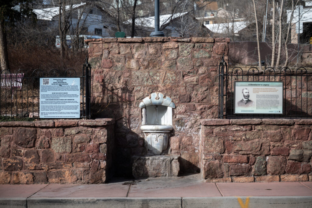
Supermarket chain H Mart hopes to revive mineral water bottling in Manitou Springs
Savannah Eller
savannah-eller@denvergazette.com
Updated 13 hours ago
A major U.S. grocer has acquired the vestiges of a historic industry in Manitou Springs with the hope of bringing it back to life. H Mart, an Asian supermarket chain based in New Jersey with nearly a hundred locations across...
Savannah Eller
Reporter

Colorado Supreme Court accepts cases about reliability of gun-to-bullet matching
Michael Karlik
michael-karlik@denvergazette.com
Updated 14 hours ago
The Colorado Supreme Court announced on Monday that it will hear two cases questioning the reliability of expert testimony that purports to identify whether a specific bullet was fired from a specific gun. At least three of the court’s seven...
Michael Karlik
Reporter
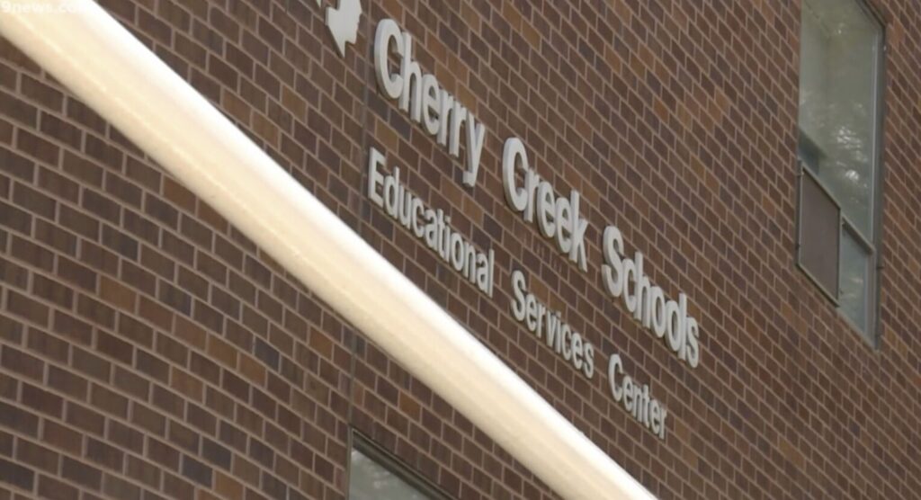
Cherry Creek orders outside audit, tightens contract oversight amid leadership shakeup
Nicole C. Brambila nico.brambila@denvergazette.com
nico.brambila@denvergazette.com
Updated 14 hours ago
Amid heightened public scrutiny following recent leadership upheaval, the Cherry Creek School District will launch an independent audit of its internal controls and impose stricter contract approval rules, lowering the dollar threshold for board oversight and requiring additional executive and...

Denver City Council to consider $24M Motorola contract for emergency services
Deborah Grigsby
deborah.smith@denvergazette.com
Updated 13 hours ago
It may be a short work week, but the Denver City Council will still have a robust agenda on Tuesday after Presidents’ Day. For those following Council Bill 26-0125, the Safety and Transparency in Public Authority Act, which proposes to...
Deborah Grigsby
Reporter
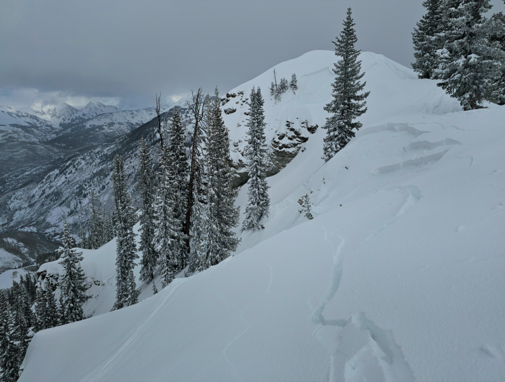
Holiday weekend to bring dangerous avalanche conditions, officials warn
Kyla Pearce
kyla-pearce@denvergazette.com
Updated 14 hours ago
Colorado avalanche officials warn of a dangerous Presidents’ Day weekend in the backcountry, aligning with historic trends in the state. The long weekend is expected to bring the highest levels of avalanche danger Colorado has seen so far in February,...
Kyla Pearce
Reporter

Aurora emergency responders adopt telehealth service for non-emergency medical calls
Kyla Pearce
kyla-pearce@denvergazette.com
Updated 14 hours ago
Aurora Fire Rescue recently adopted a new response program that integrates telehealth into 911 dispatch, connecting non-emergency medical callers with physicians. The new service, Aurora Clinical Navigation, uses a platform called MD Ally to connect 911 callers experiencing non-emergency medical...
Kyla Pearce
Reporter

Denver man gets 40 years in prison for plotting wife’s murder
Michael Braithwaite
michael.braithwaite@gazette.com
Updated 14 hours ago
A Denver man was sentenced to 40 years in prison Friday for a murder-for-hire plot against his wife while he was in jail. Yaury Hill, 34, pleaded guilty Feb. 6 for trying to convince his roommate to kill his wife...
Michael Braithwaite
Reporter

Man arrested for attempted murder after Thornton police chase
Michael Braithwaite
michael.braithwaite@gazette.com
Updated 14 hours ago
Thornton Police Department officers arrested a man on suspicion of attempted murder Wednesday after he led them on a chase. Ismael Barajas Aguilar, 39, faces attempted murder, assault, domestic violence and resisting arrest charges after he allegedly shot a woman...
Michael Braithwaite
Reporter
PREV
PREVIOUS

Denver area events for Dec. 18
If you have an event taking place in the Denver area, email information to carlotta.olson@gazette.com at least two weeks in advance. All events are listed in the calendar on space availability. Thursday MAS Presents: Mr. Sun Plays Ellington’s Nutcracker — 5 p.m., The Savoy Denver, 2700 Arapahoe St., Denver, $10.75 and up. Tickets: savoydenver.com. Takipnik, Lost Relics, […]

Nearly 90,000 without power as more high winds expected in Front Range
After Xcel Energy outages rolled through the Front Range Wednesday, nearly 90,000 Coloradans woke up without power Thursday. The electricity shutoffs, which affected Boulder, Larimer, Jefferson, Weld and Clear Creek counties, were an intentional tactic used by the energy provider to prevent downed wires from sparking wildfires in the case of a severe wind event […]