


Colorado snow outlook bleak through end of January, but one key chance of notable snow
With Colorado’s snowpack at about 59 percent of the norm as of January 19 (the lowest it’s been since records started in 1987), the state’s skiers and snowboarders are eagerly awaiting the next winter storm.
After an overnight tease of a storm dropped about 2 inches in Denver and shocked Nederland with 8 inches, the current weather outlook brings both good news and bad news for winter slopesport enthusiasts.
To start with the good news, it’s looking like many of the state’s resorts will get snowfall in the range of 4 to 7 inches this week, between Thursday evening and Saturday, according to the latest weather forecast models. That’s not much snow in terms of what comes with larger storms that hit the state, but it should be enough for a nice powder refresh that helps to qualm icy conditions that are currently present.
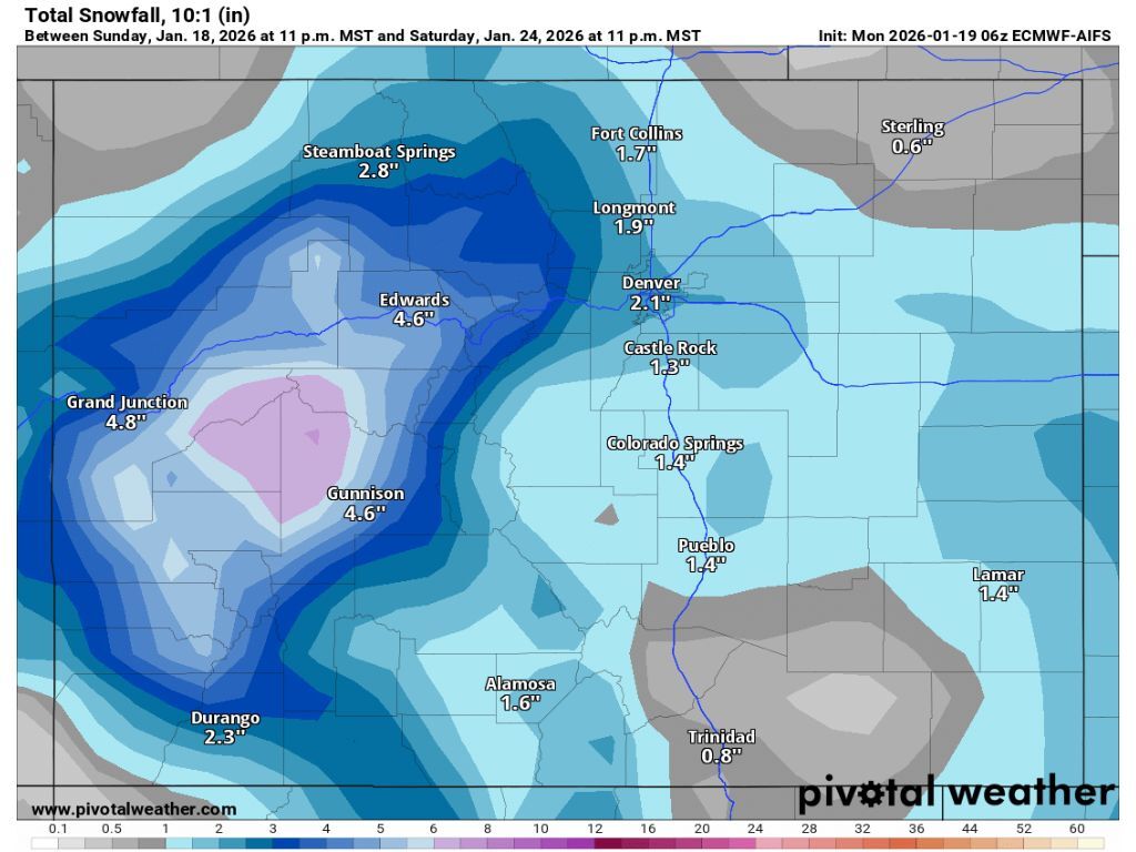
Unfortunately, that good news is followed by bad news for the state’s powderhounds – this week’s round of snow is expected to be the last significant snowfall through the end of the month, per forecasting maps published by Pivotal Weather.
Through Feb. 2, total snowfall accumulation should top out at about 9 inches, including snow that’s set to fall this weekend.

Despite the lack of snow, Colorado’s resorts are open for business. The amount of skiable terrain, however, varies quite a bit from spot to spot.
While all runs are open at Wolf Creek Ski Area at last report, most of the state’s ski areas have about 30 to 62 percent of their runs ready for skiers and snowboarders. At many spots, it’s impossible not to notice the general lack of snow.
Most ski areas report between a dusting and 2 inches of snow over the last 24 hours, with Eldora being an outlier after getting 8 inches overnight.