


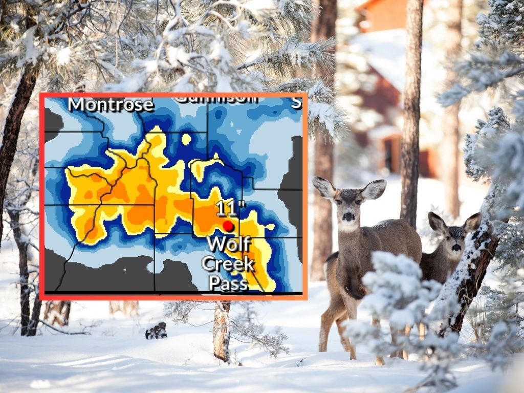
NWS mapping shows possibility of 12-plus inches of snow on some peaks this weekend
The National Weather Service has released their mapping for snowfall that’s about to hit this weekend – but keep in mind, longer-term mapping from Pivotal Weather indicates that the snow will likely continue into next Wednesday, as well.
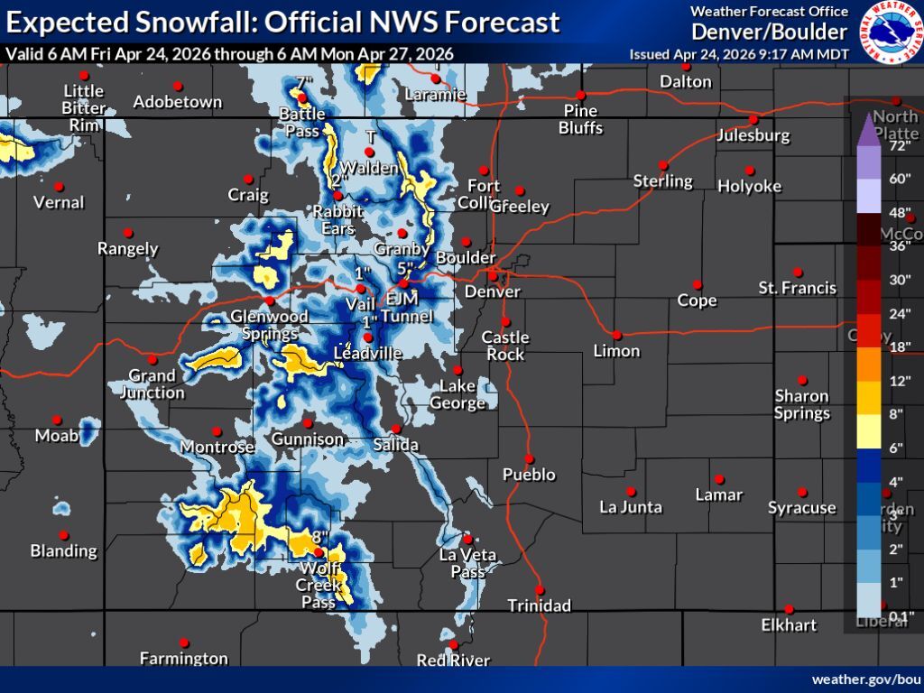
In the most likely 80-percent chance scenario, the National Weather Service is indicating that the San Juans, the Elks, parts of the Park Range, and parts of Grand Mesa get the most snow through Monday morning – in the range of about eight to 12 inches. Meanwhile, widespread totals of about six to four inches are expected around much of the state with the exception of some Front Range peaks and much of the Sangre de Cristos. The I-25 corridor gets missed and, for the most part, limited totals are seen along I-70.
See the mapping of the ‘expected’ snowfall scenario below, and keep scrolling for a look at the ‘high-end’ 10-percent chance scenario:
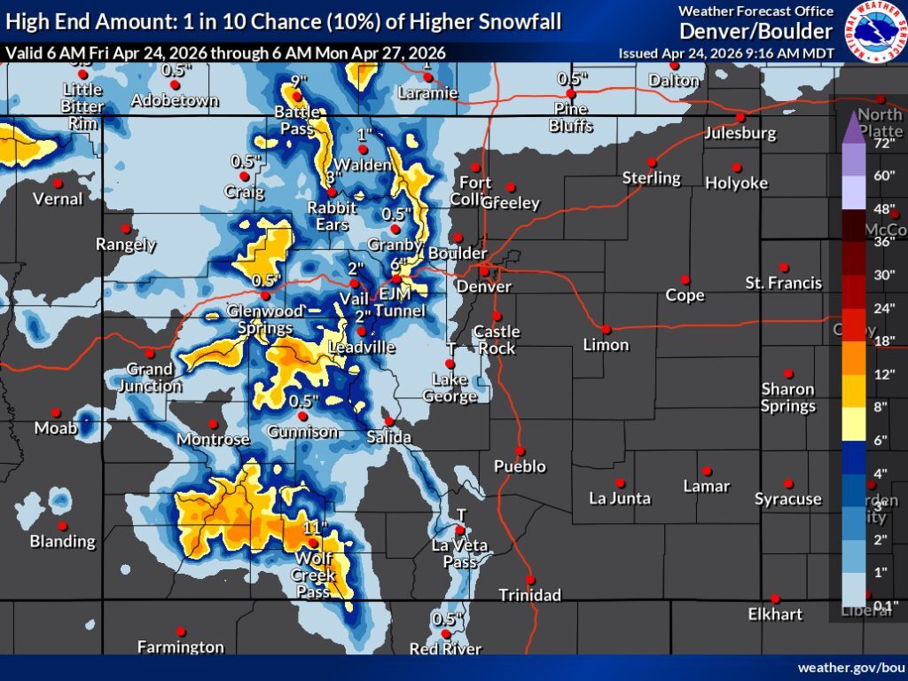
If the ‘high-end’ 10-percent chance scenario occurs, the same areas get hit the hardest, with southwest Colorado likely to see the biggest uptick in snowfall. In this scenario, snowfall in range of 12 to 18 inches would be possible in this region, along with the Elks and Grand Mesa. Snow is still very limited on the southern Front Range with Pikes Peak looking at a possibility of about one to two inches. While the I-25 corridor is also missed in the ‘high-end’ scenario, it is worth noting that this scenario could mean about six to eight inches of snow in the area of the Eisenhower tunnel, which could prove problematic for travelers.
See the ‘high-end’ scenario depicted on the map below and keep scrolling for a look at what’s ahead next week:
Per Pivotal Weather mapping, snow should continue from Monday through Wednesday. By the time this wave of snow concludes, many peaks around the state may have gotten more than a foot between now and then, with some parts of the state seeing totals in the range of 14 to 19 inches.
As of April 24, snowpack in Colorado is at just 16 percent of the norm for the date – at a level that’s typically seen around June 3.
Find additional forecasting information here.
STAY INFORMED: Get free Colorado news with our daily newsletter (Click here)
Get OutThere
Signup today for free and be the first to get notified on new updates.
PREV
PREVIOUS

A-Basin announces closing day, set to tie another spot as 'last ski area open' in Colorado
The end of an abysmal snow season is drawing to a close in Colorado and despite the widespread dryness, it looks like two Centennial State ski areas will have their lifts spinning into May. According to an announcement from Arapahoe Basin, their closing day will take place on May 3 – the same date that […]

Arapahoe Basin to close May 3 after longest ski season in Colorado this year
Arapahoe Basin announced on Thursday that it will be closing the slopes on May 3, according to its website. The current cumulative snowfall in the Denver area is a record low, as of April only reaching 27.3 inches. The 1903-04 season was the last time a winter season was dryer, peaking at 27.2 inches, according […]