


Uncompahgre Peak a Peculiar Mountain with Epic Views

At first glance, the trek up Uncompahgre Peak seems to require ropes, helmets and extensive climbing experience, for its north face is flanked by a 700-foot cliff. But with 7 miles and 3,000 feet of hard effort, you can bag this sixth-highest fourteener in Colorado.
The trailhead is a mere 9 miles from Lake City, if your car can make it up 4 miles of a four-wheel drive Forest Service Road.
From there, wind through a stand of ponderosas into a grassy valley with unobstructed views of the peak’s north face. The trail leads you up to the saddle of Uncompahgre Peak at about 12,900 feet, where you can catch your first glimpse of the peaks dotting the northwest corner of the Uncompahgre National Forest.
The name Uncompahgre, from the Ute language, loosely translates to “dirty water,” “red lake” or “red water spring” and is likely a reference to the many hot springs in the Ouray area. Make sure to look for the patches of red in the towers of rocks to your left while hiking along the saddle.
The final section of the hike requires about 50 feet of Class 2 scrambling on shallow dirt and crumbly rock, so take care with your footing.
The last 100 feet to the summit are relatively flat, a much-needed relief from the short bout of scrambling. From there, you have 360-degree views of the surrounding mountains, including Wetterhorn Peak, a Class 3 fourteener, and Matterhorn Peak, a Class 3 thirteener to the west.
It’s also possible to ski the south ridge and east slopes in winter.
After the hike, enjoy a beer and a gourmet brat at Lake City Brewing Co.
Trip log: 7 miles round trip (out and back, 15 miles if starting from the 2WD road), 3,000 feet elevation gain, 14,309 feet max
Difficulty: Difficult
Getting there: From Colorado 115, turn right onto U.S. 50 west in Penrose. Just past Gunnison, turn onto Colorado 149 south toward Powderhorn. Turn right onto Second Street in Lake City, then left onto Henson Creek Road. Drive 5 miles to the sign for Nellie Creek Trail, Forest Service Road 877. If you don’t have a high-clearance, four-wheel drive vehicle, park on Henson Creek Road and hike from there. The trailhead is 4 miles up Nellie Creek Road.
FYI: Hiking only. Dogs must be on a leash and might need to be carried up the final section of scrambling.
Get OutThere
Signup today for free and be the first to get notified on new updates.
PREV
PREVIOUS

5 Hot Springs Near Denver, Colorado
Facebook Twitter WhatsApp SMS Email Print Copy article link Save Facebook Twitter WhatsApp SMS Email Print Copy article link Save Though hot springs options are limited in the immediate Denver area, the drive will be well worth the effort for the level of relaxation Colorado’s hot springs provide. If you’re looking to experience some of […]
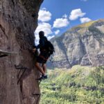
6 Things to Know About Hiking Telluride’s Via Ferrata
Facebook Twitter WhatsApp SMS Email Print Copy article link Save Facebook Twitter WhatsApp SMS Email Print Copy article link Save Traversing a cliffside high above Telluride, hiking the Via Ferrata route is a Colorado experience unlike any other. Featuring beautiful views and adrenaline-inducing exposure, this hike isn’t for the faint of heart. Italian for “iron […]