


From Blodgett Peak to Cheyenne Mountain: Dream trail taking shape in Colorado Springs
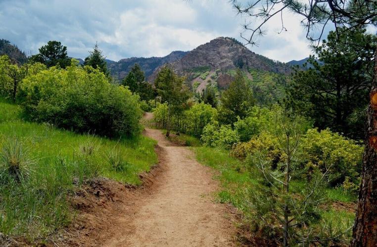
The Chamberlain Trail in North Cheyenne Cañon Park in Colorado Springs.
Courtesy city of Colorado Springs

At the edge of Colorado Springs’ north-side mountains, David Deitemeyer steps across a creek where a bridge is to be built.
The bridge will cross from a parking lot here beneath Pikeview Quarry, the historic scar turning green from reclamation. Deitemeyer represents the city’s Parks Department, which back in 2020 made a deal for the old mining company’s base here beside the creek. On the other side a trail is under construction, weaving the hills toward Blodgett Peak.
The trail could open in the fall, Deitemeyer says, along with the parking lot and bridge that he foresees lending a certain effect.
“It really creates this gateway effect,” he says.
A gateway to a long-dreamed adventure.


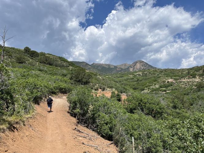
A mountain biker rides a stretch of the Chamberlain Trail in Red Rock Canyon Open Space in Colorado Springs.
Crews this summer have been building the latest stretch of Chamberlain Trail — the northernmost stretch of a trail imagined to tour the length of Colorado Springs’ skyline, from Blodgett Peak to Cheyenne Mountain.
Construction here around Blodgett is the next development in a series of recent, pivotal developments for the vision spanning decades.
In June, the City Council approved a master plan for Fishers Canyon Open Space. That plan blueprints Chamberlain Trail’s southernmost connection to Cheyenne Mountain, adjacent to the open space the city acquired in 2022. Trail construction could start in Fishers Canyon next year, says Deitemeyer, senior administrator for the city’s Trails, Open Space and Parks program.
New trails mark milestone for open space north of Colorado Springs
He oversaw that master plan for what will be the city’s next outdoor destination, following a master plan for a beloved, expanded destination. The plan for an expanded Blodgett Open Space was previously approved, clearing the way for this northern Chamberlain Trail.
“Fishers Canyon unlocks a really important part, and Blodgett unlocks a really important part,” says Cory Sutela, who has long advocated for the trail as executive director of mountain biking nonprofit Medicine Wheel.


The Chamberlain Trail is expanding near Blodgett Peak, around the foothills in view of the under-reclamation Pikeview Quarry on Colorado Springs’ north side.
There are yet more important parts to be realized. But Chamberlain’s portals opening on either end should excite this city’s “ultra users,” Sutela says.
“Which we have many that live here, those that are kind of like, ‘What kind of goofy thing could I connect together?’” he says. “It’s that spirit of adventure and discovery that draws a lot of residents to our city.”
And visitors as well, Sutela notes.
Chamberlain “will be of really high interest to visitors,” he says. “It’ll get on that tick list. If you visit Colorado Springs, ‘Oh, did you do the Chamberlain Trail? Did you do it north to south or south to north?’ It’s not quite Ring the Peak, but it’s a major connection that’s going to be very iconic.”
Not quite Ring the Peak, that much longer trail envisioned to encircle Pikes Peak. Chamberlain could span about 32 miles, according to Deitemeyer’s estimates.


David Deitemeyer, senior administrator for Colorado Springs’ Trails, Open Space and Parks program, walks a new stretch of the Chamberlain Trail coming to the city’s north side, near Blodgett Peak.
Counting dirt trail already built and the trails coming to Blodgett and Fishers Canyon along with current connections via roadways, commuter paths and easements granted, he maps an existing corridor spanning 21 miles.
Along the under-construction Chamberlain Trail at Blodgett, he points south to a ridge and “a significant gap” of private lands beyond, toward Garden of the Gods. Though, he says, one could chart a course incorporating the paved Foothills Trail and roadways through Garden of the Gods and on to Red Rock Canyon Open Space, where Chamberlain Trail has been added in recent years, joining segments farther south around Bear Creek Park and North Cheyenne Cañon Park.
From Blodgett’s new trail, one could follow Chamberlain’s roughly imagined corridor all the way south to Old Stage Road — but only by incorporating that pavement immediately south of Blodgett. “It’s a different character, it’s a different experience,” Deitemeyer says. “Our long-term goal is to try to provide the experience in the foothills.”
Happy Trails: West of Colorado Springs, a humble summit with humbling views
The goal has always been long-term. But for a man credited with Chamberlain Trail’s early development, the goal appears ever closer in view.
“It’s cool to see the various pieces coming together,” Chris Lieber says.
He intimately remembers some of the first pieces, having led the city’s Trails, Open Space and Parks (TOPS) program from 1997-2016.
Voters had approved TOPS in 1997, setting aside sales tax revenues to purchase open spaces that Lieber saw established over the years. Those included Blodgett and Red Rock Canyon open spaces — purchased in 2001 and 2003, respectively — not to mention the state park TOPS helped open in 2006: Cheyenne Mountain State Park.
The dream of Chamberlain Trail grew as an open space system grew, Lieber says. “All these puzzle pieces had to fall into place.”
It’s no coincidence the trail’s first formal segments were born out of TOPS’ first signature purchase in 1998: Stratton Open Space, bordering North Cheyenne Cañon.


The Chamberlain Trail weaves around the upper reaches of North Cheyenne Cañon Park in Colorado Springs.
“Originally, (Chamberlain) was largely focused in and around where the namesake comes from, in that Cheyenne Cañon and Stratton Open Space area,” Lieber says.
The namesake has been for Fred Chamberlain. Starting in 1937, he donated significant acreage adding to North Cheyenne Cañon Park, according to an account by local historian Eric Swab.
The account also details the rugged whereabouts of Fred’s brother, Frank. “It seems appropriate the Chamberlain trail be named after both Frank and Fred,” Swab wrote, considering Frank’s evident interest in trail building.
Yes, the interest long predated Lieber. Long before him in the ’90s and throughout his leadership, the Parks Department was focused on expanding the Pikes Peak Greenway as we know it now — the urban path spanning the city north and south. For the next century, TOPS unlocked millions of dollars to unlock possibilities across the western wilds running north and south.
‘Vision plan’ recommends outdoor projects, management ideas for Pikes Peak
For a foothills-touring trail going from a dream to a possibility, the recently retired executive director of the Trails and Open Space Coalition, Susan Davies, thanks Lieber and her predecessor, Dan Cleveland, who led from 1994-2009.
“Between the two of them, they said, ‘Oh, my gosh, this is going to be the mountain version of the greenway, and it’s going to be amazing,’” Davies says.
Like the Pikes Peak Greenway and the urban trail network, “it was this concept of, ‘What if everybody’s front door was their trailhead?’” Lieber says. “To be able to go from Stratton to Red Rock Canyon, or North Cheyenne Cañon down to Cheyenne Mountain State Park — I think people are hungry for those kinds of opportunities.”
As Deitemeyer recognized upon joining the Parks Department in 2012. More ground had been laid by then, the likes of Stratton, Red Rock Canyon and Cheyenne Mountain presenting a canvas.
“But it’s still a challenge to figure it all out,” Deitemeyer says.
For example: an easement for running the trail behind the Cheyenne Mountain Zoo and other approvals needed for a road crossing eyed near Cheyenne Mountain Space Force Station. And then there’s that “significant gap” Deitemeyer points to between Blodgett and Garden of the Gods.
Adjacent to the Garden, “we want to figure out a better way to get through Flying W Ranch,” Sutela says. “For it to be really good north to south, we’ve got to get some good singletrack through there.”
These are sensitive discussions, Deitemeyer emphasizes. “We have the vision, but sometimes there are private property owners or entities that just aren’t ready to work with us, and we understand and respect that. It may take time, and they may never play out, and we have to find alternatives.”
In conclusion, Sutela says: “It’s one of those things where you gotta keep biting the apple.”
This represents a big bite, this northernmost trail under construction.
Hiking now, Deitemeyer reaches a crest where Blodgett Peak emerges into view and Cheyenne Mountain looms to the south — seemingly not so distant, Deitemeyer observes with a smile.
“It looks simple enough to get right there,” he says.
Happy Trails: Looping a peaceful valley between the bustle of Colorado Springs
The legacy and loss of Colorado’s once-mighty glaciers
Seth Boster
seth-boster@denvergazette.com
Updated 5 days ago
High in the Indian Peaks Wilderness beyond her home in Boulder, Millie Spencer has been venturing to an extreme, jagged place of rock and ice. “Especially since I became obsessed with this idea of watching its decline,” she said. Like...
Seth Boster
Reporter
Camille Pissarro retrospective coming to Denver Art Museum
Colleen Smith
colleen-smith@gazette.com
Updated 4 hours ago
Camille Pissarro’s retrospective is coming to the Denver Art Museum (DAM), and the Mile High City is the only U.S. venue to exhibit the first major show of the “Father of Impressionism” in 40 years. On Oct. 26, the DAM...
Colleen Smith
Reporter

In its 10th year, Colorado tattoo convention inks itself as a hub for local artists
Bernadette Berdychowski
bernadette.berdychowski@denvergazette.com
Updated 1 day ago
More than a dozen tattoo artists were at work at the National Western Complex in Denver over the weekend. Inside the event hall on Saturday, attendees laid across tattoos chairs on either their backs, sides or stomachs as artists worked...
Bernadette Berdychowski
Reporter
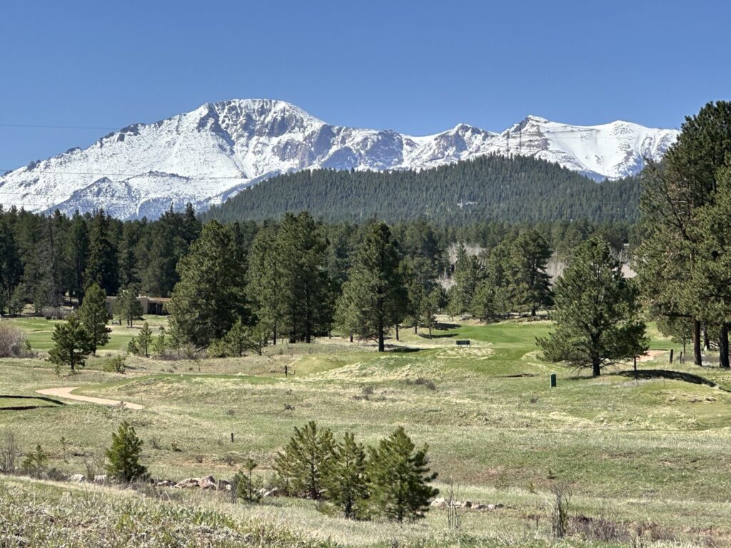
Could this be the next big outdoor destination in Woodland Park?
Seth Boster
seth-boster@denvergazette.com
Updated 3 days ago
Could a golf course be the next great outdoor escape in the “City Above the Clouds” west of Colorado Springs? Advocates in Woodland Park think so. The 18-hole Shining Mountain Golf Course “is such a big parcel, with so much...
Seth Boster
Reporter
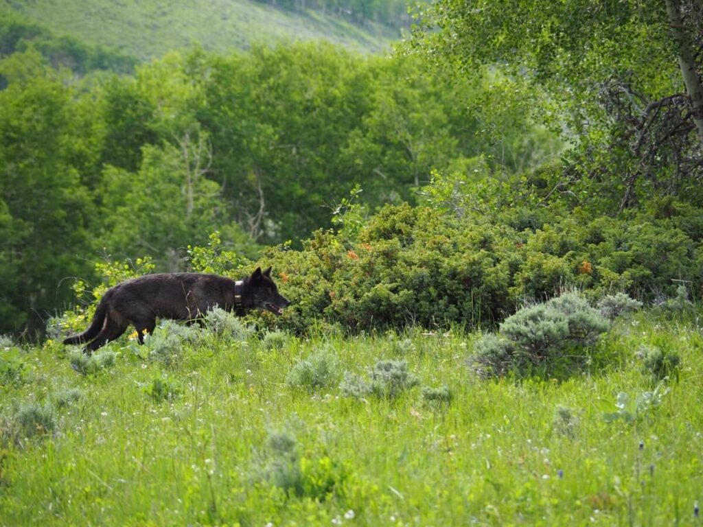
Link between wolves and aspen a point of debate beyond Colorado
Seth Boster
seth-boster@denvergazette.com
Updated 5 days ago
For the past 15 years, Luke Painter has been traveling to the northern range of Yellowstone National Park, where mountains rise and tributaries carve valleys of sage, willows and trees. This includes aspen, the beloved tree of fall that glows...
Seth Boster
Reporter
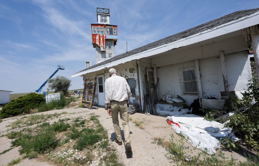
Colorado’s weirdest roadside attraction is getting a second life
Seth Boster
seth-boster@denvergazette.com
Updated 6 days ago
GENOA • On that family road trip across Colorado’s plains in 2013, it would’ve been easy to drive by this no-stoplight town with no sign of any business, other than the grain elevator at the edge of a dirt road...
Seth Boster
Reporter
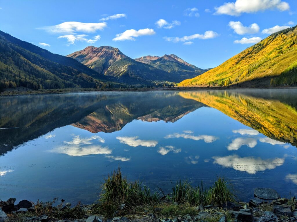
Effort afoot to revive scenic lake in southwest Colorado
Seth Boster
seth-boster@denvergazette.com
Updated 6 days ago
Early this summer in their home mountains of southwest Colorado, Tamara Gulde and Lynn Padgett were visiting a favorite scenic site that was not what it once was. Perched near 9,600 feet off the Million Dollar Highway above Ouray, Crystal...
Seth Boster
Reporter

More With Less: Multi-Functional Furniture
SPONSORED FEATURE
sponsored-feature@denvergazette.com
Updated 3 days ago
Every inch counts when you have a smaller home or a room that lives a double life (dining room AND workspace? Guest room that doubles as a room for your projects). Multi-functional furniture can give you both the comfort and storage you need. Multi-functional...
SPONSORED FEATURE
Reporter
Is Colorado’s craft brew industry on the ropes?
Dennis Huspeni
dennis.huspeni@gazette.com
Updated 2 weeks ago
A couple of high-profile metro Denver craft brewery closures in 2025 spurred some worries about the industry’s health. But industry insiders said while it’s changing for sure — as every growing industry does and there are some concerns with future...
Dennis Huspeni
Reporter