


Derby fire in Eagle County triples in size on Wednesday, new public lands closures implemented

The Derby fire in the White River National Forest north of Dotsero, Colorado has burned around 245 acres as of Wednesday, Aug. 20, 2025.
Courtesy, National Forest Service

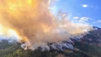
The Derby fire in the White River National Forest north of Dotsero, Colorado has burned around 245 acres as of Wednesday, Aug. 20, 2025.
The Derby fire, spanning across land in both Eagle and Garfield counties and located about 13 miles north of Doterso, Colorado, grew to approximately 2,624 acres by Thursday morning, as reported by Inciweb — more than tripling in size in the last 24 hours.
The fire was around 839 acres and 0% contained as of 9:30 a.m., Wednesday.
The fire is still 0% contained and 117 total personnel are on scene including nine engines, one helicopter and five hand crews.
The forest service reported Thursday that fire behavior has been wind driven and that growth slowed Wednesday due to slope and fuel type. However, outflow winds associated with monsoonal moisture may increase fire activity Thursday.
According to fire managers, they worked Wednesday to assess protection needs for over 100 structures along Sweetwater Road to Red Dirt Creek. They also laid firehose and scouted opportunities to build containment lines.
New land closures are in place as well.
The Upper Colorado River Interagency Fire Management Unit posted on its Facebook page Wednesday night that “effective immediately, certain public lands managed by the Bureau of Land Management (BLM) from the Colorado River Valley Field Office in Garfield and Eagle Counties are temporarily closed until the Derby fire is declared controlled or the order is rescinded.”
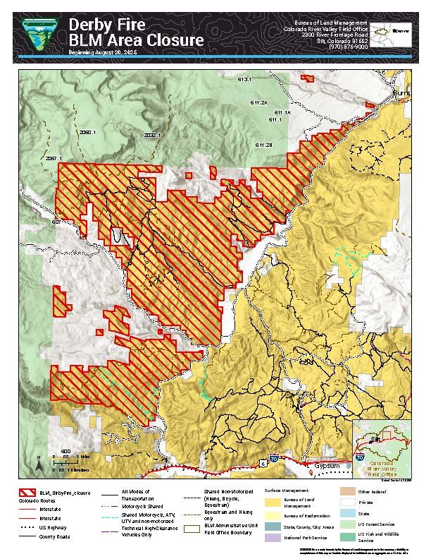
On Wednesday, Aug. 20, 2025. the BLM issued land closures in Garfield and Eagle Counties for firefighting activities due to the nearby Derby fire burning.
Courtesy, National Forest Service


On Wednesday, Aug. 20, 2025. the BLM issued land closures in Garfield and Eagle Counties for firefighting activities due to the nearby Derby fire burning.
The closure affects BLM lands north and west of the town of Gypsum that are north of Coffee Pot Road, west of the Colorado River, east of the White River National Forest boundary and south of Derby Creek.
The Derby Fire was ignited by lightning on an extremely steep cliff face in a remote area near the Flat Tops Wilderness on Saturday evening.
The fire was previously thought to have started Monday afternoon, and by 5 p.m., was estimated to be about 25 acres.
As of 8:15 p.m., Tuesday, the fire had grown to at least 245 acres.
The overnight growth of the fire from Tuesday night into Wednesday morning prompted evacuation orders on Wednesday morning in the area of Sweetwater Lake and a complete closure of Colorado River Road.
Residents in the area were alerted to evacuate by noon. The Derby Mesa loop remains in pre-evacuation at this time.
According to the forest service, initial attack efforts by smokejumpers on Sunday were hindered by rollout of burning material, repeatedly igniting the slope below the main fire.
The fire is burning in a difficult-to-access area of the White River National Forest.
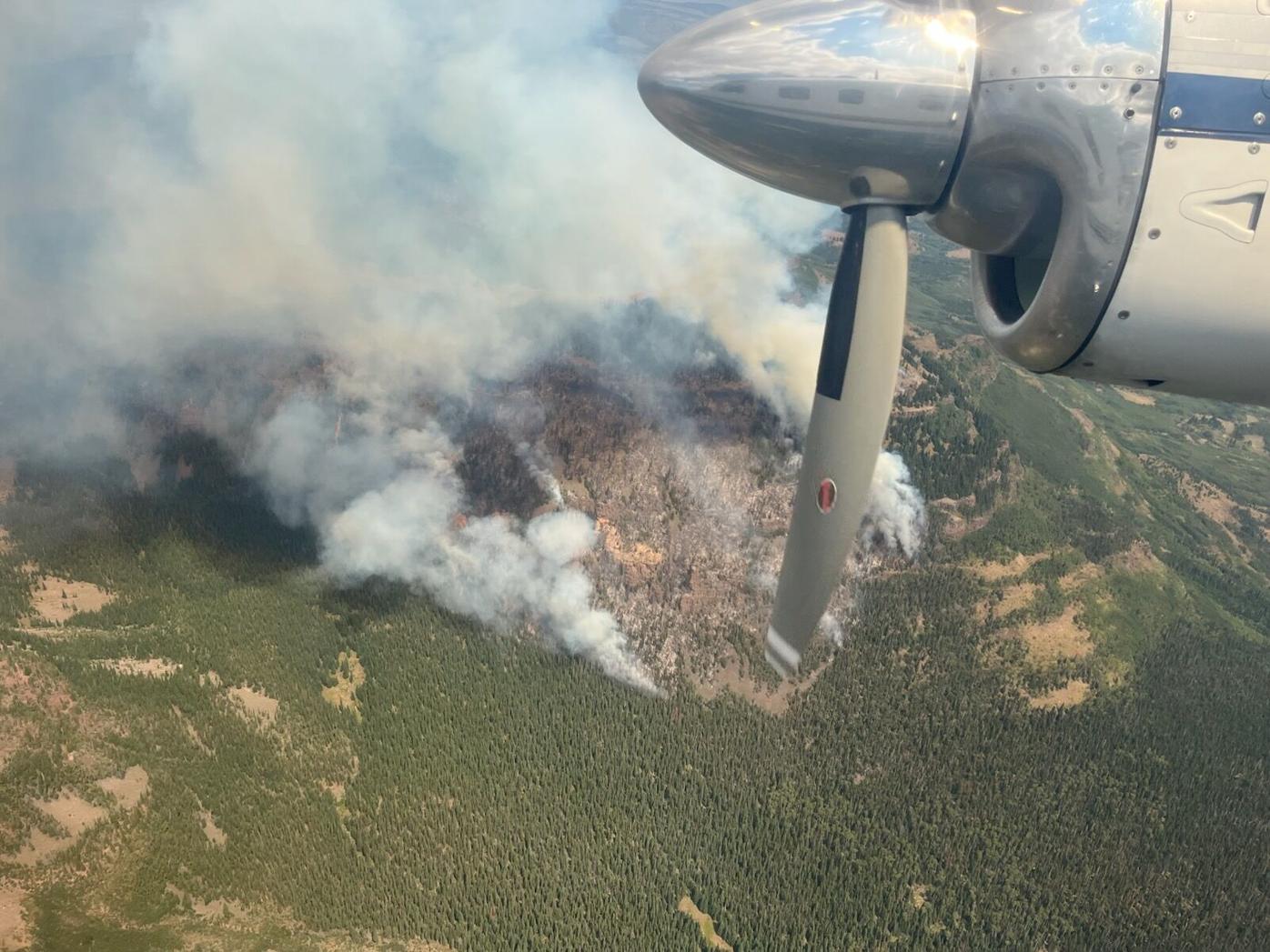
A propeller plane flies over the Derby fire in Eagle County, Colorado Tuesday, Aug. 19, 2025.
Courtesy, United States Forest Service, Facebook


A propeller plane flies over the Derby fire in Eagle County, Colorado Tuesday, Aug. 19, 2025.
The closure is within the Blanco and Eagle-Holy Cross Ranger Districts, starting north of Sweetwater Lake, following the Forest boundary north and east to the intersection of the Derby Loop Road (Eagle County Road 39); following Middle Derby Creek generally northwest to Island Lakes; then, generally south following the Island Lakes Trail, the W Mountain Trail, the Turret-Crescent Trail and the Turret Creek Trail back to Sweetwater Lake.
More evacuation information is available at www.ecemergency.org, including where to shelter and resources for pets and livestock.
Smoke will be visible around western Eagle and eastern Garfield counties on Thursday, including the Dotsero, McCoy, Eagle and Kremmling areas.

Courtesy, National Forest Service
(Contact Denver Gazette Digital Strategist Jonathan Ingraham at [email protected] or on X at @Skingraham.)