


Below zero temps coming to Colorado for MLK Jr. weekend
High temperatures barely reach the middle teens
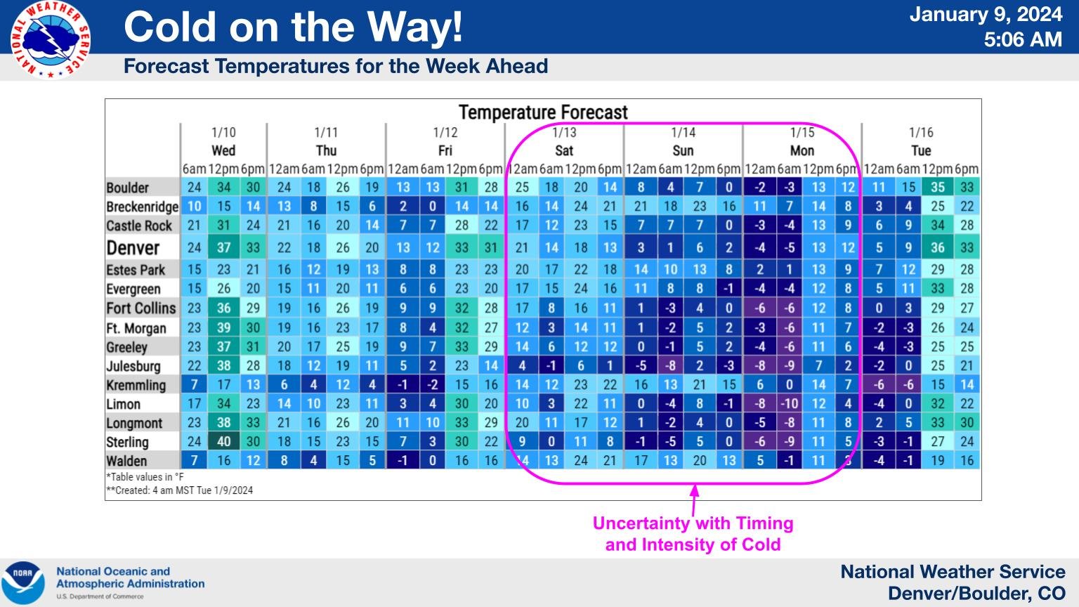
Denver and the eastern plains could experience its first below zero low temperatures of the season this weekend.
A shot of arctic air will work its way southward from Wyoming into Colorado Friday night into Saturday morning, with lows bottoming out below zero. The resulting colder temperatures are biproducts of an extension arm of the polar vortex being pushed into North America from the North Pole region.
Winter 2023-24 has been mostly mild and seasonal, but that is about to change as a high pressure ridge developing over Alaska adds one weather ingredient to the two-ingredient recipe funneling the Arctic air into large sections of the continental U.S., including Colorado. The second ingredient is a second high pressure dome over the North Atlantic, which pinches the cold air into North America.
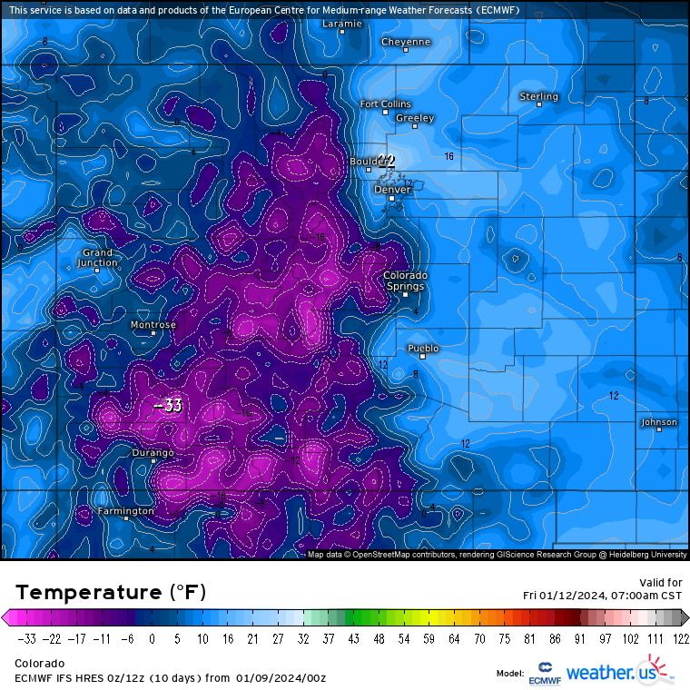
The cold temperatures don’t start for Colorado on Saturday morning however. A winter storm blowing in Thursday night into Friday morning will drop temperatures in Colorado’s high country significantly, with forecasted lows from the European Centre for Medium-range Weather Forecasts (ECMWF) high resolution model showing lows between -33 to 5 degrees.
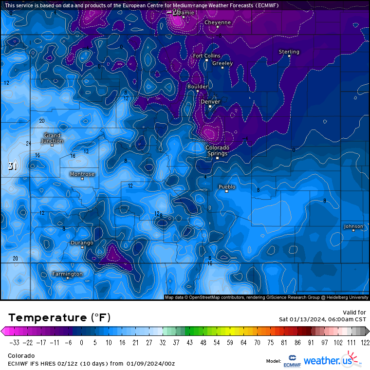
The Front Range and Interstate 25 corridor, including the northeastern and central eastern plains, receive the Arctic air Friday night. Saturday morning lows for areas north of U.S. Highway 24 and east of I-25 are forecast to be between -2 and 4 before sunrise, with highs barely reaching 20 in some areas.
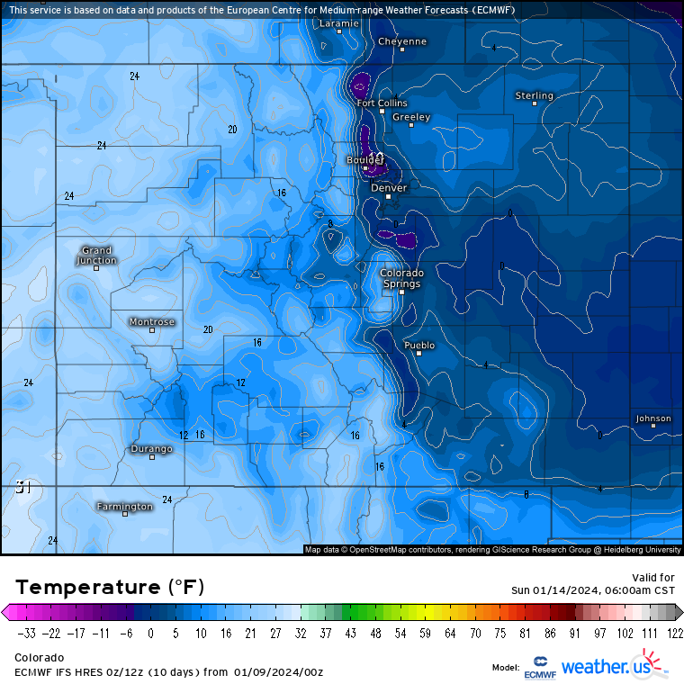
On Saturday night into Sunday morning, the low temperatures will plummet again, with lows dipping potentially lower for Sunday morning. The ECMWF high resolution model forecasts lows to be between -5 and 2 degrees, with highs again staying below 20 for the area.
What is the polar vortex?
The polar vortex or arctic polar vortex as defined by NOAA is a strong band of winds in the stratosphere, surrounding the North Pole 10-30 miles above the Earth’s surface.
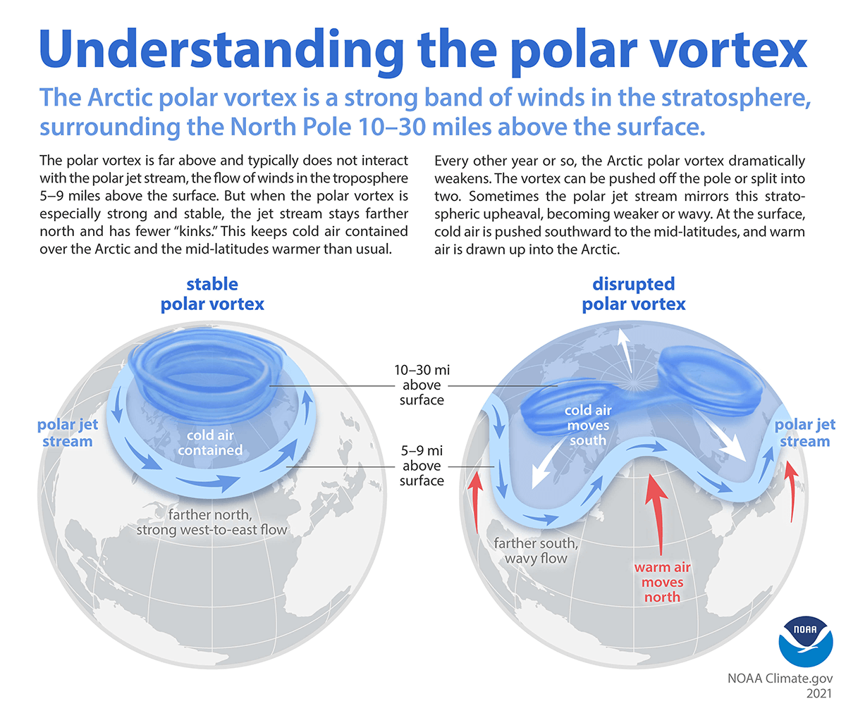
The polar vortex causes extremely cold temperatures in the continental U.S. when the low-pressure system weakens and travels from its usual position in the high Arctic. As the system weakens, some of the cold, arctic air breaks off and migrates south, bringing ample cold air with it. Areas as far south as Florida may experience arctic weather as a result, according to NOAA.
Forecast low temperatures:
- Thursday: 7
- Friday: 13
- Saturday: 2
- Sunday: -3
Denver has a chance for snow Wednesday night into Thursday and Friday through Monday to accompany the arctic air.
Get OutThere
Signup today for free and be the first to get notified on new updates.
PREV
PREVIOUS
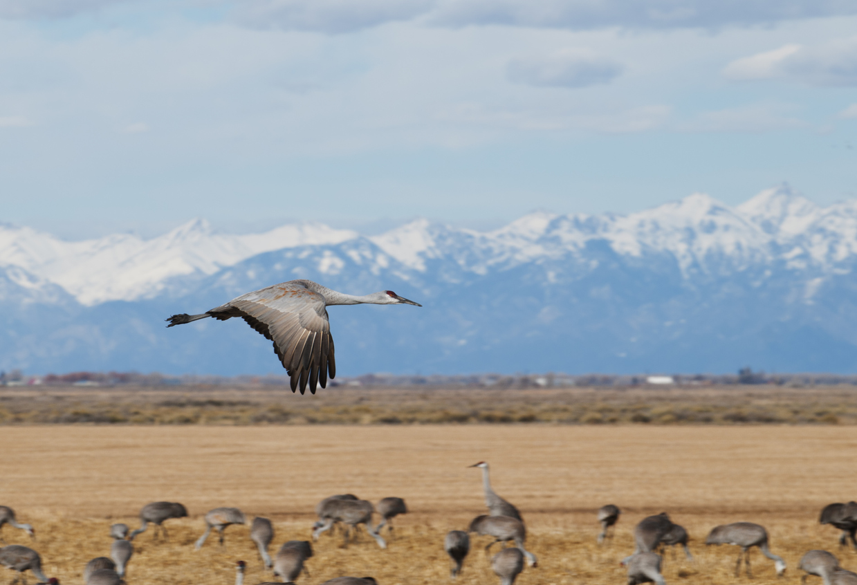
5-foot-tall bird with 7-foot wingspan a staple of Colorado wildlife sightings
They might not be the most commonly spotted bird on the average day in Colorado, but the Greater Sandhill Crane is an icon of the Centennial State thanks to their migration pattern. Known for their wide wingspan, red eye patch, and loud trumpeting call, the Greater Sandhill Crane is hard to miss when it’s around. […]
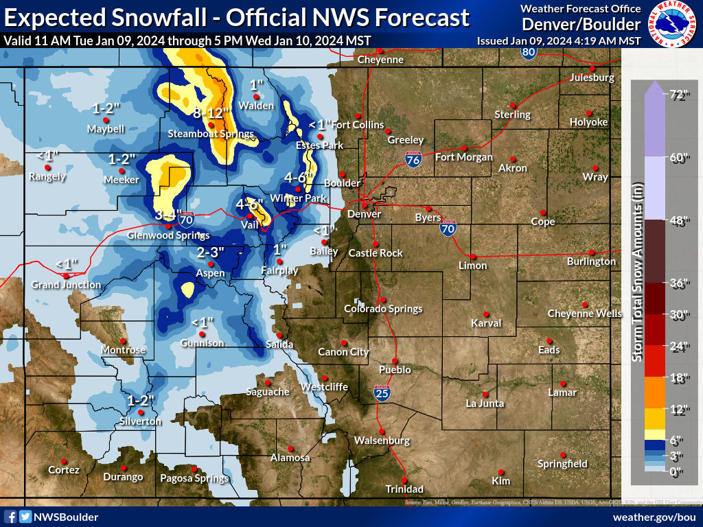
18 inches of snow expected on peaks around Colorado resort town
According to the National Weather Service, more snow is lining up to hit Colorado’s mountain region between Tuesday at 11 a.m. and Wednesday at 5 p.m. This round of snow should favor the northwest region, specifically in the area of Steamboat Springs. Current mapping shows that up to 18 inches of snow could land on […]