Colorado weather: Tornado spotted in Eastern Plains; storms dump hail on south metro Denver
The National Weather Service issued a slew of tornado warnings as the storm cells moved across the metro area from south to east

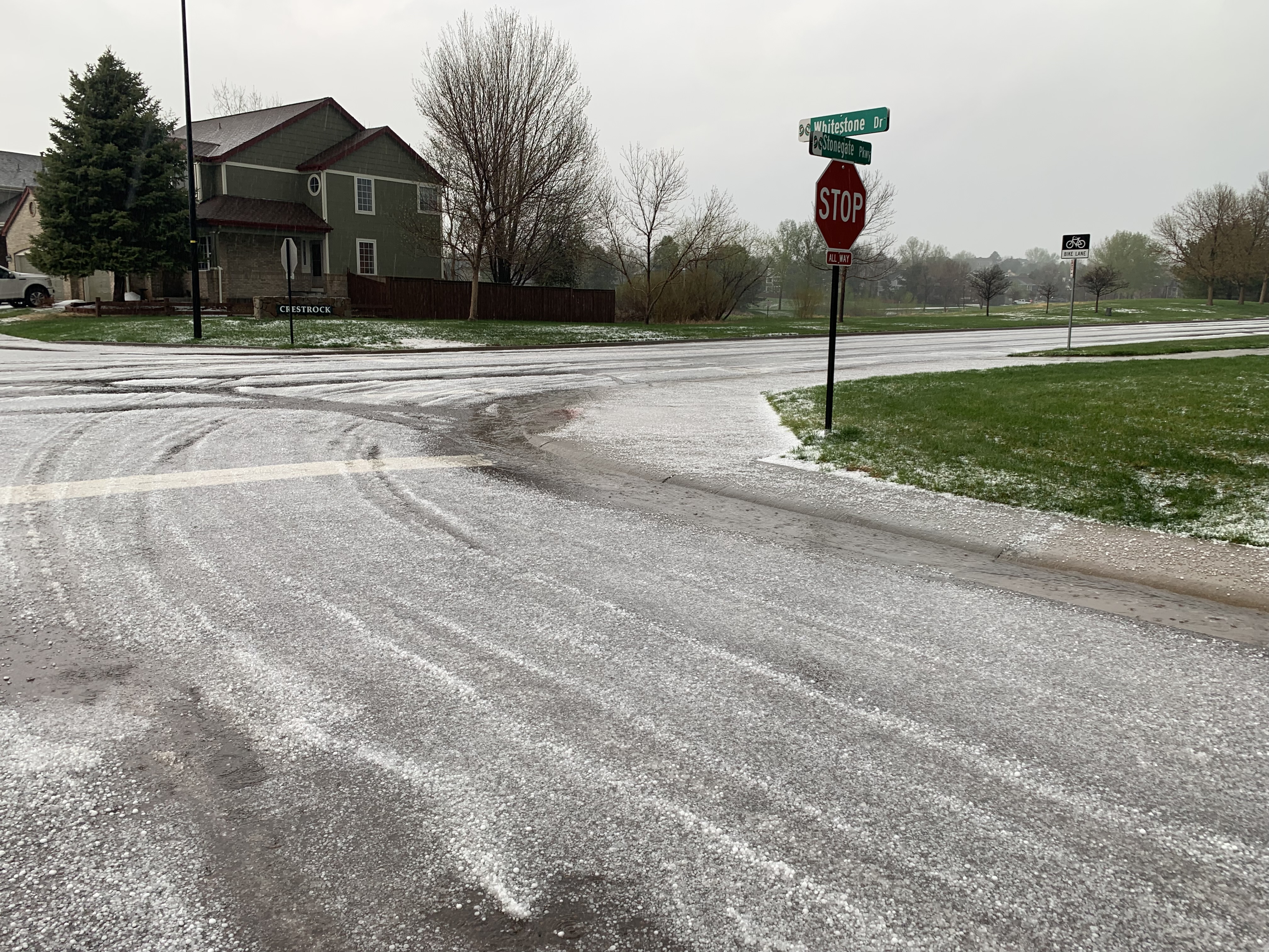
Heavy rain, lightning and hail pushed across the south metro Denver area on Wednesday afternoon, moving to the northeast toward Colorado’s Eastern Plains, where a tornado reportedly touched down in Morgan County
Denver Gazette news partner 9News reported that views captured the tornado shortly before 6 p.m. Wednesday.
The National Weather Service had issued a slew of tornado warnings Wednesday as storm cells moved across the metro area from south to east.
A tornado warning was initially issued for areas of Arapahoe, Douglas and Elbert counties until 4:30 p.m. Wednesday. Centennial, Foxfield and Watkins are included in the warning.
When those expired, the National Weather Service issued a severe thunderstorm warning for Elizabeth and Kiowa until 5 p.m.
Earlier, the weather service issued tornado warnings for Parker, Lone Tree, Castle Pines, Castle Rock, Franktown, Elizabeth, Louviers and Sedalia but those expired at 4 p.m.
Another tornado warning issued for Castle Rock, Lone Tree and Louviers expired at 3:30 p.m.
A tornado watch was in effect until 10 p.m. for most all Colorado counties in the northeast area of the state, including Denver, Douglas, Arapahoe and Adams.
Most of the foothills and plains areas were expected to see heavy rain Wednesday afternoon and evening through Thursday night, according to Zach Hiris, a meteorologist with the National Weather Service in Boulder.
The Denver metro area and eastern plains are also at “enhanced risk” of severe weather, meaning there is potential for a few tornados, large hail and damaging winds, Hiris said.
Hiris provided the following tips for mitigating property damage from severe weather.
Hail: People can avoid damage to vehicles by parking them under a structure or in a garage or getting hail pads to put on top of vehicles.
Damaging winds: Make sure things that can blow around, such as patio furniture, trash cans and other large outdoor items, are stored away to protect the items and other people and property.
Tornadoes: Find a sturdy shelter or indoor room of a building on the lowest level of the building
Any severe weather: Have multiple ways of getting information. In the case of a severe thunderstorm, flash flood or tornado warning, it is good to have options for getting those warnings in order to take appropriate action.
Have a plan. An important part of responding to weather disasters is preparedness. If and when the event happens, having a plan helps people take the right safety precautions.
Weather, particularly severe weather, can impact travel as well.
Denver International Airport (DIA) was put on a ground delay by the Federal Aviation Administration at 2 p.m. Wednesday due to thunderstorms.
This ground delay came after a second delay earlier Wednesday due to low visibility that was lifted at 10 a.m.
The hold has had a ripple effect on flights throughout the day.
As of 2:10 p.m., 261 flights were delayed into and out of DIA and 86 flights were cancelled into and out of DIA.
Travelers are encouraged to check with their airline for up-to-date flight information.
Colorado Department of Transportation (CDOT) has a page of tips for driving in various weather conditions. They include:
- Avoid driving through flooded areas, as it is hard to tell how deep or fast the water is running. Even eight to ten inches of water can float an average-size car.
- Reduce speed on wet roads. Speeding in flooded or hail-covered areas can cause vehicles to hydroplane.
- Avoid using cruise control during rainy conditions when there is standing water on the roadway.