


NWS ‘risk of heavy snow’ map includes large swath of Colorado next week
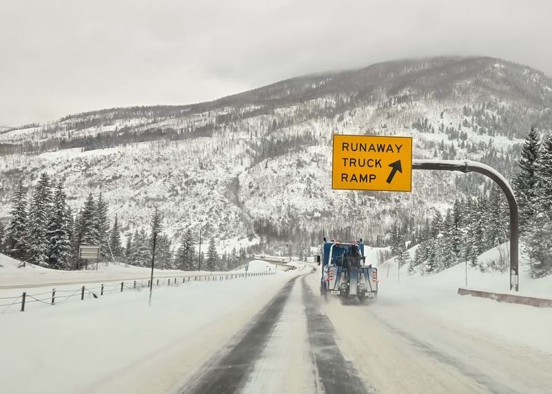
As you may have heard, three more rounds of snow are expected to hit Colorado through the month’s end. While one of those waves is expected to land on Friday, another, more significant round of snow could soon follow.
Per the National Weather Service ‘Risk of Heavy Snow’ map that’s produced by the agency’s Climate Prediction Center, much of western Colorado will be at risk of heavy snow from April 23 to April 25 during a storm that also includes a large portion of Wyoming. Places are generally included on this map when impacts are expected and even if the full extent of the storm fails to come to fruition, at least some snow tends to fall during targeted dates.
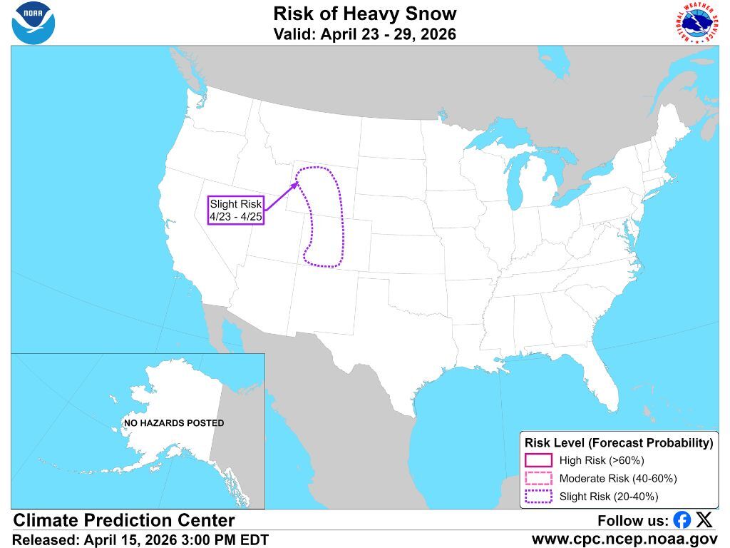
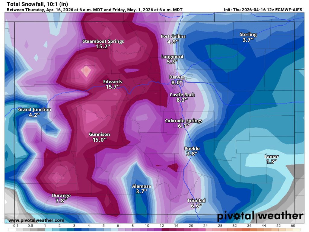
The National Weather Service hasn’t released specific snowfall totals related to this date range yet, though mapping from Pivotal Weather puts expected totals in the range of about six to eight inches, notably landing in the area of I-70 opposed to on remote peaks. It’s also possible this report could be underestimating snowfall, as inclusion on the ‘risk of heavy snow’ map from the National Weather Service tends to mean more than that is expected – the NWS will release their expected snowfall forecast next week as this storm nears, so Coloradans will know more by then.
Either way, this will be a storm to watch. Following the storm next week, another storm is expected to close out the month. Pivotal Weather shows that accumulation of all three storms combined could peak at about 28 inches in the area of the Flat Tops with total accumulation being around one to two feet on most peaks. Granted, these storms are still quite a bit away, thus plenty can change in the meantime.
As of April 16, the statewide snowpack is at 20 percent of the norm for the date – typical of what’s seen around May 31 on the normal season.
Find additional forecasting on the National Weather Service website.
STAY INFORMED: Get free Colorado news with our daily newsletter (Click here)
Get OutThere
Signup today for free and be the first to get notified on new updates.
PREV
PREVIOUS

Up to 12 inches of snow could hit peaks on Friday – but more is likely on the way
The first of three waves of snow expected to hit Colorado through the end of April should land on Friday, and while more significant snow could be on the way, some specific areas could get snow in the range of eight to 12 inches as this initial round lands. Earlier today, the National Weather Service […]

Some containment gained in fight against 1,012-acre fire burning in Colorado
Containment has finally been gained on a wildfire that’s been burning near the Colorado-New Mexico state line, southeast of Trinidad. According to a Thursday morning report, the Schwachheim fire has reached a size of 1,012 acres. That said, some containment is finally present – 36 percent. This containment has reportedly been gained on the southern […]