“Very large hail” among risks of storm set to hit much of Colorado today
According to the National Weather Service, the trend of springtime storms is set to continue in Colorado on Monday, June 8.
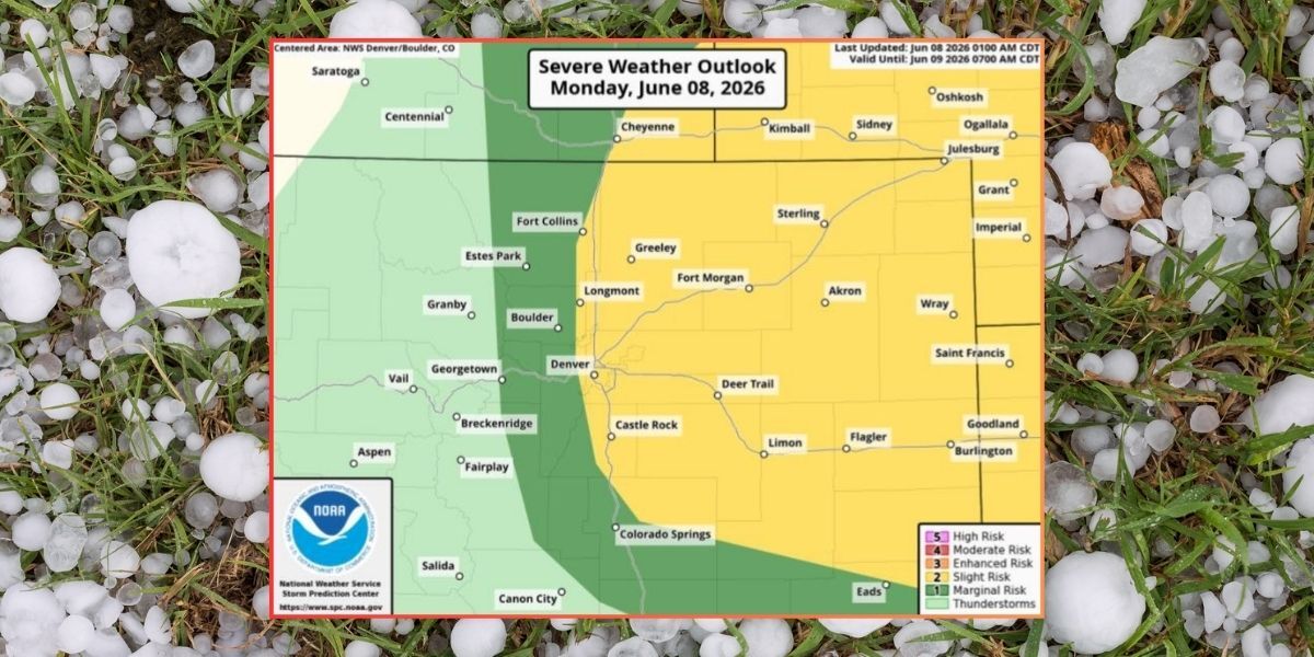
Mapping from the agency shows that there’s a severe storm threat growing for the Denver metro area and beyond, stretching into the Eastern Plains region. With expected timing of the risk being from 2 p.m. to 9 p.m., key hazards associated with the weather that’s moving through include ‘very large hail’ – somewhere between golf ball and baseball-size, damaging winds at about 65 miles per hour, and a risk of tornados. Expect plenty of lightning, too.
“A few severe storms possible across the I-25 Corridor and northeast Colorado this afternoon and evening,” reads a statement from the National Weather Service. “First storms develop in I-25 Corridor toward mid-afternoon, then move east thru early evening. Stay weather aware today!”
Find additional forecasting information on the National Weather Service website here.
STAY INFORMED: Get free Colorado news with our daily newsletter (Click here)
Get OutThere
Signup today for free and be the first to get notified on new updates.