


Apple-size hail a possible threat with severe storms expected in part of Colorado
The National Weather Service is monitoring a situation that could mean severe storms in northeast Colorado and along the Eastern Plains on June 22.
A 12:31 p.m. report from the National Weather Service Storm Prediction Center indicated that hazards related to the thunderstorms could include hail ranging from 2 to 3.5 inches (lime-size to the size of a large apple), wind speeds between 55 and 70 miles per hour, and the possibility of tornadoes, which could mean 85 to 110 mile-per-hour gusts. Potential impacts include wind damage to trees and power lines, as well as damages related to hail.
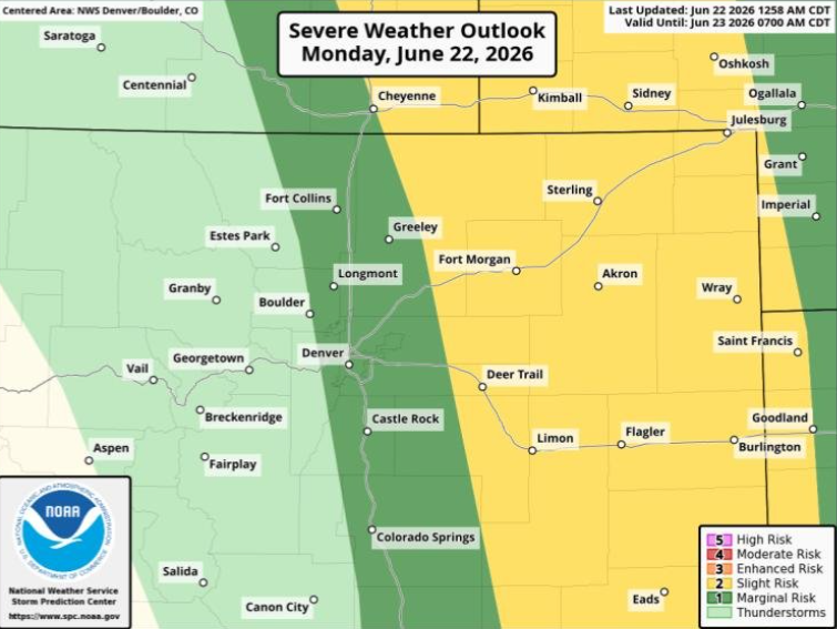
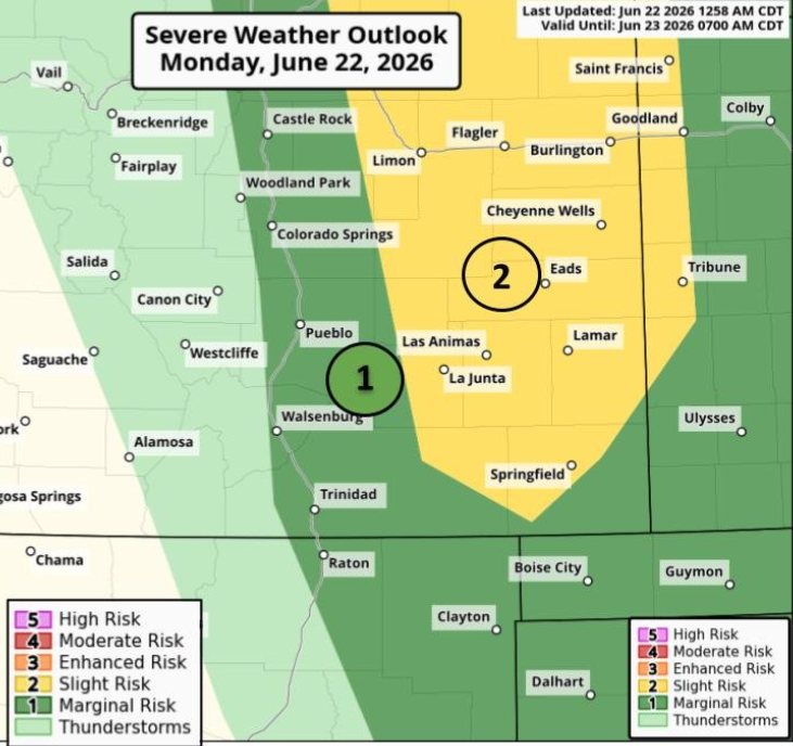
The timing of the weather concerns spans from 1 p.m. to 9 p.m. on Monday. While storms may hit the I-25 corridor, the more severe storms are expected to fall east of that, sparing most of Colorado’s population from the greatest threats.
The mapping below, respectively published by the Boulder and Pueblo branches of the National Weather Service, shows how much of Colorado could be impacted by these storms:
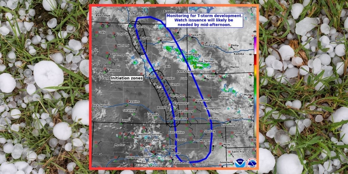
If a severe storm watch or warning is activated, it will be found on the National Weather Service website. At time of publishing, there were some hazardous weather outlooks published, but no severe storm watches or warnings in the Centennial State yet. It’s very possible that could change by the time you’re reading this piece, with a severe thunderstorm watch already activated just north of Colorado in Wyoming. Find mapping of these alerts here.
STAY INFORMED: Get free Colorado news with our daily newsletter (Click here)
Get OutThere
Signup today for free and be the first to get notified on new updates.
PREV
PREVIOUS

Latest drought impacts at Colorado's state parks include key water source running dry, major boating impacts
With roughly 98 percent of Colorado currently experiencing drought, additional related outdoor recreation impacts have been announced. According to Colorado Parks and Wildlife, extreme drought conditions are set to limit recreation at Slyvan Lake and Rifle Gap state parks, respectively near the towns of Eagle and Rifle. Dryness in this part of the state has […]

Weekly Weather Outlook for Colorado: June 22 through June 28
The weather in Colorado this week is expected to be hot and dry again, creating continued fire danger. Afternoon thunderstorms are expected to begin midweek. Here’s a look at daily temperatures across Colorado this week, courtesy of the Weather.com report: Monday: Expect sunny to partly cloudy skies, with stray afternoon thunderstorms possible in Denver. Tuesday: […]