







Colorado braces for potential rockslides and flash flooding
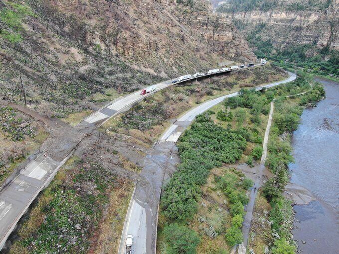
Colorado is bracing for more heavy rain, bringing with it the threat of high country flooding, mudslides, rockslides, and debris flows.
The National Weather Service (NWS) issued a flash flood watch for portions of central, southeast, and southwest Colorado on Wednesday including the Central Chaffee County below 9,000 feet, Fremont Count below 8,500 feet, eastern San Juan Mountains, upper Rio Grande Valley, La Garita Mountains above 10,000 feet, the Sangre de Cristo Mountains, the Wet Mountains, Huerfano County including Walsenburg, and the Wet Mountain Valley.
Good chance for thunderstorms today and some could produce some intense rainfall and flash flooding. Stay weather aware today and do not drive through flooded roadways! #cowx pic.twitter.com/AgSEjVLCXT
— NWS Pueblo (@NWSPueblo) July 14, 2021
A flash flood watch means that weather conditions are favorable for flash flooding to occur. The watch will take effect beginning at noon and is expected to continue through Monday evening.
Some areas could see lightning, large hail up to the size of a quarter, and winds gusting up to 50 mph, according to the NWS.
☔️Higher shower and storm coverage this afternoon and early evening. A few storms will be capable of producing locally heavy rain, and a low threat of severe weather. Burn areas will be most susceptible to flooding. Remain weather aware today. #COwx pic.twitter.com/ytf3p5pmdg
— NWS Boulder (@NWSBoulder) July 14, 2021
Strong thunderstorms capable of producing heavy rain and flash flooding will be possible Monday over the southeast mountains. Burn scars such as those created by the Decker, Hayden Pass, Junkins, and Spring fires will be at risk for mud and debris flows.
Flash Flooding will be possible today, particularly in and near burn scars! Stay weather aware and be prepared to take action if flooding threatens. #cowx pic.twitter.com/bh9CZHKAmF
— NWS Pueblo (@NWSPueblo) July 14, 2021
“Rockslides and quick rises in creeks and streams will also be possible with heavy rainfall in steep terrain”, the watch warns.
Interstate 70 through Glenwood Canyon has been shut down several times this year due to the risk of flash flooding including for nearly 3 hours on Tuesday afternoon.
Editor’s Note: Stay weather aware and remember to never drive through flooded areas. Even 8-10 inches of water can float an average-sized car, which can be easily be swept off the road. Water and mud can contain unknown hazards such as large rocks and tree branches. Turn around, don’t drown.