Cheyenne Mountain’s Dixon Trail: Not to be overlooked, nor underestimated
The sun rose and cast the hulking, granite face of Cheyenne Mountain in a golden light ー golden, like a prize to be earned.
Here at the trailhead, I was familiar with the task at hand. I was familiar with Dixon Trail’s demands.
This is the trail climbing up Colorado Springs’ second-most storied mountain, the monolith that for generations had no proper footpath like Pikes Peak’s Barr Trail. That changed in 2018, when Cheyenne Mountain State Park opened Dixon Trail after much anticipation and struggle.
Perhaps no one knew that struggle more than Jack Busher. I met him back in 2018, just as Dixon Trail was about to open after years of arduous, volunteer construction. The effort was led by Busher, who took me on a tour back then, eight years ago.
“Eight years from now, somebody’s gonna walk up these switchbacks and think, Gee, how did Mother Nature do this?” he remarked. “People have no idea these things are handbuilt.”
The thought occurred to me on my recent return, as I carefully stepped over steep and tight switchbacks amid jumbled rock 6 miles up from the trailhead. To think, Busher and fellow builders got to work here only after the long, hard hike up, heavy tools in tow. And to think, from these rocky switchbacks, they had longer to go toward the mountaintop.
Yes, recently back at the trailhead, I knew the task at hand: about 15 miles round trip and 3,000-plus feet of elevation gain. Dixon Trail is not Barr Trail, but I knew to respect it like that trail up the 14,000-foot peak.
I knew because I had partly toured Dixon before it opened back in 2018, back alongside Busher. Also around that time, rangers showed me around trails built at the top. The rangers were able to access a road and gate, so they drove me up to the Mountain Loop and Dragon’s Backbone trails.
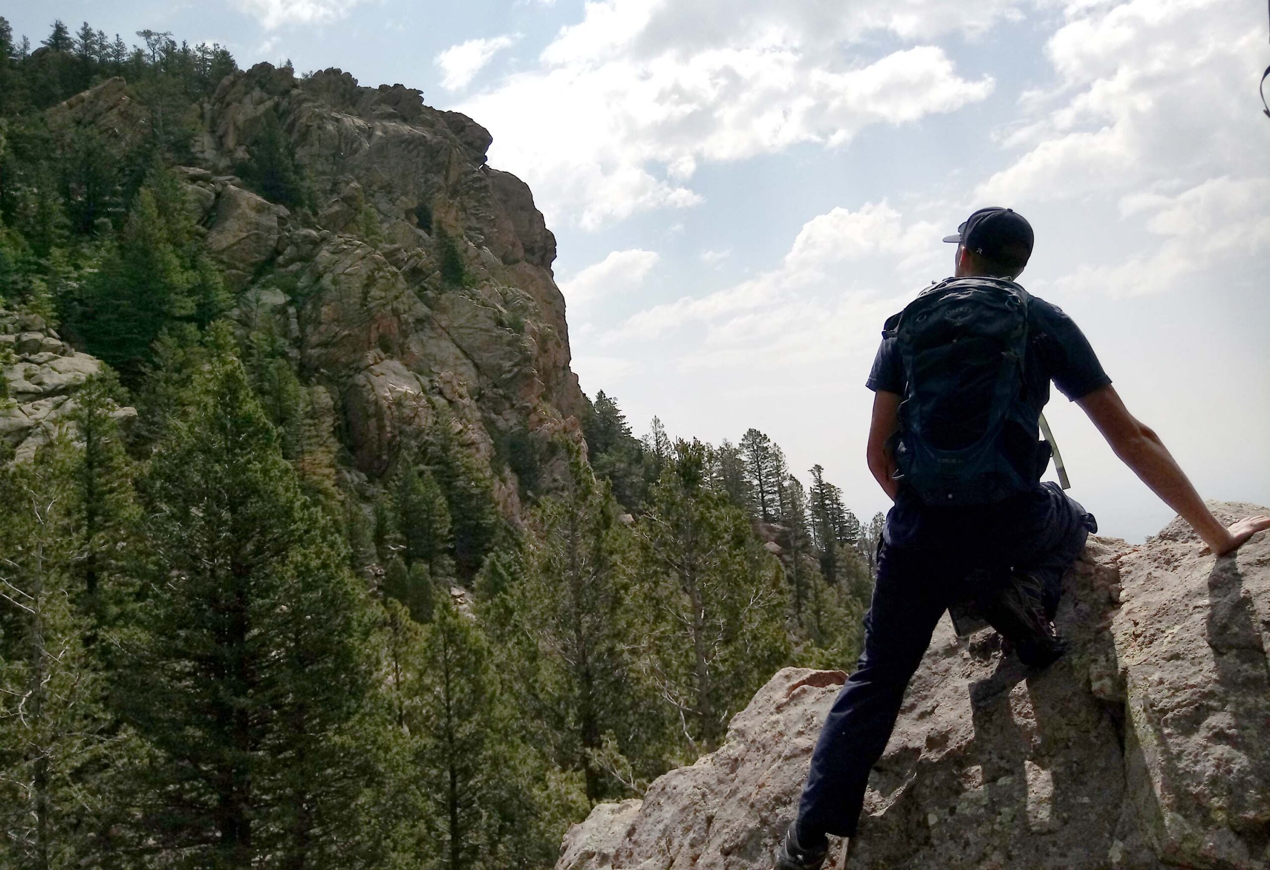
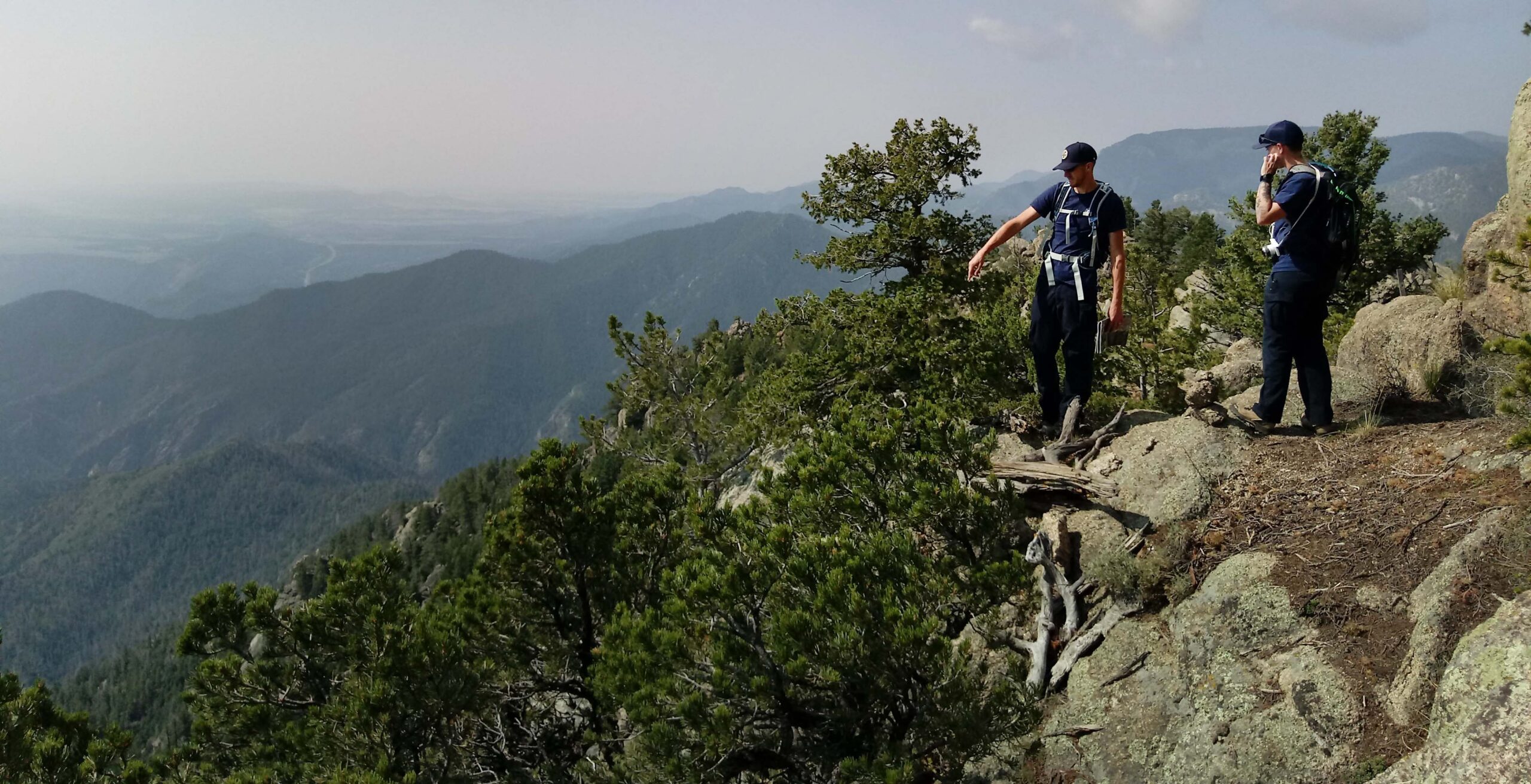
I was with Jason Hagan, now Cheyenne Mountain State Park’s manager. So named for the mythical beast the mountain resembles, we scrambled around Dragon’s Backbone, this jagged spine looking out to the surrounding foothills and canyons, the distant plains and Sangre de Cristo peaks.
A bench was posted here honoring Mark Hesse, the late founder of Rocky Mountain Field Institute who blueprinted a summit trail long before ground broke. Yes, Dixon Trail had been a dream long before private land turned public and Cheyenne Mountain State Park opened in 2006.
“People are gonna love it up here,” Hagan said atop Dragon’s Backbone, “for the few that can make it.”
How popular would Dixon Trail be? “That’s the big question,” Hagan said then ahead of the 2018 debut.
Surely the distance would keep many away. But one thing was certain to another eager local I talked to back then, Dick Standaert: “In 100 years, there hasn’t been a trail built this significant in the Front Range.”
And to think, I only just recently got back to it.
It was finally time to reacquaint myself with Dixon Trail. It was as good a time as any, I figured, amid an unseasonably warm and dry February.
I was there at the end of February, adding my name to the trail log at the parking lot. I counted names written down before me over the whole month ー just 10 others.
People are wise to heed the posted warnings.
“This hike involves steep terrain and is rated as difficult to extreme,” the sign reads. “Be prepared with plenty of water, check on weather conditions and dress accordingly.”
The sign continues about “no pick up locations” and “intermittent” cell service along the out-and-back trip, which totals closer to 17 miles with the Mountain Loop and Dragon’s Backbone.
My goal was Dixon Trail itself, culminating above 9,300 feet at the former homestead of Thomas Dixon.
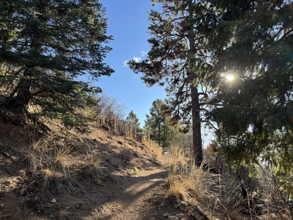
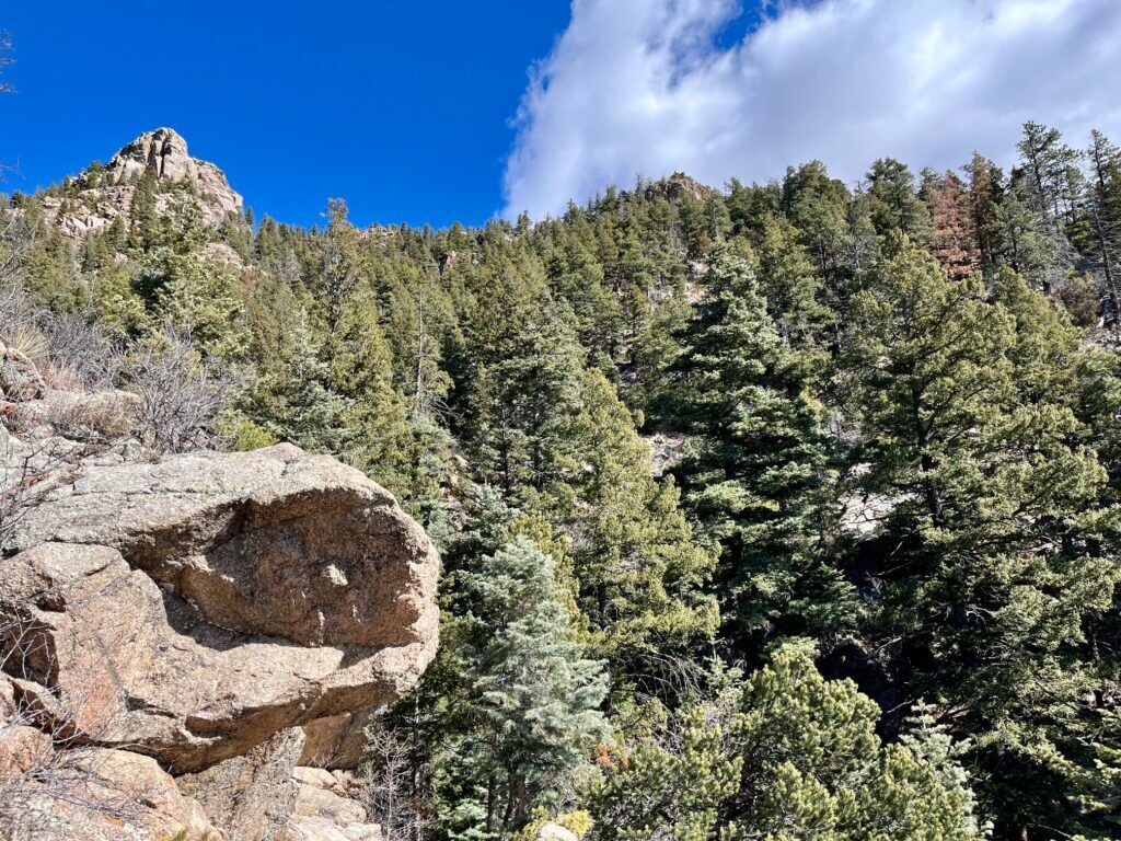
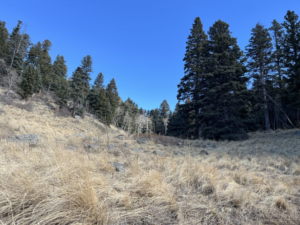
The trek starts on Talon Trail, through the meadow where Cheyenne Mountain looms large. The craggy face looms larger and more enticing over the next 3 miles, ever closer as the well-marked path steadily climbs into a pine forest.
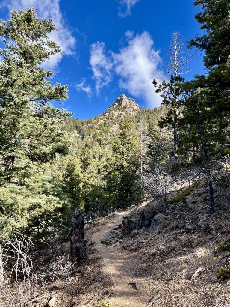
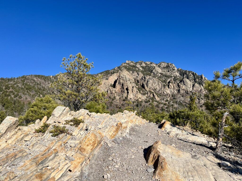
Talon Trail meets North Talon, which ascends to a rugged, white- and rust-colored hogback. This is where Dixon Trail begins, marked by a sign with more warnings about “difficult to extreme” terrain and “unpredictable weather” over the next 4 ½ miles.
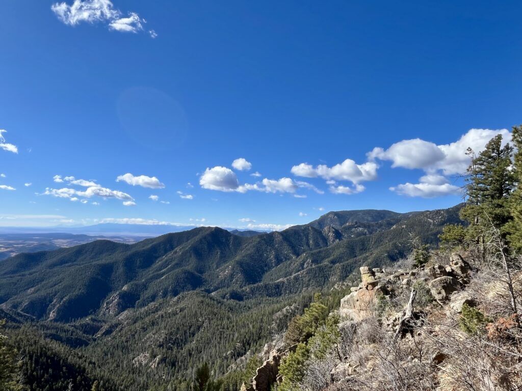
The trail relentlessly climbs, revealing spires and domes of the mountain’s face. Switchbacks continue higher to where the plains appear like an ocean sprawling east, and the Spanish Peaks appear to float far south.
Another sign is posted ahead, 2 ½ miles up from where Dixon started: no bikes or horses are allowed past this point. The sign hints as to why: “You will encounter 13%-20% grades with sharp switchbacks and long rock crossings. Elevation will rise dramatically.”
The sharp, rocky switchbacks require some brief route-finding between stone steps and logs that point the way along with Dixon’s occasional pink markers. Along these rough switchbacks, I was remembering what Busher said. “People have no idea these things are handbuilt.”
The dirt trail returns, rising up to the mangled remains of a trainer jet. It crashed here in 1957, killing the two inside who were bound for Peterson Air Force Base. Older remains are found a mile up, up through the meadow and aspen grove. This is where Thomas Dixon built a cabin many decades before the antennae now seen from afar.
The Mountain Loop continues here at the end of Dixon, connecting with Dragon’s Backbone, that jagged spine that offers something more like a true summit experience with unobstructed views. I started back the long way I came.
I had not seen another soul until the trek down. The man stopped to catch his breath and take it all in.
“Beautiful, isn’t it?”